Related Research Articles
Babine River Corridor Provincial Park is a provincial park in British Columbia, Canada, located to the north of Hazelton. The park was established by Order-in-Council in 1999 and is approximately 15,339 hectares in area.
Dall River Old Growth Provincial Park is a provincial park in British Columbia, Canada. It is part of the larger Muskwa-Kechika Management Area and is located immediately northwest of Denetiah Provincial Park, northwest of the junction of the Gataga and Kechika Rivers. Established in 1999, the park is 642 ha. in area. The park protects areas of white spruce old growth.

Marble River Provincial Park is a provincial park in British Columbia, Canada. The park is located on northern Vancouver Island. It is 14.19 km2 (5.48 sq mi) in area. The park protects an eagle nesting habitat near Quatsino Narrows in Quatsino Sound, a steelhead fishery, and an extensive waterfowl habitat. A 4.2 km (2.6 mi)-long biking or walking trail is available, as well as opportunities for wildlife viewing.
Nimpkish Lake Provincial Park is a provincial park on northern Vancouver Island, British Columbia, Canada on Vancouver Island. The park is 3,949 ha. in area and was established on 1995. It is 32 km south of Port McNeill and on the southwest side of Nimpkish Lake. Primary access is by boat launch, though radio-controlled logging roads lead to the edge of the park. Western Forest Products in Woss, British Columbia should be contacted for road advisories. The park is in the traditional territory of the Namgis First Nation.
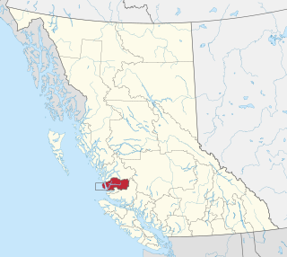
The Stikine Ranges are a group of mountain ranges and mountainous plateaus in northwestern British Columbia, Canada. They are the northernmost subdivision of the Cassiar Mountains and among the least explored and most undeveloped parts of the province.

Namu is a small fishing port, former cannery town and First Nations community on the coast of British Columbia, Canada. It is located about 95 km (59.0 mi) southwest of Bella Coola or 35 km (21.7 mi) SSE of Bella Bella, on the mainland shore of the Inside Passage ferry route directly opposite Hunter Island, and just south of the opening of Burke Channel and King Island. The community's harbour is named Namu Harbour, and a large lake just inland is Namu Lake, which lies in the short drainage basin of the 15 km Namu River, immediately east of which is the small but rugged Namu Range.

The Gwa'sala-Nakwaxda'xw Nations are an amalgamation of two Kwakwaka'wakw peoples in a band government based on northern Vancouver Island in British Columbia, whose main reserve community is near the town of Port Hardy in the Queen Charlotte Strait region of the Central Coast region of British Columbia, Canada. In the 1960s the Gwa'sala (Gwaʼsa̱la), the 'Nakwaxda'xw (ʼNakʼwaxdaʼx̱w) and the Kwakiutl peoples were amalgamated. Eventually the Gwa'sala-'Nakwaxda'xw Nations and the Kwakiutl First Nation separated into the two groups that are recognized by the federal government to this day. Gwa'sala-'Nakwaxda'xw Nations were forcibly relocated from their homelands to a location near Port Hardy.
The Wuikinuxv Nation, also known as the Oweekeno Nation, is a First Nations band government whose traditional territory is the shores of Rivers Inlet and Owikeno Lake in the Central Coast region of the Canadian province of British Columbia, in the area south of Bella Bella and north of Queen Charlotte Strait. The Wuikinuxv people a.k.a. the Oweekeno people reside in the area of Rivers Inlet and Owikeno Lake, primarily at a village on the Wannock River. Substantial numbers of Wuikinuxv also reside away from the traditional territory in Port Hardy on Vancouver Island and in larger BC communities such as Campbell River, Vancouver and Victoria. Approximately 80 people reside at the village while overall membership was 283 in 2006, 194 of whom lived off-reserve.
The Namu Range is a small mountain range in southwestern British Columbia, Canada, located south of Namu Lake, east of Fitz Hugh Sound. It has an area of 197 km2 and is a subrange of the Pacific Ranges which in turn form part of the Coast Mountains.
The Koeye Range is a small mountain range in southwestern British Columbia, Canada, located between the Koeye River and Elizabeth Lake. It has an area of 68 square kilometres (26 sq mi) and is a subrange of the Pacific Ranges which in turn form part of the Coast Mountains.
Horneline Creek Provincial Park is a provincial park in far northern British Columbia, Canada. It is located west of the Kechika River about 130 km south of Lower Post and 30 km north of Denetiah Provincial Park and southwest of the community of Liard River.
The Chuckwalla River is a river in the Central Coast region of British Columbia, Canada, flowing into Kilbella Bay, which is a side water of Rivers Inlet. The river's headwaters are at 51°52′N127°54′W.
The Kilbella River is a river in the Central Coast region of British Columbia, Canada, flowing into Kilbella Bay, which is an arm of Rivers Inlet.
Kilbella Bay is a bay on the Central Coast of British Columbia, Canada, off the north side of Rivers Inlet to the northeast of McAllister Point. A steamer landing formerly operated by the Northland Navigation Company was located on the east side of the bay.
Katit Indian Reserve No. 1 is the main Indian reserve of the Wuikinuxv people, and is one of the three reserves governed by the Wuikinuxv Nation band government. It is located in British Columbia, Canada, on the entrance to Owikeno Lake on the north side of the Wannock River near to, but separate from, the non-native community and sport fishing resort of Rivers Inlet. Similarly named Katit Island is in the Wannock River at 51°40′41″N127°11′48″W, while Kahtit Creek is downstream, near the mouth of the Wannock River at 51°40′47″N127°15′00″W near the Wuikinuxv village known as Oweekeno.
Cockmi Indian Reserve No. 3, officially Cockmi 3, is one of the three Indian reserves of the Wuikinuxv Nation band government located on the west tip of Walbran Island, which is near Darby Channel in the area of Fitz Hugh Sound on the Central Coast of British Columbia, Canada. The other two Wuikinuxv reserves are Kiltala Indian Reserve No. 2 on the Kilbella River near Kilbella Bay and Katit Indian Reserve No. 1, up the Wannock River from the community of Rivers Inlet at the entrance to Owikeno Lake.
The Nicknaqueet River is a river in the Central Coast region of British Columbia, Canada, flowing north into the head of Rivers Inlet just south of the mouth of the Wannock River.
Takush Harbour is a harbour on the south side of Smith Sound in the Central Coast region of British Columbia, Canada. Nathlegalis IR No. 3 of the Gwa'sala-'Nakwaxda'xw Nations band government of the Kwakwaka'wakw peoples is located in Browning Channel in front of the harbour. The Takush River enters Smith Sound in the same area, at Ahclakerho Channel.

The Nekite River is a river in the Central Coast region of British Columbia, Canada, flowing south to the head of Smith Inlet. Nekite Indian Reserve No. 2 is located at the mouth of the river and is one of the many reserves of the Gwa'sala-'Nakwaxda'xw Nations band government located in the area of Smith Sound, of which Smith Inlet is the uppermost part.
Long Lake is a lake south of the head of Smith Inlet in the Central Coast region of British Columbia, Canada. It flows west into the Smith Inlet and its main tributary is Smokehouse Creek at its north-east end.
References
51°15′52″N127°35′56″W / 51.26444°N 127.59889°W
| | This article about a river in the Coast of British Columbia, Canada is a stub. You can help Wikipedia by expanding it. |