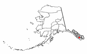
Naukati Bay is a census-designated place (CDP) in the Prince of Wales-Hyder Census Area of the Unorganized Borough of the U.S. state of Alaska. The population was 113 at the 2010 census, down from 135 in 2000.

The English River is a tributary of the Iowa River in southeastern Iowa in the United States. The main stem of the river is 37.4 miles (60.2 km) long. Including its longest headwaters tributary, the North English River, the total length increases to 89.2 miles (143.6 km). Via the Iowa River, it is part of the Mississippi River watershed. The Deep River is a minor tributary of the English River. The towns of North English, South English and Deep River are named for the English and Deep rivers.

The Yentna River is a river in South Central Alaska, formed by its East Fork and West Fork at 62°16′50″N151°46′26″W, flows South-East to Susitna River, 30 miles (48 km) North-West of Anchorage, Alaska; Cook Inlet Low.

The Kasilof River or Ggasilatnu in the Dena'ina language is a river on the western Kenai Peninsula in southern Alaska. The name is an anglicization of Reka Kasilova, the name given to the river by early Russian settlers in the area. It begins at Tustumena Lake and flows northwest to Cook Inlet near Kasilof. The upper section of the river is very swift, with several sections considered Class II whitewater, and underwater hazards are difficult to detect, due to the silty nature of the glacial runoff that comprises most of the river. The entire river has powerful currents and is very cold. There is public access to the lower section from the Sterling Highway. Drift and bank fishing for salmon is popular on the lower Kasilof.

Beaver Creek is a 180-mile (290 km) tributary of the Yukon River in the U.S. state of Alaska. The creek begins at the confluence of Champion and Bear creeks in the White Mountains National Recreation Area, about 50 miles (80 km) north of Fairbanks. From there it flows west around the southern end of the White Mountains, then northeast into the Yukon Flats National Wildlife Refuge, then west into the Yukon River downstream of Beaver.

Birch Creek is a 150-mile (240 km) tributary of the Yukon River in the U.S. state of Alaska. Beginning at the confluence of Ptarmigan and Eagle creeks near Porcupine Dome, it flows southwest, then south under the Steese Highway and into the Steese National Conservation Area. It then turns east, then north, again passing under the Steese Highway and entering the Yukon Flats National Wildlife Refuge. Turning northwest, it ends where it splits into two distributaries, Lower Mouth Birch Creek and Upper Mouth Birch Creek, near Birch Creek, Alaska. The distributaries flow into the Yukon River at separate locations downstream of Fort Yukon.
The Black River is a 41.1-mile-long (66.1 km) river on the Upper Peninsula of the U.S. state of Michigan, flowing mostly in Gogebic County into Lake Superior at 46°40′03″N90°02′57″W. Its source at 46°18′54″N90°01′15″W is a boreal wetland on the border with Iron County, Wisconsin. The northern section of the river, 14 miles (23 km) within the boundaries of the Ottawa National Forest, was designated a National Wild and Scenic River in 1992.

The San Jacinto River is a 42-mile-long (68 km) river in Riverside County, California. The river's headwaters are in San Bernardino National Forest, but the lower portion of the 765-square-mile (1,980 km2) watershed is urban and agricultural land. As a partially endorheic watershed that is contiguous with other Great Basin watersheds, the western side of the San Jacinto Basin is a portion of the Great Basin Divide.
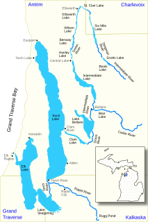
The Elk River Chain of Lakes Watershed is a 75-mile-long (121 km) waterway consisting of 14 lakes and connecting rivers in the northwestern section of the Lower Peninsula of the U.S. state of Michigan, which empty into Lake Michigan.
Alexander Creek, also known as Taguntna Creek, is a stream from Alexander Lake which merges with the big Susitna River near the village of Alexander Creek, Alaska also known as Alexander, Alaska, an Alaska Native and Alaska Bush community, in Matanuska-Susitna Borough, Alaska.

Yuba is a former settlement in Yuba County, California. It was located on the Southern Pacific Railroad 1.5 miles (2.4 km) north-northwest of Olivehurst, at an elevation of 62 feet. It still appeared on maps as of 1895. Yuba is 38.6 miles way from San Francisco.

Bloomer is a former settlement in Butte County, California, United States. It was located 5.5 miles (8.9 km) north-northwest from Bidwell's Bar on the Western Pacific Railroad, at an elevation of 902 feet, and was inundated by Lake Oroville.
Fondo is an unincorporated community in Imperial County, California. It is located on the Southern Pacific Railroad 6.5 miles (10 km) west of Calipatria, at an elevation of 203 feet below sea level.

The Ocqueoc River is stream in Presque Isle County in the northeastern part of the lower peninsula in the U.S. state of Michigan. It is 34.2 miles (55.0 km) long and encompasses a watershed of approximately 94,394 acres (382.00 km2).
Howard Draw is a valley that heads in the extreme south of Reagan County, Texas at an elevation of 2720 feet at 30°05′09″N101°22′27″W, and runs through Crockett County to its foot on the Pecos River in Val Verde County, elevation 1575 feet.

Temescal Creek is an approximately 29-mile-long (47 km) watercourse in Riverside County, in the U.S. state of California. Flowing primarily in a northwestern direction, it connects Lake Elsinore with the Santa Ana River. It drains the eastern slopes of the Santa Ana Mountains on its left and on its right the western slopes of the Temescal Mountains along its length. With a drainage basin of about 1,000 square miles (2,600 km2), it is the largest tributary of the Santa Ana River, hydrologically connecting the 720-square-mile (1,900 km2) San Jacinto River and Lake Elsinore watersheds to the rest of the Santa Ana watershed. However, flowing through an arid rain shadow zone of the Santa Ana Mountains, and with diversion of ground water for human use, the creek today is ephemeral for most of its length, except for runoff from housing developments and agricultural return flows.

Grand Central River is a waterway on the Seward Peninsula in the U.S. state of Alaska. It enters Salmon Lake from the west. Although the Grand Central and Kruzgamepa rivers form one stream, their names differ, and their physical features vary. The Grand Central flows into Salmon Lake, while the Kruzgamepa flows out.
Beaverdam Creek is a stream in Butler and Ripley counties in the Ozarks of southern Missouri. It is a tributary of the Little Black River.
