
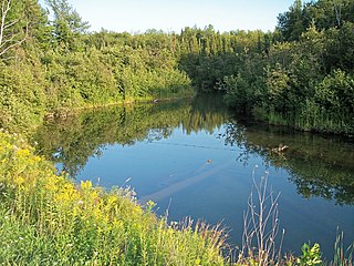
The Kalamazoo River is a river in the U.S. state of Michigan. The river is 130 miles (210 km) long from the junction of its North and South branches to its mouth at Lake Michigan, with a total length extending to 178 miles (286 km) when one includes the South Branch. The river's watershed drains an area of approximately 2,020 square miles (5,200 km2) and drains portions of eight counties in southwest Michigan: Allegan, Barry, Eaton, Van Buren, Kalamazoo, Calhoun, Jackson, Hillsdale, Kent and Ottawa. The river has a median flow of 1,863 cubic feet per second (52.8 m3/s) at New Richmond, upstream from its mouth at Saugatuck.

The Fawn River is a 55.4-mile-long (89.2 km) river in southwest Michigan and northeast Indiana in the United States. It flows into the St. Joseph River in the city of Constantine, Michigan. The headwaters rise in a series of lakes and marshes in northern Steuben County, Indiana near Pokagon State Park, where it is known as "Crooked Creek" and "Little Fawn River". It flows west-northwest across the northeast corner of LaGrange County, Indiana and then over the state line across the southeast corner of Branch County, Michigan before entering St. Joseph County, Michigan. Passing to the south of Sturgis, Michigan, the river meanders across the state line a few more times before flowing north into Constantine. Except for Constantine, the river does not flow through any large communities, although it passes near Fremont, Indiana, Orland, Indiana, Sturgis, Howe, Indiana, and White Pigeon, Michigan.

Watersmeet is an unincorporated community and census-designated place (CDP) in Watersmeet Township, Gogebic County, Michigan, in the United States. As of the 2010 census, the CDP had a population of 428, out of a total population in the township of 1,417. The community was platted in 1884, designated as a station of the Chicago, St. Paul, Minneapolis & Omaha Railways.
The Mineral River is an 18.7-mile-long (30.1 km) tributary of Lake Superior on the western Upper Peninsula of Michigan in the United States. It flows for its entire length in western Ontonagon County, rising in the Ottawa National Forest and flowing generally northward to meet Lake Superior about 11 miles (18 km) west-southwest of Ontonagon. The United States Board on Geographic Names settled on "Mineral River" as the stream's name in 1976; according to the Geographic Names Information System it has also been known historically as "Beaver Creek".
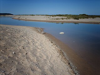
The Platte River is located in the northern part of the Lower Peninsula of Michigan. Its mouth is located in Sleeping Bear Dunes National Lakeshore and much of the rest is in the Pere Marquette State Forest.

Lake Duluth was a proglacial lake that formed in the Lake Superior drainage basin as the Laurentide ice sheet retreated. The oldest existing shorelines were formed after retreat from the Greatlakean advance, sometime around 11,000 years B.P. Lake Duluth formed at the western end of the Lake Superior basin. Lake Duluth overflowed south through outlets in Minnesota and Wisconsin at an elevation of around 331 m above sea level.
The Baltimore River is a 33.6-mile-long (54.1 km) river in Michigan. It originates in Ontonagon County and flows into the Middle Branch of the Ontonagon River and thence into Lake Superior. The O Kun de Kun Falls are located on the river.
The Big Iron River is a 28.3-mile-long (45.5 km) river in western Ontonagon County on the Upper Peninsula of Michigan in the United States. It flows northwards, entering Lake Superior at the village of Silver City.
The Cranberry River is a 20.0-mile-long (32.2 km) river in Ontonagon County on the Upper Peninsula of Michigan in the United States. It is a tributary of Lake Superior.
The East Sleeping River is a 21.3-mile-long (34.3 km) river in Ontonagon County, Michigan, in the United States. It is a tributary of Lake Superior.
The Flintsteel River is a 28.3-mile-long (45.5 km) river in Ontonagon County on the Upper Peninsula of Michigan in the United States. It is a tributary of Lake Superior.
The Jumbo River is a 15.5-mile-long (24.9 km) tributary of the East Branch Ontonagon River in Iron and Houghton counties on the Upper Peninsula of Michigan in the United States. Via the East Branch, its waters flow north to the Ontonagon River and then to Lake Superior.
The Little Cranberry River is an 11.3-mile-long (18.2 km) river in Ontonagon County, on the Upper Peninsula of Michigan, in the United States. It is a tributary of Lake Superior.
The Little Iron River is a 17.9-mile-long (28.8 km) river in western Ontonagon County on the Upper Peninsula of Michigan in the United States. It is a tributary of Lake Superior.
The Pelton River is a 5.9-mile-long (9.5 km) tributary of the Slate River in Gogebic County on the Upper Peninsula of Michigan in the United States. Via the Slate River, its water flows to Lake Gogebic, which feeds the West Branch Ontonagon River, flowing to the Ontonagon River and ultimately to Lake Superior.
The Potato River is a 10.3-mile-long (16.6 km) river in Ontonagon County on the Upper Peninsula of Michigan in the United States. It is a tributary of Lake Superior.
The West Sleeping River is an 8.5-mile-long (13.7 km) river in Ontonagon County, Michigan, in the United States. It is a tributary of Lake Superior.
Floodwood River is an 11.0-mile-long (17.7 km) river in Ontonagon County in the U.S. state of Michigan.


