
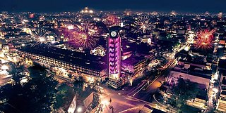
Kolhapur is a city on the banks of the Panchganga River in the southern part of the Indian state of Maharashtra.
Jalgaon is a city in Maharashtra, India. The city is located in North Maharashtra in the subregion of Khandesh, and serves as the administrative headquarters of its namesake district, the Jalgaon district. Situated on Asian Highway 53 and 76.3 Km from 'Ajanta Caves'. The Girna river flows from the western part of the city. Jalgaon is colloquially known as the "Banana city of India" as the region's farmers grow approximately two-thirds of Maharashtra's banana production.

Thane district is a district in the Konkan Division of Maharashtra, India. At the 2011 Census it was the most populated district in the country, with 11,060,148 inhabitants; however, in August 2014 the district was split into two with the creation of a new Palghar district, leaving the reduced Thane district with a 2011 census population of 8,070,032. The headquarters of the district is the city of Thane. Other major cities in the district are Navi Mumbai, Kalyan-Dombivli, Mira-Bhayander, Bhiwandi, Ulhasnagar, Ambarnath, Badlapur, Murbad and Shahapur.
Amravati is a city in Maharashtra located in the Vidarbha region. It is the ninth largest city in Maharashtra, India & second largest city in the Vidarbha region in terms of population. It is the administrative headquarter of Amravati district as well as Amravati Division which includes Amravati District, Akola District, Buldhana District, Washim District & Yavatmal District. It is one of Maharashtra's nominated cities under Smart Cities Mission.
Akola is a major city in the Vidarbha region of the Indian state of Maharashtra. The third largest city in Eastern Maharashtra after Nagpur and Amravati, it is located about 580 kilometres (360 mi) east of the state capital, Mumbai, and 250 kilometres (160 mi) west of the second capital, Nagpur. Akola is the administrative headquarters of the Akola district located in the Amravati division.
Palghar is a prominent town in the Konkan division of Maharashtra state, India, and a municipal council. It is Strategically located within the Mumbai Metropolitan Region, and since 2014, it has been the administrative capital of the Palghar district. Palghar plays a crucial role in Western Line of the Mumbai Suburban Railway in the busy Mumbai-Ahmedabad rail corridor. The town is located approximately 87 kilometers north of Mumbai, about 35 kilometers north of Virar, and about 24 kilometers west of the Mumbai-Ahmedabad National Highway at Manor and Mumbai is approximately 50+ km from Palghar.
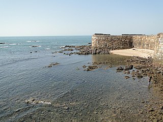
Sindhudurg district is an administrative district of the Konkan division in India, which was carved out of the erstwhile Ratnagiri district. The district headquarters are located at Oros. The district occupies an area of approximately 5,207 km2 and has a population of 849,651, of which 12.59% were urban. As of 2011, it is the least populous district of Maharashtra.
Kolhapur district is a district in the Maharashtra state of India. The city of Kolhapur is its district headquarter. It is situated near Panchaganga river.
Kagal is a town in Kolhapur district of the Indian state of Maharashtra.

Chikkodi is a town, taluka and one of three Subdivisional headquarter, in the Belagavi district of Karnataka, India. Chikodi, Athani, Hukkeri, Raybag, Nipani and Kagwad are the taluks that come under Chikodi Subdivision. It is 75 kilometers from the city of Belgaum, 65 kilometers from Kolhapur, 51 kilometers from Miraj, 160 kilometers from Hubli, and 570 kilometers from the capital of Karnataka state, Bangalore. Chikodi has many district level offices but it is not designated as a district by the Government of Karnataka. It is one of the major cities that lie in the border between Karnataka and Maharashtra states.
Malkapur is a city and municipality in the Buldhana district of Maharashtra, India. It is Known for its historical and economic significance.
Umarkhed is a Municipal council in Yavatmal district of Indian State of Maharashtra. Audumber Nagari is the name given to Umarkhed city in Maharashtra, India, before the Mughal invasion.
Gampalagudem is a town situated in the NTR district of Andhra Pradesh, India. It serves as the headquarters of the Gampalagudem mandal, which is under the administration of the Tiruvuru revenue division. The town is located on the banks of the Kattaleru river and is situated at a distance of 74 km (46 mi) from the district headquarters Vijayawada.
Peth or Peint is the smallest tehsil of Nashik subdivision of Nashik district in Maharashtra, India. It belongs to Northern Maharashtra region. It belongs to Nashik Division. Peth is a Taluka headquarter. It is located 54 km to the West of Nashik District headquarters. It is also called as Peint. Pin code of Peth is 422208 and postal head office is Peth.

Athani is a town in the Belagavi district of Karnataka, India. It is 140 kilometers from the city of Belagavi, 70 kilometers from Vijayapura, 55 kilometers from Miraj, 100 kilometers from Kolhapur, and 624 kilometers from Bengaluru.

Shelu is a town in Karjat Tehsil, Maharashtra, India. It also has a station on the Mumbai Suburban Railway in Raigad district. The station is on the Mumbai - Karjat route after Vangani. Shelu Local Language is Marathi. Shelu Village Total population is 1374 and number of houses are 286. Female Population is 48.7%. Village literacy rate is 71.4% and the Female Literacy rate is 31.7%. The famous Ulhas River passed through this town and it is a source of fresh water for this area. In the western side of the shelu town Matheran Mountains are there and on the easter side of the Shelu town Ulhas River passes through. The Shelu town has India Post's Branch Post office its PIN Code is 410101.
Bhood is a village in Khanapur tehsil of Sangli district in Maharashtra, India. It is located near the city Vita.
Mungurwadi is a town in Gadhinglaj Taluka of Kolhapur district in Maharashtra, India. In 2001 it had a population of 3,271, but as of 2011, it has a population of 12,199. It is a major market place and the tenth largest settlement in Gadhinglaj taluka. Mungurwadi is about 24 km from Gadhinglaj, 29 km from second-largest settlement Kadgaon and 12 km from National Highway 48 (NH48).

Gadhinglaj is a taluka in Maharashtra. The city of Gadhinglaj is the taluka headquarters and Gadhinglaj subdivision headquarters as well. As of 2011, the taluka had a population of 874,015, of which 35% were urban. Languages spoken in this area are Marathi, Kannada, Hindi and English also. But the most-spoken language is Marathi, as Marathi is a state language.
Dadar is a Census Town situated in Pen taluka Raigad district of Maharashtra, India. The Pen railway station serves as the nearest railway station and is located approximately 14 kilometers away from Dadar.
