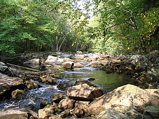
Algonquin Provincial Park is an Ontario provincial park located between Georgian Bay and the Ottawa River, mostly within the Unorganized South Part of Nipissing District. Established in 1893, it is the oldest provincial park in Canada. Additions since its creation have increased the park to its current size of about 7,653 km2 (2,955 sq mi). The park is contiguous with several smaller, administratively separate provincial parks that protect important rivers in the area, resulting in a larger total protected area.

Kejimkujik National Park is a national park of Canada, covering 404 km2 (156 sq mi) in the southwest of Nova Scotia peninsula. Located within three municipalities, Annapolis, Queens, Digby, it consists of two separate land areas: an inland part, which is coincident with the Kejimkujik National Historic Site of Canada, and the Kejimkujik National Park Seaside on the Atlantic coast.

Prince Albert National Park encompasses 3,874 square kilometres (1,496 sq mi) in central Saskatchewan, Canada and is about 200 kilometres (120 mi) north of Saskatoon. Though declared a national park March 24, 1927, official opening ceremonies weren't performed by Prime Minister William Lyon Mackenzie King until August 10, 1928. This park is open all year but the most visited period is from May to September. Although named for the city of Prince Albert, the park's main entrance is actually 80 kilometres (50 mi) north of that city via Highways 2 and 263, which enters the park at its southeast corner. Two additional secondary highways enter the park, Highway 264, which branches off Highway 2 just east of the Waskesiu townsite, and Highway 240, which enters the park from the south and links with 263 just outside the entry fee-collection gates. Prince Albert National Park is not located within any rural municipality, and is politically separate from the adjacent Northern Saskatchewan Administration District (NSAD). Until the establishment of Grasslands National Park in 1981, it was the province's only national park.

The Boundary Waters Canoe Area Wilderness comprises 1,090,000 acres (440,000 ha) of pristine forests, glacial lakes, and streams in the Superior National Forest. Located entirely within the U.S. state of Minnesota at the Boundary Waters, the wilderness area is under the administration of the United States Forest Service. Efforts to preserve the primitive landscape began in the 1900s and culminated in the Boundary Waters Canoe Area Wilderness Act of 1978. The area is a popular destination for canoeing, hiking, and fishing, and is the most visited wilderness in the United States.

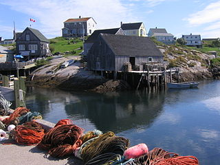
Peggy's Cove is a small rural community located on the eastern shore of St. Margarets Bay in the Halifax Regional Municipality, which is the site of Peggys Cove Lighthouse.

Superior National Forest, part of the United States National Forest system, is located in the Arrowhead Region of the state of Minnesota between the Canada–United States border and the north shore of Lake Superior. The area is part of the greater Boundary Waters region along the border of Minnesota and the Canadian province of Ontario, a historic and important thoroughfare in the fur trading and exploring days of New France and British North America.

The Eastern Shore is a region of the Canadian province of Nova Scotia. It is the Atlantic coast running northeast from Halifax Harbour to the eastern end of the peninsula at the Strait of Canso.

Pinecone Burke Provincial Park is a provincial park in British Columbia, Canada. It extends from the southwest corner of Garibaldi Provincial Park, west of Pitt Lake and Pitt River to include Burke Mountain in the City of Coquitlam. Most of the park is unserviced wilderness with very rough trails such as the Fools Gold Trail in the Boise Valley. There is canoe access to Widgeon Slough and from there hiking trails that lead to Widgeon Lake, and a network of old logging roads, hiking and mountain biking trails on Burke Mountain. Visitors can also use the park for camping, backcountry skiing, and snowshoeing.
The Tobeatic Wilderness Area is the largest protected area in the Canadian Maritimes, located in southwestern Nova Scotia. It contains nearly 120,000 hectares of land and spans parts of five counties, Annapolis, Digby, Queens, Shelburne and Yarmouth. Located adjacent to Kejimkujik National Park, it was formerly known as the Tobeatic Wildlife Management Area, and the Tobeatic Game Reserve.

Lake Bemidji State Park is a state park of Minnesota, United States, on the north shore of 6,765-acre (27.38 km2) Lake Bemidji. The northern half of the park preserves a spruce-tamarack bog. A district of National Park Service rustic structures built by the Civilian Conservation Corps and National Youth Administration in the 1930s is on the National Register of Historic Places. The park is located 5 miles (8.0 km) north of the city of Bemidji.
The Marine Drive is a designated scenic route along Nova Scotia's Eastern Shore. It closely follows the coast of the Atlantic Ocean and the Strait of Canso from the Canso Causeway to the junction of Route 322 and Highway 111 in Dartmouth.

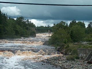
Sheet Harbour is a rural community in Nova Scotia, Canada. It is located in the eastern reaches of the Halifax Regional Municipality, approximately 117 km (73 mi) northeast of the central urban area of the municipality, concentrated on Downtown Halifax and Dartmouth. The community is located along the Marine Drive scenic route on Trunk 7 at its junctions with Route 224 and Route 374. Surrounding the branched harbour which its name is derived from, the community has a population of about 800 and its respective census tract, containing sizable amounts of land around the community, has a population of 3,478 as of the 2011 Census. Two rivers, West River and East River, flow through the community and into the Northwest and Northeast Arms of the harbour respectively. The coastline of the community is heavily eroded and the region in which the community is located has an abundance of lakes. The region has a humid continental climate, congruent with the majority of Nova Scotia, and the ocean significantly influences the temperature.

Nova Scotia is a province located in Eastern Canada fronting the Atlantic Ocean. One of the Maritime Provinces, Nova Scotia's geography is complex, despite its relatively small size in comparison to other Canadian provinces.

Tangier Grand Lake is a lake in the Halifax Regional Municipality of Nova Scotia, Canada. It is located near Mooseland, Nova Scotia.

The White Lake Wilderness Area is a wilderness area located in Nova Scotia, Canada, in Halifax Regional Municipality. Several trails, all maintained by the Musquodoboit Trailways Association, pass through it; Gibraltar Rock Loop, White Lake Wilderness Trails, the Musquodoboit Rail Trail, the Bayers Lake Loop, and the Admiral Lake loop. Access to much of the remainder of the wilderness area is possible only by canoe, requiring multiple portages to get to some of the more remote lakes.

The Waverley - Salmon River Long Lake Wilderness Area is a provincial wilderness area located about 20 kilometers east of Dartmouth Nova Scotia, Canada.
The Musquodoboit Trailway is a 14.5-kilometre-long (9.0 mi) multiuse rail trail located in Halifax County, Nova Scotia, running the distance from Gibralter to Musquodoboit Harbour. The entire route is part of the Halifax spur of The Great Trail, and follows Nova Scotia Route 357 for its length.

The Eastern Shore Granite Ridge, also known as the Musquodoboit Batholith, is a range of prominent hills averaging 100-125m (330-410ft) in height, located just inland from the Eastern Shore of Nova Scotia. Geologically, it is related to the much larger South Mountain Batholith, but the two are geologically distinct areas. Many of the hills have steep cliffs on one or more of their sides, some featuring vertical drops in excess of 50m (160ft); as a result, many of the taller hills offer extensive views despite their relatively low elevation.

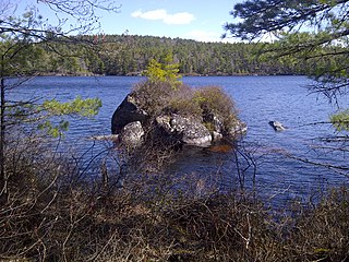
Moose Cove Lake is a lake located in Halifax County, Nova Scotia, approximately 3.3 kilometres (2.1 mi) due north of Salmon River Bridge. The lake is located within the Ship Harbour Long Lake Wilderness Area.


