Tangkrogen

Last updated
Tangkrogen
CirkusSummarum2009.jpg
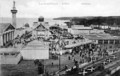
Circus in Tangkrogen
Type Urban park
Location Aarhus, Denmark
Area9.884 acres
Owned by Aarhus Municipality

Tangkrogen (lit.: The Kelp-nook) is a public park in Aarhus, Denmark. The park is situated in the neighborhood Midtbyen by the coast with the Bay of Aarhus to the southeast, the Marselisborg neighborhood to the West and the Port of Aarhus to the North. The park is bounded by Strandvejen and Marselis Havnevej across from Chr. Filtenborgs Square. It is a municipal park managed by the Nature and Environment department (Danish: Natur og Miljø) of Aarhus Municipality. Tangkrogen got its name from the kelp that filled the cove when recreational jetties were constructed when the city of Aarhus initially developed the area into a public park in the early 20th century. [1] [2] [3]

Kelp Large brown seaweeds in the order Laminariales

Kelps are large brown algae seaweeds that make up the order Laminariales. There are about 30 different genera.

Aarhus City in Central Denmark Region, Denmark

Aarhus is the second-largest city in Denmark and the seat of Aarhus municipality. It is located on the east coast of the Jutland peninsula, in the geographical centre of Denmark, 187 kilometres (116 mi) northwest of Copenhagen and 289 kilometres (180 mi) north of Hamburg, Germany. The inner urban area contains 273,077 inhabitants and the municipal population is 340,421. Aarhus is the central city in Business Region Aarhus and in the East Jutland metropolitan area, which had a total population of 1.378 million in 2016.

Denmark Constitutional monarchy in Europe

Denmark, officially the Kingdom of Denmark, is a Nordic country. Denmark proper, which is the southernmost of the Scandinavian countries, consists of a peninsula, Jutland, and an archipelago of 443 named islands, with the largest being Zealand, Funen and the North Jutlandic Island. The islands are characterised by flat, arable land and sandy coasts, low elevation and a temperate climate. The southernmost of the Scandinavian nations, Denmark lies southwest of Sweden and south of Norway, and is bordered to the south by Germany. The Kingdom of Denmark also includes two autonomous territories in the North Atlantic Ocean: the Faroe Islands and Greenland. Denmark has a total area of 42,924 km2 (16,573 sq mi), land area of 42,394 km2 (16,368 sq mi), and the total area including Greenland and the Faroe Islands is 2,210,579 km2 (853,509 sq mi), and a population of 5.8 million.

Contents

Overview

The park is 9.884 acres of open grassy fields, clay covered event spaces and a part of the coastline, used as a berthing area for small recreational boats such as kayaks and dinghys. The park is the main event venue in Aarhus and it is divided between different areas designed for different purposes. The central area is dubbed Cirkus Pladsen (Circus Square), is a 2700 acres clay covered venue frequently used by travelling circuses, markets and other events that require fixed structures or heavy machinery. Adjacent to it is 3400 acres of grassy fields designed for durability and smaller structures such as tents. The park is bounded by 3707 acres of grassy recreational areas with trees and bushes mainly intended for daily low intensity use. [1]

Coast Area where land meets the sea or ocean

The coast, also known as the coastline or seashore, is the area where land meets the sea or ocean, or a line that forms the boundary between the land and the ocean or a lake. A precise line that can be called a coastline cannot be determined due to the coastline paradox.

Kayak small boat propelled with a double-bladed paddle

A kayak is a small, narrow watercraft which is typically propelled by means of a double-bladed paddle. The word kayak originates from the Greenlandic word qajaq.

Dinghy type of small boat

A dinghy is a type of small boat, often carried or towed for use as a lifeboat or tender by a larger vessel. The term is a loanword from the Bengali ḍiṅgi, Urdu ḍīngī & Hindi ḍieṁgī. Utility dinghies are usually rowboats or have an outboard motor, but while some are rigged for sailing, they are not to be confused with sailing dinghies which are designed first and foremost for sailing. Dinghies' main use is transfers from larger boats, especially when the larger boat can't dock at a suitably-sized port or marina.

The park includes water fountains in different areas, sewers and public toilets and is rated to host up to 20.000 visitors. There are 500 adjacent parking spaces and it lies close to public transport from Strandvejen, Chr. Filtenborgs Plads and Hans Broges Gade. The park has through the years been host to many of the largest events in Aarhus including the annual solstitial celebration celebrations, Sculpture by the Sea, circuses, the Food Festival, fairs, markets, festivals and concerts. [4] [5] [6] [7] [8] [9]

Midsummer is the period of time centered upon the summer solstice, and more specifically the northern European celebrations that accompany the actual solstice or take place on a day between June 19 and June 25 and the preceding evening. The exact dates vary among different cultures. The celebration predates Christianity, and existed under different names and traditions around the world.

Sculpture by the Sea

The Sculpture by the Sea exhibition in Sydney and Perth is Australia's largest annual outdoor sculpture exhibition. This exhibition was initiated in 1997, at Bondi Beach and it featured sculptures by both Australian and overseas artists. In 2005, a companion event was established at Cottesloe Beach in Western Australia featuring over 70 artists. In 2009 it was announced that Aarhus in Denmark would host the first Sculpture by the Sea exhibition outside of Australia.

Circus Commonly a travelling company of performers

A circus is a company of performers who put on diverse entertainment shows that may include clowns, acrobats, trained animals, trapeze acts, musicians, dancers, hoopers, tightrope walkers, jugglers, magicians, unicyclists, as well as other object manipulation and stunt-oriented artists. The term circus also describes the performance which has followed various formats through its 250-year modern history. Although not the inventor of the medium, Philip Astley is credited as the father of the modern circus. In 1768 Astley, a skilled equestrian, began performing exhibitions of trick horse riding in an open field called Ha'Penny Hatch on the south side of the Thames River. In 1770 he hired acrobats, tightrope walkers, jugglers and a clown to fill in the pauses between the equestrian demonstrations and thus chanced on the format which was later named a "circus". Performances developed significantly over the next fifty years, with large-scale theatrical battle reenactments becoming a significant feature. The traditional format, in which a ringmaster introduces a variety of choreographed acts set to music, developed in the latter part of the 19th century and remained the dominant format until the 1970s.

Danish National Exhibition of 1909

The Danish National Exhibition of 1909 or The National Exhibition in Aarhus 1909 was an industry, crafts and culture exhibition held in Aarhus, Denmark in 1909 from 18 May to 3 October. The exhibition displayed some 1850 individual works by architects, artists, craftsmen and businesses and attracted 650.000 visitors. The project was a large undertaking for the city with long-lasting effects on cultural institutions and short-term economic problems. The exhibition fairgrounds was named The white City based on the architectural expression chosen by the leading architect Anton Rosen.

Related Research Articles

Aarhus Municipality municipality in the Central Denmark Region

Aarhus Municipality, until 2011 formerly known as Århus Municipality, is a municipality in Central Denmark Region, on the east coast of the Jutland peninsula in central Denmark.

Aarhus Festuge

Aarhus Festuge is a 10-day arts and culture festival in the city of Aarhus, Denmark. It takes place every year in late August to early September, in week 35-36. Since its start in 1965, the festival has grown to become one of the largest cultural events in Scandinavia and showcases a mix of local, national and international artists.

Marselisborg Palace

Marselisborg Palace, is a royal residence of the Danish Royal Family in Aarhus. It has been the summer residence of Queen Margrethe II since 1967.

Aarhus Docklands Neighbourhood in Aarhus Municipality, Central Denmark Region, Denmark

Aarhus Docklands is a new neighbourhood and construction site in Aarhus, Denmark.

Skjoldhøjkilen

Skjoldhøjkilen is a recreational and natural site, in the district of Brabrand in the western part of Aarhus in Denmark. It stretches westwards from Hasle Hills, like a wavy green strip of meadows, small lakes and woodlands. It is 3.5 km long and just as Hasle Hills, it is administered by the self-governing institution 'Hasle Bakker'.

Marselisborg Forests forest to the south of Aarhus City in Denmark

Marselisborg Forests, or simply Marselisborg Forest, is a 1,300 hectares forest to the south of Aarhus City in the Kingdom of Denmark. Many present day sources now includes the forest of Fløjstrup, as part of the Marselisborg Forests, upping the total area with another 200 hectares. Marselisborg Forests runs along the coastline of the Aarhus Bay in a hilly terrain with steep slopes and deep gullies, especially at the shoreline. There are many traces of prehistoric activities here and the landscape have been covered by woodlands for thousands of years.

Musikhuset Aarhus concert hall in Aarhus, Denmark

Musikhuset Aarhus is a large concert hall complex in Aarhus, Denmark. Located in the city centre, Musikhuset is Aarhus' main venue for music and with seating for more than 3,600 people in total, it is the largest concert hall in Scandinavia. Musikhuset Aarhus was designed by Kjær & Richter and built in 1979-1982, commissioned by Aarhus Municipality.

Vennelystparken

Vennelystparken is the oldest park in the city of Aarhus, constructed in the years 1824 to 1830 between the streets Vennelyst Boulevard and Nørrebrogade. Through the 19th century up to the Second World War the park was a social focal point in Aarhus hosting revues, circusses, plays and concerts in changing venues. The park is now part of the Aarhus University campus in Midtbyen. The park no longer has any venues but is frequently used for open-air concerts and protests and functions as the local park of the neighborhood Øgadekvarteret.

Skanseparken

Skanseparken is one of the oldest parks in the city of Aarhus. It is situated in the neighborhood of Frederiksbjerg in Midtbyen. Skanseparken was constructed in the years 1901 to 1902 between the streets Strandvejen, Marselisborg Allé and Heibergsgade. The park is typical of the parks in the city with large, open areas bounded by beech trees, raised flower beds and playgrounds. It is a popular area for festivals, concerts and other cultural events.

St. Olufs Cemetery small park in Aarhus

St. Oluf Cemetery is a small public park and historic site in central Aarhus, Denmark. The park is situated by the coast in the city center of Midtbyen, in the Latin Quarter, bounded by the streets of Kystvejen and St. Olufs Stræde, overlooking the Docklands and the Bay of Aarhus in the East. It is one of only two green spaces in the historic inner city, the other one being Frue Kirkeplads at the Church of Our Lady, but is one of five protected scheduled monuments.

Åparken

Åparken is a public park in central Aarhus, Denmark. The park is situated by the Aarhus River in the Vesterbro neighborhood in Midtbyen close to CeresByen, bounded by the streets Carls Blochs Gade and Thorvaldsensgade. The park is divided by a central pedestrian pathway which runs from the urban center and connects to the recreational path Brabrandstien towards the west, circumventing Brabrand Lake area. Åparken is the first of a number of green areas extending from the city centre along the river and the pathway of Brabrandstien. The long distance "Aarhus-Silkeborg hiking route" starts off from Åparken.

Rådhusparken

Rådhusparken is a public park in central Aarhus, Denmark. The park is situated by the City Hall in the Indre By neighborhood of Midtbyen, between the streets Frederiks Allé to the west and Park Allé to the east. The park lies within a scenic semi-circle of some of the more important cultural and political institutions in the city; the Concert Hall, the ARoS Art Museum, Vester Allés Kaserne and the city hall. The City Hall Park was listed along with the adjacent city hall on 10 March 1995.

Villa Kampen

Villa Kampen is a listed building in Aarhus, Denmark, constructed by architect Hack Kampmann between 1901 and 1902, during his tenure as the Royal Building Inspector for Northern Jutland. Villa Kampen is a villa situated in Midtbyen in central Aarhus, in the affluent neighbourhood around Strandvejen south of the neighbourhood Marselisborg. It lies next to Havreballe Forest behind it and to the west, with an east-facing view of Tangkrogen and the Bay of Aarhus in front of it and the Marselisborg Forests visible on the hills to the south. The building and the surrounding estate was listed on 2 March 1983 by the precursor to the Danish Heritage Agency.

University Park, Aarhus

Aarhus University Park or the University Park is a public park in central Aarhus, Denmark. The University Park is at the centre of Aarhus University's main campus.

Concert Hall Park, Aarhus park in Denmark

The Concert Hall Park is a public park in central Aarhus, Denmark. The park is laid out in front of the Aarhus Concert Hall main entrances in the Indre By neighborhood of the inner city. It is bordered by the street Frederiks Allé to the east, Thomas Jensen's Allé to the south and Vester Allé to the north, behind the historic buildings of the former Vester Allés Barracks. The park is named after the Aarhus Concert Hall which is situated prominently immediately west of the park. The Concert Hall Park forms a center-point between some of the most prominent buildings in the city, the ARoS Aarhus Art Museum, Vester Allé Barracks, the concert halls, and Aarhus City Hall in view behind the City Hall Park across Frederiks Allé. The Concert Hall Park was designed by the landscape architect Sven Hansen as a parterre garden, and it was established in the 1980s.

Aarhus Pride Annual LGBT event in Aarhus, Denmark

Aarhus Pride is a pride parade in Aarhus, Denmark and the largest Danish event focused on LGBT issues outside Copenhagen. The first event was held in 2012 and has been repeated every year since. It is managed and controlled by private individuals from the LGBT community and supported with funds from the city of Aarhus. In 2017, about 6,000 people took part in the 3.5-kilometre-long (2.2 mi) parade with floats and flags.

Marienlyst Park

Marienlyst Park is a public park in Hasle in the Aarhus V district, north-west Aarhus, Denmark. The park is situated west of the Herredsvang neighborhood along the street Fjældevænget Busvej to the south and Brendstrup Forest to the west. Marienlyst Park is one of the largest parks in Aarhus and features both landscaped lawns and artificial forested hills. Facilities include an amphitheatre, soccer fields, playgrounds and a 6-hole golf course. Marienlyst Park was established in connection with the development of western Hasle in the 1970s and today forms part of a green corridor extending from Vestereng to Brabrand Lake. The park is owned by Aarhus Municipality and is managed by the municipal department Natur og Miljø. Marienlyst Park can be rented for public events.

Langenæs Park

Langenæs Park is a public park in the Langenæs neighborhood in the Aarhus C district in Aarhus, Denmark. The park is situated west of the Frederiksbjerg neighborhood along the curved street Langenæs Allé to the south and the AArhus rail yard to the north. Langenæs Park is one of the largest parks in Aarhus and is composed of mainly landscaped lawns with trees scattered throughout along with a large section dedicated to sports. Facilities include soccer fields, a disc gold field, picnic areas and a paved running track. Langenæs Park was established in connection with the development of the Langenæs neighborhood in the 1970s and is today the primary recreational spot in the area along with Frederiksbjerg Bypark to the west and the Rehabilitation PArk to the south. The park is owned by Aarhus Municipality and is managed by the municipal department Natur og Miljø and can be rented for public events.

Ådalen is a green area and event site in Åbyhøj, in Aarhus. It is about 45 hectares in size and located along the Aarhus River, two kilometers from the inner city. Ådalen can be reached by Søren Frichs Vej from the nearby Ring 1 ring road or the outer Ring 2 ring road. The area is surrounded by a business park and a total of three allotment gardens.

References

  1. 1 2 "Tangkrogen" (in Danish). Aarhus Municipality. Archived from the original on 23 September 2015. Retrieved 30 August 2015.
  2. "Food Festival i Tangkrogen" (in Danish). Aarhus Municipality . Retrieved 30 August 2015.
  3. "Tangkrogen" (in Danish). Aarhus Municipality . Retrieved 30 August 2015.
  4. "Historisk succes i Tangkrogen" (in Danish). Arhus Stiftstidende . Retrieved 30 August 2015.
  5. "Front Page" (in Danish). Sculpture by the Sea. Retrieved 30 August 2015.
  6. "Front Page" (in Danish). Aarhus Kræmmermarked. Retrieved 30 August 2015.
  7. "Spørgsmål og Svar" (in Danish). Cirkus Summarum. Retrieved 30 August 2015.
  8. "Front page" (in Danish). Food festival. Retrieved 30 August 2015.
  9. "Sankt Hans aften" (in Danish). City of Aarhus. Archived from the original on 6 July 2015. Retrieved 30 August 2015.

Commons-logo.svg Media related to Tangkrogen at Wikimedia Commons

Coordinates: 56°08′17″N10°12′34″E / 56.138161°N 10.209472°E / 56.138161; 10.209472

Geographic coordinate system Coordinate system

A geographic coordinate system is a coordinate system that enables every location on Earth to be specified by a set of numbers, letters or symbols. The coordinates are often chosen such that one of the numbers represents a vertical position and two or three of the numbers represent a horizontal position; alternatively, a geographic position may be expressed in a combined three-dimensional Cartesian vector. A common choice of coordinates is latitude, longitude and elevation. To specify a location on a plane requires a map projection.