Tangutur

Last updated

Tangutur
Tanguturu
Tangutur tollgate on NH16.jpg
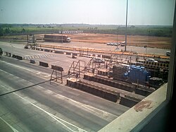
Tollgate on National Highway 16 at Tangutur, Prakasam district
India Andhra Pradesh location map (current).svg
Red pog.svg
Tangutur
Location in Andhra Pradesh, India
India location map.svg
Red pog.svg
Tangutur
Tangutur (India)
Coordinates: 15°21′N80°03′E / 15.35°N 80.05°E / 15.35; 80.05 Coordinates: 15°21′N80°03′E / 15.35°N 80.05°E / 15.35; 80.05
CountryFlag of India.svg  India
State Andhra Pradesh
District Prakasam
Talukas Tangutur
Population
  Total27,652
Languages
  Official Telugu
Time zone UTC+5:30 (IST)
PIN
523274
Telephone code08592
Vehicle registration AP

Tangutur is a town in Prakasam district of the Indian state of Andhra Pradesh. It is a mandal headquarters in Ongole revenue division. Nearby towns are Singarayakonda, Kandukur, Prakasam district, Kondapi and the nearest city will be Ongole. [1]

Contents

Geography

Tangutur is located at 15°20'26"N 80°2'4"E. It has an average elevation of 36 feet. The total area of the town was 3,760 hectares (9,300 acres).

Demographics

According to the 2011 Census of India, with total 7200 families, the total population of Tangutur was 27,652 comprising 13,674 males and 13,978 females. Tangutur has higher literacy rate compared to Andhra Pradesh. In 2011, literacy rate of Tangutur was 68.68% compared to 67.02% of Andhra Pradesh. In Tangutur Male literacy stands at 77.28% while female literacy rate was 60.34%. [2]

See also

Related Research Articles

Ongole City in Andhra Pradesh, India

Ongole is a city in Prakasam district of the Indian state of Andhra Pradesh. It is the headquarters of Prakasam district and also the mandal headquarters of Ongole mandal in Ongole revenue division. Ongole cattle, an indigenous breed of oxen, derived its name from Ongole.

Prakasam district District of Andhra Pradesh in India

Prakasam district is one of the 12 districts in the coastal Andhra region of the Indian state of Andhra Pradesh. It was formed in 1970 and reorganised in 2022 on April 4. The headquarters of the district is Ongole. It is located on the western shore of Bay of Bengal and is bounded by Bapatla district and Palnadu districts on the north, Nandyal district on the west, Kadapa and Nellore districts on the south. A part of north west region also borders with Nagarkurnool district of Telangana. It is the largest district in the state with an area of 14,322 km2 (5,530 sq mi) and had a population of 2,288,026 as per 2011 Census of India.

Kandukur or Kandukuru is a town in SPSR Nellore district of the Indian state of Andhra Pradesh. It is a municipality and the headquarters of Kandukur mandal as well as Kandukur revenue division.

Pamur Town in Andhra Pradesh, India

Pamuru is a town in Prakasam district of the Indian state of Andhra Pradesh. It is the mandal headquarters of Pamur mandal in Kanigiri revenue division. This is the border town of Prakasam district. This is near from Nellore than Ongole around 100 km and also near by Kadapa.

Singarayakonda is a town in Prakasam district of the Indian state of Andhra Pradesh. It is the mandal headquarters of Singarayakonda mandal. Singarayakonda is located at sea level. It is spread across 10 Grama panchayats. It is under Kandukur Revenue division. Singarayakonda is located 30 kilometers from Ongole. This is situated on the NH-5 Highway and has a connectivity of the Railway line between Vijayawada and Chennai. This gives highest revenue than any other station in this line of South Central Railway in the Prakasam district. This also has been the center for transportation for all the nearby villages which are located around a distance of the 15 kilometres (9.3 mi) from this place.

Vetapalem is a census town in Prakasam district of the Indian state of Andhra Pradesh. It is the mandal headquarters of Vetapalem mandal in Ongole revenue division.

Giddaluru is a town in the Prakasam district of the Indian state of Andhra Pradesh. It is the mandal headquarters of the Giddaluru mandal in Markapur revenue division. It was part of kurnool district till 1969 later it was merged into Prakasam district in 1970. Till 2008 it was under Nandyal parliament segment after delimitation it was moved to Ongole MP segment. Giddalur is also known as "3 zilla la muddu bidda " because during the Britishers rule it was in kadapa district later moved to kurnool then in 1970 merged in prakasam district. Giddalur is the only constituency in coastal districts which has Rayalseema culture,slang and traditions. Giddalur town has good transport connectivity to Nandyal, Markapur, Ongole, Kurnool, Kadapa.

Kondapi is a village in Prakasam district of the Indian state of Andhra Pradesh. It is the mandal headquarters of Kondapi mandal in Kandukur revenue division.

Kovur is a village in Kandukur Mandal of Prakasam district, in the State of Andhra Pradesh, India. It is one of the large tobacco farming villages in the Kandukur region.

Koru Uppalapadu is a village in Kondapi mandal, located in Prakasam district of the Indian state of Andhra Pradesh. It belongs to Kandukur revenue division..

Palukuru is a village in the Kandukur mandal of the Prakasam district, from the state of Andhra Pradesh, India, located 33 kilometers south of district headquarters Ongole.

Valaparla is a village located west of National Highway 5 in Martur Mandal of Prakasam district in Andhra Pradesh, India. The village was previously called Olupara. The village code in the 2011 census was 590698; its pin code is 523260.

Ongole mandal is one of the 56 mandals in Prakasam district of the state of Andhra Pradesh, India. It is administered under Ongole revenue division and its headquarters are located at Ongole. The mandal is bounded by Naguluppalapadu, Maddipadu, Santhanuthlapadu, and Kothapatnam Tangutur mandals. The mandals lies on the shore of Bay of Bengal.

Maddipadu mandal is one of the 56 mandals in Prakasam district of the state of Andhra Pradesh, India. Its headquarters are located at Maddipadu. The mandal is bounded by Naguluppalapadu, Ongole, Santhanuthlapadu, and Chimakurthi mandals. The mandals lies on the shore of Bay of Bengal.

Singarayakonda mandal is one of the 56 mandals in Prakasam district of the Indian state of Andhra Pradesh. Its headquarters are located at Singarayakonda. The mandal is bounded by Tangutur, Zarugumilli, Kandukur, and Ulavapadu mandals.

Rajupalem is a village in Prakasam district of Andhra Pradesh in India. It belongs to Ballikurava, Martur mandals and is inhabited by approximately 5371 people.

Gajjalakonda is a village in Markapur Mandal, Prakasam District of Andhra Pradesh State, India.

Vennuru is a village in Prakasam District, in the state of Andhra Pradesh, India. This village comes under Kondapi Mandal in Kandukur revenue division. Nearby villages are Chodavaram, Venkanna Palem, Koru Uppalapadu, Thumadu and Muppavaram.

Muppalla, Prakasam District Village in Andhra Pradesh, India

Muppalla is a village in Ponnaluru mandal, Prakasam district in Indian state of Andhra Pradesh.

Kandukuru mandal is one of the 38 mandals in Nellore district of the Indian state of Andhra Pradesh. Its headquarters are located at Kandukuru. The mandal is bounded by mandal.This mandal is located at Kandukur revenue division.

References

  1. "Prakasam District Mandals" (PDF). Census of India. pp. 159, 178. Retrieved 19 June 2015.
  2. "Sub District Information". census2011.co.in. Retrieved 24 April 2019.