Related Research Articles

Prairie Creek is a census-designated place (CDP) in Benton County, Arkansas, United States. Per the 2020 census, the population was 2,217. It is a lakefront community adjacent to Beaver Lake and Rogers within the Northwest Arkansas region.

Alcona Township is a civil township of Alcona County in the U.S. state of Michigan. The population was 966 at the 2020 census.

Caledonia Township is a civil township of Alcona County in the U.S. state of Michigan. The population was 1,161 at the 2010 census.
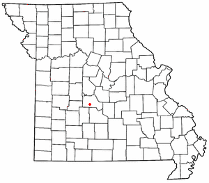
Roach is an unincorporated community in southern Camden County, Missouri, United States. It is located north of U.S. Route 54 on Missouri Route AA, approximately five miles west of Camdenton and 2.5 miles west of the Niangua River arm of the Lake of the Ozarks. The ZIP Code for Roach is 65787.
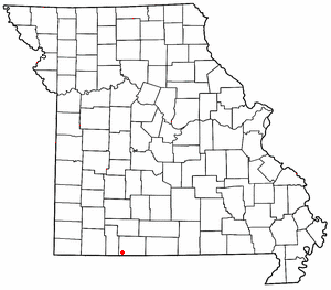
Dora is an unincorporated community in Ozark County, in the U.S. state of Missouri. The ZIP Code for Dora is 65637.
Ridgedale is an unincorporated community in southern Taney County, Missouri, United States. It lies approximately ten miles south of Branson on U.S. Route 65, about one-half mile north of the Arkansas state line. The community is part of the Branson, Missouri Micropolitan Statistical Area.

El Paso is an unincorporated community and census-designated place (CDP) in southwestern White County, Arkansas, United States. It was first listed as a CDP in the 2020 census with a population of 267. Its name is Spanish for "the pass", referring to a small gap in the hills on the community's northern edge. Once known as Peach Orchard Gap in its early settlement, the origin of El Paso's Spanish name is unknown.
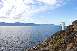
Francis Point Provincial Park is a provincial park in British Columbia, Canada, located on the southwest end of the Francis Peninsula, south of the community of Pender Harbour on the west side of the Sechelt Peninsula in the Sunshine Coast region. Established in 2004, the park is 81 ha. in size, 72 ha. of it upland, the other 9 ha. foreshore.

Area code 501 is a telephone area code in the North American Numbering Plan (NANP) for central Arkansas, including Little Rock and most of its suburbs. The numbering plan area (NPA) comprises most communities in Cleburne, Conway, Faulkner, Garland, Hot Spring, Lonoke, Perry, Pulaski, Saline, White and Van Buren counties.
Timbo is an unincorporated community in Stone County, Arkansas, United States. It is in the Ozark Mountains region of the northern part of the state and is near the town of Mountain View.
Jersey is an unincorporated community in Sumpter township which is located in Bradley County, Arkansas, United States. It is situated at an elevation of 161 feet above mean sea level. The ZIP Code for Jersey is 71651.
Foxboro is an unincorporated community, in Douglas County, in the town of Summit, in the northwestern part of the U.S. state of Wisconsin.
Hagood is an unincorporated community in the High Hills of Santee area in western Sumter County, South Carolina, United States. It lies west of South Carolina Highway 261, north of Stateburg and is the location of Magnolia Hall, which is listed on the National Register of Historic Places. Its mail now comes from Rembert zip code 29128. The community was originally called Sander's Station by the South Carolina Railway, apparently for Dr. Swepson Saunders, the owner of Magnolia Hall plantation, on which it was located, but was renamed Hagood for Johnson Hagood, brigadier general in the Confederate States Army and later governor of South Carolina.
Doddridge is an unincorporated community in southern Miller County, Arkansas, United States, approximately five miles north of the Louisiana border. Doddridge is located at the junction of Arkansas Highway 160 and U.S. Route 71, and I-49 passes through the area, connecting it to Texarkana and Louisiana, as well as the confluence of the Sulphur and Red rivers. Although unincorporated, Doddridge has a post office, with the ZIP code of 71834.
Crocketts Bluff is an unincorporated community in Arkansas County, Arkansas, United States. It is the location of Crocketts Bluff Hunting Lodge, which is located at the end of the dirt road north of the point at which AR 153 turns south, and is listed on the National Register of Historic Places. Crocketts Bluff sits at the highest point in Arkansas County. The ZIP Code for Crocketts Bluff is 72038.
Tichnor is an unincorporated community in Arkansas County, Arkansas, United States. It is the location of the Tichnor Rice Dryer and Storage Building, and is the nearest community to the Roland Site, both listed on the National Register of Historic Places. The ZIP Code for Tichnor is 72166.
Vendor is an unincorporated community in Newton County, Arkansas, United States. The ZIP Code is 72683. It connects with Mt. Judea and Piercetown. Vendor's name is derived from the merchants who would stop and sell their wares by the road, according to local legend.
Forty Five is an unincorporated community located in southeastern Fayette County, Tennessee, United States. It shares a ZIP code of 38057 with Moscow, Tennessee. The center of the town lies at the junction of State Route 57 and Forty 5 Road. It is home to a Baptist church and shares several local businesses with neighboring areas.
Drasco is an unincorporated community and census-designated place (CDP) in Cleburne County, Arkansas, United States, with a ZIP code of 72530. Drasco lies just northeast of Greers Ferry Lake and includes the lakeside community of Tannenbaum.
Onia is an unincorporated community in Stone County, Arkansas, United States. It has an estimated population of approximately 30 civilians. The ZIP Code for Onia is 72663.
References
Municipalities and communities of Cleburne County, Arkansas, United States | ||
|---|---|---|
| Cities |  | |
| Towns | ||
| CDPs | ||
| Other unincorporated communities | ||
| Footnotes | ‡This populated place also has portions in an adjacent county or counties | |
35°33′32″N92°03′26″W / 35.55889°N 92.05722°W
| | This article about a location in Cleburne County, Arkansas is a stub. You can help Wikipedia by expanding it. |