
Ghazipur is a city in the state of Uttar Pradesh, India. Ghazipur city is the administrative headquarters of the Ghazipur district, one of the four districts that form the Varanasi division of Uttar Pradesh. It is located on the Ganges (Ganga) River near the border with Bihar state, about 40 miles northeast of Varanasi (Benares). The city of Ghazipur also constitutes one of the seven distinct tehsils, or subdivisions, of the Ghazipur district.

Afzal Ansari is an Indian politician of the Samajwadi Party and currently an incumbent Member of Parliament (MP) of India for Ghazipur constituency, Uttar Pradesh. He won the 2004 and 2019 Indian general election.
Yusufpur Mohammadabad is a town and a Township in Ghazipur district in the Indian state of Uttar Pradesh. Haydaria village near Mohammadabad is the starting point of Purvanchal Expressway.
The Great Sherpur is a region or a pargana of 'Shankarwar Vansh' in the Mohammadabad tehsil of Ghazipur district in Uttar Pradesh. It consists of Sherpur Kalan, Sherpur Khurd, Semra, Firozpur, villages which were established by the descendants of Dullah Rai. It has population of 31322 as per 2011 Census.
Reotipur is a historic village located in the Ghazipur district of Uttar Pradesh, India. Situated approximately 18 km from the district headquarters, Reotipur is known for its rich cultural heritage and traditional rural charm.
Yusufpur and Mohammadabad is a Twin Town/Qasba in Mohammadabad Tahsil of the Ghazipur district of Uttar Pradesh, India.It belongs to Varanasi Division. Coordinates: 25°37′22″N 83°45′27″E It is located 21 km East of District head quarters Ghazipur and 347 km from the state capital, Lucknow. It borders the Ballia District, Mau District and Buxar District of Bihar. Yusufpur has a railway station which lies on the railway line linking Varanasi to Chhapra via Ghazipur and Ballia in the North Eastern Railway Zone. Yusufpur was founded by Qazi Ahmed Ansari in 1593.
Pakhanpura is a village situated in Bhawarnkol Block in Ghazipur district of Uttar Pradesh, India. The village lies 29 km east of Ghazipur, 18 km (11 mi) from Bhawarnkol, and 373 km (232 mi) from the State capital Lucknow. The village has one post office. The population of the village is approximately 20,000 people.
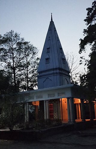
Jevpur is a village located near the Ganga (Ganges) River in Uttar Pradesh, India. It comes under the Ghazipur (Loksabha) Parliamentary Constituency and the Zamania Legislative Assembly. It is about 8 kilometres (5.0 mi) distance from the town of Zamania, about 16 kilometres (9.9 mi) approx distance from Ghazipur, and 337 kilometres (209 mi) distant from Lucknow. The Ganga is on the village's western side and on its eastern side is a shrine to Shiva, locally called Maheshwar Nath Baba.
Ghazipur is a village in East Delhi district of Delhi, India. situated near Delhi-Uttar Pradesh border near Ghaziabad. The border in Ghazipur village is one of the main borders of Delhi that's why it is known as Ghazipur border. It is one of the biggest village in Delhi. By the time many castes are living in this village with harmony. It is located 8 km towards north from district headquarters Preet Vihar.
Khardiha is a village in the Karail area of the Mohammadabad tehsil in Ghazipur district, Uttar Pradesh, India. It has population of 1896 as per 2011 Census. It has its own local administration under Panchayati Raj system, with Gram Pradhan as head of local administration. Since the very beginning this village has been an important center of education and cultural activities.

Kerakat railway station (KCT) is a passenger rail station serving the town of Kerakat and nearby villages. It is situated 28 kilometres (17 mi) from Jaunpur Junction. It has two platforms.
Bhurkura is a village in Jakhanian tehsil of Ghazipur district. of Uttar Pradesh, India. It belongs to Varanasi Division.
Joga Musahib is a village located in the Karail area of Mohammadabad tehsil in Ghazipur district in the Indian state of Uttar Pradesh. It had a population of 3,612 in the 2011 Census. Its local administration follows the Panchayati Raj system.
Kundesar is a village in Ghazipur district, Uttar Pradesh. It has a population of 4602 according to the 2011 Census. Having a history of five hundred years, this village has rich heritage of the Kinwar clan. Kundesar has had special mention in the gazettes of Ghazipur since 1781. Kundesar is situated on the Ghazipur–Patna National Highway 19.
Dewa is a village in Jakhania tehsil, Ghazipur district, Uttar Pradesh, India. It forms a part of Varanasi division and is situated on the border of Ghazipur-Azamgarh districts. It is located approximately 32 kilometres (20 mi) north of the district headquarters at Ghazipur, five kilometres (3.1 mi) from Jakhania and 319 kilometres (198 mi) from the state capital at Lucknow. The village is served by the nearby railway station at Dullahpur.
Rajapur is a village in Mohammadabad Tehsil in Ghazipur District of Uttar Pradesh State, India. It belongs to Varanasi Division. It is located 28 km towards east from District headquarters Ghazipur. Rajapur has total 835 families residing. The Rajapur village has population of 4872 of which 2487 are males while 2385 are females as per Population Census 2011.
Amarupur is a village located in Mohammadabad Tehsil of Ghazipur district, Uttar Pradesh. It has a total 146 families residing. Amarupur has a population of 1216 as per Population Census 2011. This village is one of the oldest establishments of Karail area of Mohammadabad Tehsil of Ghazipur.
Firozpur Kalan is a village located in Mohammadabad tehsil of Ghazipur district, Uttar Pradesh. It has total 316 families residing. Firozpur has population of 2167 as per Population Census 2011. This village belongs to Varanasi Division. It is located at distance of 13 km towards East from District headquarters Ghazipur, 6 km towards west from Mohammadabad tehsil and at a distance of 357 km towards east from State capital Lucknow.
Lathudih is a village located in Mohammadabad tehsil of Ghazipur district of Uttar Pradesh in India. It has total 646 families residing. Lathudih has population of 4,080 as per government records. It is located at a distance of 18 km towards east from tehsil headquarter Mohammadabad and 41 km from district headquarter Ghazipur.The total geographical area of village is approximately 440 hectares.
Semara is a village in Ghazipur district, Uttar Pradesh, India. Sadhobur village, also known as Rampur, is located across the Ganges opposite Semara. These villages are jointly called Rampur-Semara by the locals. Semara village comes under Sherpur gram panchayat of Mohammadabad tehsil. The population of this village is around 5500 while the number of voters is 3800.