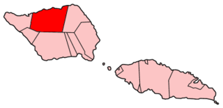
Gaga'ifomauga is a political district on the island of Savai'i in Samoa. The district is situated on the northern side of the island with a population of 4,770.

Vavau is a small village on south east end of Upolu island in Samoa. The village is part of Lotofaga Electoral Constituency which is within the larger political district of Atua.

Lepea is a small village at the southeastern end of Upolu island in Samoa. The village has a population of 170. It is also the name of an electoral faipule district, Lepea Electoral Constituency, which consists of 6 villages, including Lepea village, with a total population of 1,429..
Siumu is a village on the central south coast of Upolu island in Samoa. The population is 1,092. There is also a sub-village Siumu Uta which has a population of 206.
Sataoa is a small village situated on the central south coast of Upolu island in Samoa. Like many villages in the country, Sataoa has two settlements, one inland and one by the coast. The population of Sataoa Uta is 924 and Sataoa Tai is 320.
Salamumu is a village on the south west coast of Upolu island in Samoa. The village has two settlements, Salamumu Uta and Salamumu Tai.
Afega is a village on the island of Upolu in Samoa. It is located on the central north coast of the island to the west of the capital Apia in the countryside. The population is 1,781.
Tuana'i is a small village on the central north coast of Upolu island in Samoa. It is situated to the west of Apia, the country's capital. The population is 1,247.
Moata'a is a village on the island of Upolu in Samoa. It is situated on the central north coast of the island, to the east of the capital Apia. The village is in the political district of Tuamasaga.
Lauli'i is a village on the island of Upolu in Samoa. It is located on the central north coast of the island to the east of the capital Apia. Lauli'i is part of Vaimauga East Electoral Constituency which forms part of the larger political district of Tuamasaga.
Pesega is a village on the island of Upolu in Samoa. It is located on western outskirts of Apia, the country's capita. Pesega is part of Faleata West Electoral Constituency which forms part of the larger political district of Tuamasaga.
Poutasi is a village on the south east coast of Upolu island in Samoa. The population was 379 in the 2006 Census. The village is part of Falealili Electoral Constituency in the larger political district of Atua. Poutasi was extensively damaged by the 2009 Samoa earthquake and tsunami.
Faleapuna is a village on the island of Upolu in Samoa. It is situated on the north east coast of the island in the political district of Va'a-o-Fonoti. The village is an exclave of Va'a-o-Fonoti and is geographically located further west within the district of Atua.
Safa'atoa is a village on the island of Upolu in Samoa. It is situated on the south west side of the island. Safa'atoa is in the electoral constituency of Lefaga & Falese'ela which forms part of the larger political district A'ana.
Matautu is a village in the large traditional settlement of Lefaga in Samoa. The village is situated on the south west coast of Upolu island and lies within the political district of A'ana.
Sāvaia is a village on the island of Upolu in Samoa. It is situated on the south west coast of the island in the political district of A'ana.
Matatufu is a small village on south east end of Upolu island in Samoa. The village is part of Lotofaga Electoral Constituency which is within the larger political district of Atua.
Saleapaga is a village on the south east coast of Upolu island in Samoa. The village is part of Lepa Electoral Constituency which is within the larger political district of Atua.
Luatuanu'u is a village situated on the east side of Upolu island in Samoa. The village is part of Anoamaa West Electoral Constituency which is within the larger political district of Atua.
Malie is a village on the island of Upolu in Samoa. It is located on the north coast in the Electoral Constituency of Sagaga Le Usoga which forms part of the larger political district of Tuamasaga.


