Falemauga Caves

Last updated
Falemauga Caves
F 2 067 155 AK Uni Falemauga Caves 1957 unknown photographer.jpg
Falemauga Caves - large chamber (1957 photo)
Samoa location map.svg
Archaeological site icon (red).svg
location in Samoa
Locationcentral ridge of Upolu island
Region Tuamasaga district, Samoa
Coordinates 13°54′58″S171°49′20″W / 13.91611°S 171.82222°W / -13.91611; -171.82222
Site notes
Excavation dates1940s
Archaeologists Derek Freeman
Entrance to main shaft (1957 photo) F 2 068 162 Ak Uni entrance to main shaft Falemauga Caves 1957.jpg
Entrance to main shaft (1957 photo)
Heaped scoria in the main gallery (1957 photo) F 2 067 158 Ak Uni Falemauga caves heaped scoria main gallery - Samoa 1957.jpg
Heaped scoria in the main gallery (1957 photo)

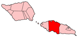
The Falemauga Caves are large natural caverns in a series of lava-tunnels situated in the Tuamasaga district along the central ridge of Upolu island in Samoa. The caves have been studied by archaeologists in Samoa with evidence of human occupation in pre-history. They were also used as a place of refuge by the people of Tuamasaga. [1]

Contents

The caves were explored and excavated in the early 1940s by New Zealand anthropologist Derek Freeman [2] who published his report in the Journal of the Polynesian Society in 1944. [1] Platforms constructed of stacked rocks, charcoal, stone adzes and marine shells were found in the caves. [3]

In the Samoan language, the name Falemauga can be broken down into two words, fale which means 'house' and mauga which means 'mountain.'

Location

The Falemauga Caves are located in an inland area called Falemauga, about 6 miles south west from Apia, Samoa's capital. Entrance to the main system of tunnels is about five and a half miles south (inland) of the coastal village of Malie. [1]

History

When Freeman studied the caves in 1941, they were all located on a plantation owned by a 'Mr. S. V. Mackenzie of Apia.' During his field work, Freeman stayed in Mackenzie's house in Falemauga, located about 900 feet from the caves. Prior to Mackenzie, the land had formerly been owned by a German, Herr Paul Ludwig Schroeder, whose son Mr. H. H. Schroeder, discovered the caves in 1914. The caves were visited in August 1914 by members of the New Zealand Expeditionary Force, which was occupying the country at the time. In 1920, they were visited by Dr. J. Allan Thomson, Director of the Dominion Museum in New Zealand. [1] Other scholars who visited the caves include Jack Golson, who explored the caves in 1957 as well as eminent archaeologist Janet Davidson.

Geology

The caves are part of lava tubes, a result of old lava-flows near an extinct volcano called Sigaele [1] in the island's volcanic interior. The islands of Samoa consist of high volcanic islands [3] which have resulted in geological formations including caves and lava tubes, some which occur as water conduits and forming natural springs around the islands' coastlines, like the Mata o le Alelo Pool on Savai'i island and Piula Cave Pool on Upolu.

Archaeology

Freeman describes in his report the entrance into the tunnels as almost circular, and measuring approximately 50 ft (15 m) in diameter. The height above sea level at this point averaged about 1,555 ft (474 m). [1]

The down-break opening had divided from what was once a single tunnel into two distinct sections, one to the north and one to the south. Freeman called the north section the North Cave and the south section the South Cave. The North Cave was a lot longer than the South Cave. Both caves were inhabited by Pe'ape'a ( Collocalia francica ), a species of swift and by many small bats.

North Cave

Entry into the North Cave was extremely confined and only four and one half feet in height and three feet in width. The length of the North Cave was 1,408 ft (429 m). Its width averaged at 25 ft (7.6 m) until at a distance from the entrance of about 850 ft (260 m), there was an amphitheater (maximum width 56 ft (17 m)) of considerable size which formed the center of a series of branches. The first branch was 150 ft (46 m), the second branch 900 ft (270 m), beyond which it was too confined for Freeman to measure. The height varied from 4 ft (1.2 m) at the entrance to 30 ft (9.1 m) in the amphitheater. [1]

South Cave

In contrast to the confined entry to the North Cave, entry into the South Cave was 30 ft (9.1 m) wide and about 20 ft (6.1 m) high. Its length from the entry to termination was 513 ft (156 m), and there was no branching.

Findings

An elaborate system of rocky platforms were found in the caves, constructed mainly with pieces of fallen lava-rock and built up to a height of about 2 to 3 ft (0.61 to 0.91 m) above the cave floor. Freeman recorded 152 platforms, 129 in the north cave, and 23 in the south cave. He also found numerous umu cook sites, fireplaces, and kitchen-middens as well as several lumps of ele a type of red volcanic rock used as a natural dye for Samoan siapo or tapa, a traditional bark cloth material. [1] He found 5 stone adzes, four in the North Cave and one in the South Cave, a common type of prehistoric adze found in Samoa. A small circular rubbing-stone was found by a platform, which Freeman surmised was used for sharpening and polishing.

See also

Related Research Articles

<span class="mw-page-title-main">Samoa</span> Polynesian island country

Samoa, officially the Independent State of Samoa and until 1997 known as Western Samoa, is a Polynesian island country consisting of two main islands ; two smaller, inhabited islands ; and several smaller, uninhabited islands, including the Aleipata Islands. Samoa is located 64 km (40 mi) west of American Samoa, 889 km (552 mi) northeast of Tonga, 1,152 km (716 mi) northeast of Fiji, 483 km (300 mi) east of Wallis and Futuna, 1,151 km (715 mi) southeast of Tuvalu, 519 km (322 mi) south of Tokelau, 4,190 km (2,600 mi) southwest of Hawaii, and 610 km (380 mi) northwest of Niue. The capital and largest city is Apia. The Lapita people discovered and settled the Samoan Islands around 3,500 years ago. They developed a Samoan language and Samoan cultural identity.

<span class="mw-page-title-main">Transport in Samoa</span> Overview of transport in Samoa

Transport in Samoa includes one international airport situated on the north west coast of Upolu island, paved highways reaching most parts of the two main islands, one main port in the capital Apia and two ports servicing mainly inter island ferries for vehicles and passengers between the two main islands, Upolu and Savai'i.

<span class="mw-page-title-main">Apia</span> Capital of Samoa

Apia is the capital and only city of Samoa. It is located on the central north coast of Upolu, Samoa's second-largest island. Apia falls within the political district (itūmālō) of Tuamasaga.

<span class="mw-page-title-main">Upolu</span> Island in Samoa

Upolu is an island in Samoa, formed by a massive basaltic shield volcano which rises from the seafloor of the western Pacific Ocean. The island is 75 kilometres long and 1,125 square kilometres in area, making it the second largest of the Samoan Islands by area. With approximately 145,000 inhabitants, it is by far the most populous of the Samoan Islands. Upolu is situated to the southeast of Savai'i, the "big island". Apia, the capital, is in the middle of the north coast, and Faleolo International Airport at the western end of the island. The island has not had any historically recorded eruptions, although there is evidence of three lava flows, dating back only to between a few hundred and a few thousand years ago.

<span class="mw-page-title-main">Samoan Islands</span> Archipelago in the South Pacific Ocean

The Samoan Islands are an archipelago covering 3,030 km2 (1,170 sq mi) in the central South Pacific, forming part of Polynesia and of the wider region of Oceania. Administratively, the archipelago comprises all of the Independent State of Samoa and most of American Samoa. The land masses of the two Samoan jurisdictions are separated by 64 km (40 mi) of ocean at their closest points.

<span class="mw-page-title-main">Savaiʻi</span> Island in the Samoan Islands chain

Savaiʻi is the largest and highest island both in Samoa and in the Samoan Islands chain. The island is also the sixth largest in Polynesia, behind the three main islands of New Zealand and the Hawaiian Islands of Hawaii and Maui. While it is larger than the second main island, Upolu, it is significantly less populated.

The Alofaaga Blowholes, also known as the Taga Blowholes, are a natural feature located in the district of Palauli, south west of Salelologa wharf on the island of Savai'i in Samoa. The entrance to the blowholes is in the village of Taga.

<span class="mw-page-title-main">Apolima</span> Island in Samoa

Apolima is the smallest of the four inhabited islands of Samoa, in central South Pacific Ocean. It lies in the Apolima Strait, between the country's two largest islands: Upolu to the east, and Savai'i to the west.

<span class="mw-page-title-main">Districts of Samoa</span> Overview of the districts of Samoa

Samoa is made up of eleven itūmālō. These are the traditional eleven districts that were established well before European arrival. Each district has its own constitutional foundation (faavae) based on the traditional order of title precedence found in each district's faalupega.

<span class="mw-page-title-main">Aʻana</span> District in Samoa

Aʻana is a district of Samoa. It is on the western third of Upolu island, with a small exclave surrounded by Aiga-i-le-Tai. It has an area of 193 km² and a population of 23,265. The main centre is Leulumoega.

<span class="mw-page-title-main">Mulinu'u</span>

Mulinu'u is a small village situated on a tiny peninsula on Upolu island in Samoa. It became the site of the colonial administration in Samoa in the 1870s and continues to be the site for the Parliament of Samoa. It is located on the central north coast of the island and is part of the urban area comprising Apia, the country's capital.

Taufusi is a village on the Samoan island of Upolu. It is part of the Vaimauga West Electoral Constituency, Tuamasaga District, in the Apia Urban Area of Samoa. The village had a population of 364 at the 2016 census. The village name in English means Swamp as it was a swampy area in late 19th century. Taufusi is bordered by Saleufi to the North, Tuloto to the East, Lalovaea to the South East, Mt. Vaea and Palisi to the South, Vaimea and Fugalei to the West.

Furna de Água is a cave system located in the municipality of Angra do Heroísmo, on the island of Terceira in the Portuguese archipelago of the Azores. The 560 metres (1,840 ft) long volcanic lava tube, is one of the main sources of fresh water on the island, due to the presence of several springs within the cave. Although known since 1838, Furna de Água only began to be prospected and used in the mid-20th century.

<span class="mw-page-title-main">Archaeology of Samoa</span>

Archaeology of Samoa began with the first systematic survey of archaeological remains on Savai'i island by Jack Golson in 1957. Since then, surveys and studies in the rest of Samoa have uncovered major findings of settlements, stone and earth mounds including star mounds, Lapita pottery remains and pre-historic artifacts.

Vailele is a village situated on the central north coast of Upolu island in Samoa. It’s not to be confused with the far bigger Vaitele.

Piula Cave Pool is a natural freshwater pool by the sea beneath the historic Methodist Chapel at Piula on the north coast of Upolu island in Samoa. It is situated at Lufilufi in the political district of Atua, 26 km east from the capital Apia, along the scenic coastal road. Entry is by the main road through the painted stone wall of Piula Theological College with steps leading down to the pool.

<span class="mw-page-title-main">Lepea</span> Village in Tuamasaga, Samoa

Lepea is a village on the island of Upolu in Samoa. The picturesque settlement of round Samoan houses built in a concentric pattern in large open grounds (malae) is situated 5mins drive west of the capital Apia on the north central coast of the island. It is part of the Tuamasaga electoral district.

<span class="mw-page-title-main">Gruta das Torres</span>

Gruta das Torres, is a lava cave, a geological formation of volcanic origin formed from the flow and cooling of subterranean magma rivers. This formation is located outside the parish of Criação Velha, in the municipality of Madalena, on the western flanks of the island of Pico. The cave system formed from a series of pāhoehoe lava flows which originating from the Cabeço Bravo parasitic cone about 500 to 1500 years ago. The caves are a group of interconnected lava tubes between 0.5–22 metres (2–72 ft) width, created from both pāhoehoe and ʻaʻā types of lavas generated during different geological periods. It has a height between 1.1 and 15 metres (3.6–49 ft) and is located at an elevation of 300 metres (980 ft). With an estimated length of over 5.2 km (3.2 mi) it is the longest lava cave in the Azores. Access to the cave was managed by the Mountaineering Association. Starting in 2011, AZORINA, SA took over the management and organization of the cave.

The Vaisigano River is a river on Upolu, one of the two main islands of Samoa. It is one of several rivers and streams which flow through the nation's capital, Apia. The river has three main branches, all of which have their sources in the central volcanic ridge which runs the length of the island. The main (central) branch of the river rises on the northern slopes of Mount Le Pu'e, and joins with the eastern branch 4 km south of central Apia. The western branch joins one kilometre further north.

<span class="mw-page-title-main">Naval Base Upolu</span> Naval base in United States

Naval Base Upolu was a naval base built by the United States Navy in 1942 to support the World War II effort. The base was located on Upolu Island, Samoa in the Western Pacific Ocean, part of the Samoan Islands's Naval Base Samoa. After the surprise attack on Naval Station Pearl Harbor on December 7, 1941, the US Navy was in need of setting up more advance bases in the Pacific Ocean. At Naval Base Upolu the Navy built a sea port, an airbase and a seaplane base.

References

  1. 1 2 3 4 5 6 7 8 Freeman, JD (1944). "The Falemauga Caves". Journal of the Polynesian Society. 53 (3): 86–106. Retrieved 25 January 2022.
  2. Hempenstall, Peter (2004). "Our Missionaries and Cultural Change in Samoa". The Journal of Pacific History. Vol. 39, No.2. 39: 241–250. doi:10.1080/0022334042000250760. JSTOR   25169695.
  3. 1 2 Keating, Barbara H. "The Geology of the Samoan Islands". In Keating, Barbara H.; Bolton, Barrie R. (eds.). Geology and Offshore Mineral Resources of the Central Pacific Basin (PDF). Springer-Verlag. Retrieved 26 January 2022.