
The Zagros Mountains are a long mountain range in Iran, northern Iraq, and southeastern Turkey. The mountain range has a total length of 1,600 km (990 mi). The Zagros range begins in northwestern Iran and roughly follows Iran's western border while covering much of southeastern Turkey and northeastern Iraq. From this border region, the range continues southeast under also the waters of the Persian Gulf. It spans the southern parts of the Armenian highlands, the whole length of the western and southwestern Iranian plateau, ending at the Strait of Hormuz. The highest point is Mount Dena, at 4,409 metres (14,465 ft).

The Levallois technique is a name given by archaeologists to a distinctive type of stone knapping developed around 250,000 to 300,000 years ago during the Middle Palaeolithic period. It is part of the Mousterian stone tool industry, and was used by the Neanderthals in Europe and by modern humans in other regions such as the Levant.

Khorramabad is a city in the Central District of Khorramabad County, Lorestan province, Iran, serving as capital of the province, the county, and the district.
The Little Zab or Lower Zab is a river that originates in Iran and joins the Tigris just south of Al Zab in the Kurdistan region of Iraq. The Little Zab is approximately 400 kilometres (250 mi) long and drains an area of about 22,000 square kilometres (8,500 sq mi). The river is fed by rainfall and snowmelt, resulting in a peak discharge in the spring and low water in the summer and early fall. Two dams built on the Little Zab regulate the river flow, providing water for irrigation and generating hydroelectricity. The Zagros Mountains have been populated since at least the Lower Palaeolithic, but the earliest archaeological site in the Little Zab basin, Barda Balka, dates to the Middle Palaeolithic. Human occupation of the Little Zab basin has been attested for every period since then.
The Palaeolithic Era in Iran is the prehistory of Iran in the period from c. 800,000 BCE to c. 11,000 BCE and can be divided into the Lower Paleolithic, Middle Paleolithic and Upper Paleolithic periods.
The Baradostian culture was an Upper Paleolithic flint industry culture found in the Zagros region in the border-country between Iraq and Iran. It was preceded by the Middle Paleolithic Mousterian culture, directly overlying it without an intervening bladelet industry. This culture is known for the high percentage of burins and some of these were similar to the distinctive nosed profile of the Aurignacian burins. Baradost is one of the mountains in the Zagros Mountains in Iraq.
Sefid-Ab is an archeological site in central Iran and is the first known evidence for Upper Paleolithic occupation of that region.
Harold Lewis Dibble was an American Paleolithic archaeologist. His main research concerned the lithic reduction during which he conducted fieldwork in France, Egypt, and Morocco. He was a professor of Anthropology at the University of Pennsylvania and Curator-in-Charge of the European Section of the University of Pennsylvania Museum of Archaeology and Anthropology.

Darband Cave is a Lower Paleolithic site in the Gilan Province in northern Iran, located on the north side of a deep tributary canyon of the Siahrud River, a tributary of the Sefīd-Rūd River that flows into the Caspian Sea.

Yafteh is an Upper Paleolithic cave located at the foot of Yafteh Mountain in the Zagros Mountains range, located northwest of Khoramabad in western Zagros, Lorestan Province of western Iran.
Fereidoun Biglari is an Iranian archaeologist and a museum curator.
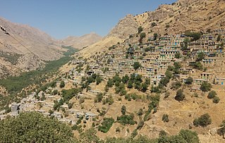
Cultural Landscape of Hawraman or Cultural Landscape of Uramanat is the 26th tangible cultural heritage of Iran. This remote and mountainous landscape bears testimony to the traditional culture of the Hawrami people, an agropastoral Kurdish tribe that has inhabited the region since about 3000 BCE. The property, at the heart of the Zagros Mountains in the provinces of Kurdistan and Kermanshah along the western border of Iran.

Bisitun Cave is an archaeological site of prehistoric human habitation in the Zagros Mountains in the Kermanshah province, north-west Iran. Bisitun Cave is one of five caves situated at the base of The Rock of Bisitun, a 1,300 m (4,300 ft) high cliff within the Chamchamal Plain. It was first excavated in 1949 by Carlton Coon, and is notable for the discovery of Mousterian stone tools of the Middle Paleolithic, as well as the remains of 109 identifiable species of Pleistocene mammals, and hominid remains. Harold Dibble described the stone tools as having strong Levallois components. All artefacts are apparently from the same period.

The prehistory of the Iranian plateau, and the wider region now known as Greater Iran, as part of the prehistory of the Near East is conventionally divided into the Paleolithic, Epipaleolithic, Neolithic, Chalcolithic, Bronze Age and Iron Age periods, spanning the time from the first settlement by archaic humans about a million years ago until the beginning of the historical record during the Neo-Assyrian Empire, in the 8th century BC.

Maiwala or Farokhshad is a mountain of the Zagros Mountains, located in western Iran, north of the city of Kermanshah. It is one of the mountains of Paraw range, with an altitude of 2445 above sea level. It is about 5 km long from the Tang-e Malavard at west to Taq-e Kenesht at east. The mountain contains several archaeological caves.

Frank Hole is an American Near Eastern archaeologist known for his work on the prehistory of Iran, the origins of food production, and the archaeology of pastoral nomadism. He is C. J. MacCurdy Professor Emeritus of Anthropology at Yale University.

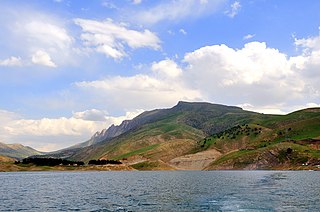
Darian Dam was constructed on the Sirwan River between 2009 and 2015. The Dam is located in the Hawrāmān region of Kurdistan and Kermanshah. The Darian Dam Archeological Salvage Program (DDASP) was planned by the Iranian Center for Archaeological Research before flooding the reservoir.
Maysoon Al-Nahar is a Jordanian archaeologist specializing in the Paleolithic, Epipaleolithic, and Neolithic of the Southern Levant. Al-Nahar studied Anthropology and Prehistory at Arizona State University between 1995 and 2000. She is now a full professor in the Department of Archaeology at the University of Jordan. Prof. Al-Nahar is acting now as Editor-in-Chief for the Jordan Journal for History and Archaeology, which is indexed in SCOPUS. Al-Nahar has held the position of the Dean of the School of Archaeology and Tourism at the University of Jordan (2013-2017). Also in previous years, she served as the Assistant Dean for Archaeological and Heritage Museums, the Head of the Department of Archaeology, and the Museum Director at the University of Jordan. She worked on more than 45 excavations. She directed the Tell Abu Suwwan excavation, Jerash, Jordan, and she is a partner on the left bank of the Jordan Valley, researching the first human settlements project and co-directed more many other excavation projects. Al-Nahar has experience in lithic technologies and analysis and paleoenvironmental reconstruction. She has more to 60 publications.
Darai Rockshelter is an archaeological site in the southwest of Kurdistan Province, in west Iran. It is located in the Sirwan River valley, between Naw and Asparez villages, in the Hawraman region. It faces NNW at an altitude of 760m a.s.l.The shelter was discovered during Darian Dam Archaeological Salvage Program in 2015, excavated in 2015–2016, and it was subsequently submerged in 2016.
The Archaeology of Iran encompasses the following subjects:
