Caves of Nanumanga

Last updated
Caves of Nanumanga
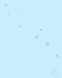
Tuvalu location map.svg
Archaeological site icon (red).svg
location in Tuvalu
Locationoff the northern shore of Nanumanga
Region Tuvalu in western Polynesia
Coordinates 6°16′7.32″S176°19′15″E / 6.2687000°S 176.32083°E / -6.2687000; 176.32083

Caves of Nanumanga is an underwater cave off the northern shore of Nanumanga, Tuvalu in western Polynesia. It was discovered by two scuba divers in 1986. [1]
Contents

Legend

The discovery of the Caves of Nanumanga was made because of interest aroused by a local legend. According to this legend, there existed "a large house under the sea". The existence of this legend led to the scuba diving expedition in 1986, during which the caves were discovered. [1] These are sometimes referred to as the Fire Caves of Nanumanga. [2]

Sea level debates

The caves are currently submerged underneath the ocean, highlighting the profound change in sea level over time. Public controversies regarding sea level changes in contemporary Tuvalu are thus set against this background.

Footnotes

  1. 1 2 The Age (Melbourne, Australia), Monday 13 April 1987
  2. Gibbons, John R. H.; Clunie, Fergus G. A. U. (1968). "Sea Level Changes and Pacific Prehistory: New Insight Into Early Human Settlement of Oceania". Journal of Pacific History. 21 (1–2): 58–82.

Related Research Articles

<span class="mw-page-title-main">Tuvalu</span> Country in Oceania

Tuvalu is an island country in the Polynesian subregion of Oceania in the Pacific Ocean. Its islands are situated about midway between Hawaii and Australia. They lie east-northeast of the Santa Cruz Islands, northeast of Vanuatu, southeast of Nauru, south of Kiribati, west of Tokelau, northwest of Samoa and Wallis and Futuna, and north of Fiji. Tuvalu is composed of three reef islands and six atolls. They are spread out between the latitude of 5° and 10° south and between the longitude of 176° and 180°. They lie west of the International Date Line. Tuvalu has a population of 11,204. The total land area of the islands of Tuvalu is 26 square kilometres (10 sq mi).

<span class="mw-page-title-main">Geography of Tuvalu</span> Overview of the geography of Tuvalu

The Western Pacific nation of Tuvalu, formerly known as the Ellice Islands, is situated 4,000 kilometers (2,500 mi) northeast of Australia and is approximately halfway between Hawaii and Australia. It lies east-northeast of the Santa Cruz Islands, southeast of Nauru, south of Kiribati, west of Tokelau, northwest of Samoa and Wallis and Futuna and north of Fiji. It is a very small island country of 26 km2 (10 sq mi). Due to the spread out islands it has the 38th largest Exclusive Economic Zone of 749,790 km2 (289,500 sq mi).

<span class="mw-page-title-main">History of Tuvalu</span> Aspect of history

The first inhabitants of Tuvalu were Polynesians, so the origins of the people of Tuvalu can be traced to the spread of humans out of Southeast Asia, from Taiwan, via Melanesia and across the Pacific islands of Polynesia.

<span class="mw-page-title-main">Vaitupu</span> Atoll in Tuvalu

Vaitupu is the largest atoll of the nation of Tuvalu. It is located at 7.48 degrees south and 178.83 degrees east. There are 1,061 people living on 5.6 square kilometres with the main village being Asau.

Sheck Exley was an American cave diver. He is widely regarded as one of the pioneers of cave diving, and he wrote two major books on the subject: Basic Cave Diving: A Blueprint for Survival and Caverns Measureless to Man. On February 6, 1974, Exley became the first chairman of the Cave Diving Section of the American National Speleological Society. During his career, he established many of the basic safety procedures used in cave and overhead diving today. Exley was also a pioneer of extreme deep scuba diving.

<i>Sea Hunt</i> American action adventure television series from 1958 to 1961

Sea Hunt is an American action adventure television series that aired in syndication from 1958 to 1961 and was popular for decades afterwards. The series originally aired for four seasons, with 155 episodes produced. It stars Lloyd Bridges as former Navy diver Mike Nelson, and was produced by Ivan Tors.

<span class="mw-page-title-main">Nanumanga</span> Reef Island in Tuvalu

Nanumanga or Nanumaga is a reef island and a district of the Oceanian island nation of Tuvalu. It has a surface area of about 3 km2 with a population of 491.

<span class="mw-page-title-main">Niutao</span> Reef Island in Tuvalu

Niutao is a reef island in the northern part of Tuvalu. It is one of the nine districts (islands) of Tuvalu. It is also one of the three districts that consist of only one island - not counting the three islets inside the closed lagoon. Niutao has a population of 582.

<span class="mw-page-title-main">Tabon Man</span> Oldest modern human remains from the Philippines

Tabon Man refers to remains discovered in the Tabon Caves in Lipuun Point in Quezon, Palawan in the Philippines. They were discovered by Robert B. Fox, an American anthropologist of the National Museum of the Philippines, on May 28, 1962. These remains, the fossilized fragments of a skull of a female and the jawbones of three individuals dating back to 16,500 years ago, were the earliest known human remains in the Philippines, until a metatarsal from the Callao Man discovered in 2007 was dated in 2010 by uranium-series dating as being 67,000 years old. However, some scientists think additional evidence is necessary to confirm those fossils as a new species, rather than a locally adapted population of other Homo populations, such as H. erectus or Denisovan.

William C. "Bill" Stone is an American engineer, caver and explorer, known for exploring deep caves, sometimes with autonomous underwater vehicles. He has participated in over 40 international expeditions and is president and CEO of Stone Aerospace.

<span class="mw-page-title-main">Religion in Tuvalu</span>

Christianity is the predominant religion in Tuvalu, with Calvinism being the single largest denomination. The Church of Tuvalu accounts for around 97% of the total population and is the state church of Tuvalu, although in practice this merely entitles it to "the privilege of performing special services on major national events". It is Calvinist in orientation and has a Congregationalist polity.

<span class="mw-page-title-main">Climate change in Tuvalu</span> Emissions, impacts and responses of Tuvalu related to climate change

Climate change is particularly threatening for the long-term habitability of the island state of Tuvalu. This is because the average height of the islands is less than 2 metres (6.6 ft) above sea level, with the highest point of Niulakita being about 4.6 metres (15 ft) above sea level. Between 1971 and 2014, during a period of global warming, Tuvalu islands have increased in size, according to aerial photography and satellite imagery. Over four decades, there was a net increase in land area in Tuvalu of 73.5 ha (2.9%), although the changes were not uniform, with 74% of land increasing in size and 27% of land decreasing in size. The sea level at the Funafuti tide gauge has risen at 3.9 mm per year, which is approximately twice the global average.

<span class="mw-page-title-main">Bob Halstead</span> Underwater photographer, author, journalist and commentator on the recreational diving industry.

Bob Halstead, has made significant contributions to the sport of scuba diving in a multitude of capacities: photographer, author of eight diving books, early innovator in the development of dive tourism, pioneer in the dive liveaboard industry, diving instructor and educator, marine-life explorer and influential diving industry commentator. An ardent diver since 1968, Halstead has over 10,000 logged dives.

<span class="mw-page-title-main">Cyclone Pam</span> Category 5 South Pacific cyclone in 2015

Severe Tropical Cyclone Pam was the second most intense tropical cyclone of the South Pacific Ocean in terms of sustained winds and is regarded as one of the worst natural disasters in the history of Vanuatu. A total of 15–16 people lost their lives either directly or indirectly as a result of Pam with many others injured. The storm's impacts were also felt, albeit to a lesser extent, to other islands in the South Pacific, most notably the Solomon Islands, Tuvalu, and New Zealand. Pam is the third most intense storm of the South Pacific Ocean according to pressure, after Winston of 2016 and Zoe of 2002. It is also the second most intense tropical cyclone in 2015, only behind Hurricane Patricia. In addition, Pam is tied with Orson, Monica, Marcus and Fantala for having the second strongest ten-minute maximum sustained winds in the Southern Hemisphere. Thousands of homes, schools and buildings were damaged or destroyed, with an estimated 3,300 people displaced as a result.

Otinielu Tauteleimalae Tausi is a politician from Tuvalu for the constituency of Nanumanga. He served as the speaker of the Parliament of Tuvalu from 2003 until 2006, then again from March 2014 onward, and has also been the deputy prime minister of Tuvalu.

<span class="mw-page-title-main">Cyclone Raja</span> 1986–1987 South Pacific cyclone

Severe Tropical Cyclone Raja was a tropical cyclone that holds the 24-hour rainfall record of 674.9 mm (26.57 in) for the French Overseas Territory of Wallis and Futuna. The system was first noted by the Fiji Meteorological Service (FMS) as a weak tropical disturbance northeast of Tokelau in mid-December 1986. The system developed further as it moved southwest over the next few days, and it was classified as Tropical Cyclone Raja on 23 December. The newly named system slowed and unexpectedly recurved southeast towards the French territory of Wallis and Futuna on 24 December. Over the next two days, Raja interacted with what would become Severe Cyclone Sally and executed a tight loop, passing within 55 km (35 mi) of Futuna. The system peaked as a Category 3 severe tropical cyclone on 28 December, with estimated 10-minute sustained winds of 90 mph (150 km/h). The storm turned southwest the next day and threatened Fiji, where it passed within 20 km (10 mi) of Vanua Levu and near several smaller islands in the Lau group during the following day. Raja gradually weakened over the next few days as it moved south of Fiji; it was last noted on 5 January 1987 after it filled up over the north Tasman Sea.

Elands Bay Cave is located near the mouth of the Verlorenvlei estuary on the Atlantic coast of South Africa's Western Cape Province. The climate has continuously become drier since the habitation of hunter-gatherers in the Later Pleistocene. The archaeological remains recovered from previous excavations at Elands Bay Cave have been studied to help answer questions regarding the relationship of people and their landscape, the role of climate change that could have determined or influenced subsistence changes, and the impact of pastoralism and agriculture on hunter-gatherer communities.

<span class="mw-page-title-main">History of scuba diving</span> History of diving using self-contained underwater breathing apparatus

The history of scuba diving is closely linked with the history of the equipment. By the turn of the twentieth century, two basic architectures for underwater breathing apparatus had been pioneered; open-circuit surface supplied equipment where the diver's exhaled gas is vented directly into the water, and closed-circuit breathing apparatus where the diver's carbon dioxide is filtered from the exhaled breathing gas, which is then recirculated, and more gas added to replenish the oxygen content. Closed circuit equipment was more easily adapted to scuba in the absence of reliable, portable, and economical high pressure gas storage vessels. By the mid-twentieth century, high pressure cylinders were available and two systems for scuba had emerged: open-circuit scuba where the diver's exhaled breath is vented directly into the water, and closed-circuit scuba where the carbon dioxide is removed from the diver's exhaled breath which has oxygen added and is recirculated. Oxygen rebreathers are severely depth limited due to oxygen toxicity risk, which increases with depth, and the available systems for mixed gas rebreathers were fairly bulky and designed for use with diving helmets. The first commercially practical scuba rebreather was designed and built by the diving engineer Henry Fleuss in 1878, while working for Siebe Gorman in London. His self contained breathing apparatus consisted of a rubber mask connected to a breathing bag, with an estimated 50–60% oxygen supplied from a copper tank and carbon dioxide scrubbed by passing it through a bundle of rope yarn soaked in a solution of caustic potash. During the 1930s and all through World War II, the British, Italians and Germans developed and extensively used oxygen rebreathers to equip the first frogmen. In the U.S. Major Christian J. Lambertsen invented a free-swimming oxygen rebreather. In 1952 he patented a modification of his apparatus, this time named SCUBA, an acronym for "self-contained underwater breathing apparatus," which became the generic English word for autonomous breathing equipment for diving, and later for the activity using the equipment. After World War II, military frogmen continued to use rebreathers since they do not make bubbles which would give away the presence of the divers. The high percentage of oxygen used by these early rebreather systems limited the depth at which they could be used due to the risk of convulsions caused by acute oxygen toxicity.

<span class="mw-page-title-main">Minute Alapati Taupo</span> Tuvaluan politician (1962–2022)

Minute Alapati Taupo OBE was a Tuvaluan politician, diplomat, economist and accountant. Taupo was elected to the Parliament of Tuvalu in the 2019 Tuvaluan general election to represent the Nanumanga electorate. He was appointed Deputy Prime Minister & Minister for Fisheries and Trade in the Natano Ministry.

<span class="mw-page-title-main">Coral reefs of Tuvalu</span> List of coral reefs in Tuvalu

The coral reefs of Tuvalu consist of three reef islands and six atolls, containing approximately 710 km2 (270 sq mi) of reef platforms. The islands of the Tuvalu archipelago are spread out between the latitude of 5° to 10° south and longitude of 176° to 180°, west of the International Date Line. The islands of Tuvalu are volcanic in origin. On the atolls, an annular reef rim surrounds the lagoon, and may include natural reef channels. The reef islands have a different structure to the atolls, and are described as reef platforms as they are smaller tabular reef platforms that do not have a salt-water lagoon, although they may have a completely closed rim of dry land, with the remnants of a lagoon that has no direct connection to the open sea or that may be drying up.