
 A black rectangular enclosure with rows of dots
 Four yellow giraffes, situated 2.4 to 3.0 meters above the ground. These are the highest and clearest of the Manyana paintings.
 A red gemsbok
 A black, medicinal herb
 Three men carrying a prey on their back
 One giraffe and three kudus. The giraffe is situated at the top center
 A man
A man A rhinoceros facing the left
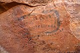
 What looks like the letter "p" is believed to be the symbol of venomous snakes
 Two men, a woman (right) and a kudu (bottom left)
 A zebra standing upright
| Manyana Rock Paintings | |
|---|---|
 Four yellow animals | |
| Location | Kweneng District, Botswana |
| Coordinates | 24°45′52″S25°35′28″E / 24.76444°S 25.59111°E |
 Manyana Rock Paintings | |
The Manyana Rock Paintings are a collection of rock art and caves located at the Kolobeng hills, neighbouring Manyana, Southern District, Botswana. It is believed that the artworks were made by the Khoikhoi or the San people between 1100 AD and 1700 AD. [1] The paintings are found on five cliff areas around the rocky hill. [2] Today, the site is fenced and protected as a National Monument. [3] [4]


