Shum Laka

Last updated
Shum Laka
Cameroon physical map.svg
Red pog.svg
Shum Laka Archaeological Site
LocationBamenda, Cameroon
Coordinates 5°51′31″N10°4′40″E / 5.85861°N 10.07778°E / 5.85861; 10.07778

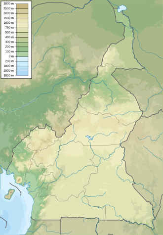
The archaeological site of Shum Laka is the most prominent rockshelter site in the Grasslands region of the Laka Valley, northwest Cameroon. Occupations at this rockshelter date to the Later Stone Age. [1] This region is important to investigations of the development and subsequent diffusion of Bantu-speaking peoples. [2] The site of Shum Laka is located approximately 15 kilometers from the town of Bamenda, and it resides on the inner wall of the Bafochu Mbu caldera. [3] The deposits at Shum Laka include each phase of cultural development in the Grasslands. [2]

Contents

Archaeology

Geoarchaeology of Shum Laka

The rockshelter itself at Shum Laka is approximately 50 meters wide at its greatest point and 20 meters deep. [4] Stratigraphic dating of surface and near surface deposits support occupations as early as 30,000 BP. [5] Geomorphological analysis determined that the rockshelter had been subjected to alluvial depositional events during the Holocene, but archaeological deposits remained mostly intact and in situ. [6] Fluvial erosional processes at the site were determined to have had their greatest impact laterally, and thus not damaged contextual integrity between cultural occupations. [4] The importance of geoarchaeological investigations conducted at Shum Laka includes the construction of a reliable cultural chronology of the area, and an emphasis on the need to critically evaluate other rockshelter sites in the region. [4]

Archaeological deposits

At Shum Laka, over 1,000 ceramic sherds, nearly 500,000 pieces of lithic materials, and 18 human skeletons were recovered. [2] Radiocarbon dating of the bone and plant remains recovered demonstrated multiple occupations spanning from 30,000 BP to around 400 BP. [2] [5] Bone preservation from the early occupations is poor, with only a few surviving faunal remains and no bone tools. [1] Later occupations depict common exploitation of medium-sized fauna from the forest. [7] These remains include those from several gorillas and chimpanzees, and various artiodactyla. [7] Based upon the small amounts of materials found in individual strata, it is proposed that the site was occupied for numerous short periods of time. [2] Macrobotanical remains recovered were originally claimed to include both savanna grasses and forest trees, but the source wrongly cited a montane forest herb, Hypericum, as a savanna grass. [2] These were interpreted as meaning that for a period of occupation during the Holocene, Shum Laka was located within an ecotone. [2] Ceramic assemblages recovered from the site date from 7000 BP onward and are indicative of continued longer occupation by semi-agricultural populations. [2] Additionally, these ceramic assemblages indicate the use of the rockshelter by different groups of peoples and that these people interacted with various western African states. [2]
Lithic assemblage and environmental variability

The lithic assemblage in some of the late Pleistocene occupations at Shum Laka are unique in the presence of a quartz industry early than most other sites in the region. [5] The presence of a microlithic quartz industry at Shum Laka, when combined with supporting evidence from other rockshelter and late Pleistocene sites in the Grasslands, is indicative of a more mobile population that exploited a variety of resources in the ecotonal landscape. [5] This behavioral strategy is ascribed as an adaptation to common regional environmental changes during the late Pleistocene. [5] It is well established that the late Pleistocene in northern Cameroon and the surrounding area was highly variable climatically. [1] Particularly during the Last Glacial Maximum, refuge occupations by people would have been short-term and highly variable based on rapid, localized changes. [1] Similar lithic assemblages and strategies as those found at Shum Laka have been delineated at other rockshelter sites in the area dating to the same period. [1]

Genetics

Ancient DNA

Geneticists sequenced genome-wide DNA data from four Shum Laka foragers buried at the site of Shum Laka in Cameroon between 8000–3000 years ago. [8] One individual 2/SEII carried the deeply divergent haplogroup A00 found at low frequencies among some present-day Niger-Congo speakers, but the genome-wide ancestry profiles for all four individuals are very different from the majority of West Africans today and instead are more similar to West-Central African hunter-gatherers. [8] Despite the geographic proximity of Shum Laka to the hypothesized birthplace of Bantu languages and the temporal range of the samples bookending the initial Bantu expansion, these individuals are not representative of a Bantu source population. [8] Phylogenetic model including Shum Laka features three major radiations within Africa: one phase early in the history of modern humans, one close to the time of the migration giving rise to non-Africans, and one in the past several thousand years. [8] Present-day West Africans and some East Africans, in addition to Central and Southern African hunter-gatherers, retain ancestry from the first phase, which is therefore still represented throughout the majority of human diversity in Africa today. [8]

World Heritage status

This site was added to the UNESCO World Heritage Tentative List on February 2, 2018 in the Cultural category. [9]

Related Research Articles

Hoabinhian is a lithic techno-complex of archaeological sites associated with assemblages in Southeast Asia from late Pleistocene to Holocene, dated to c. 10,000–2000 BCE. It is attributed to hunter-gatherer societies of the region and their technological variability over time is poorly understood. In 2016 a rockshelter was identified in Yunnan (China), where artifacts belonging to the Hoabinhian technocomplex were recognized. These artifacts date from 41,500 BCE.

<span class="mw-page-title-main">Kondoa Rock-Art Sites</span> National Historic Site of Tanzania

The Kondoa Rock-Art Sites or Kondoa Irangi Rock Paintings are a series of ancient paintings on rockshelter walls in central Tanzania. The Kondoa region was declared a UNESCO World Heritage Site in 2006 because of its impressive collection of rock art. These sites were named national monuments in 1937 by the Tanzania Antiquities Department. The paintings are located approximately nine kilometres east of the main highway (T5) from Dodoma to Babati, about 20 km north of Kondoa town, in Kondoa District of Dodoma Region, Tanzania. The boundaries of the site are marked by concrete posts. The site is a registered National Historic Sites of Tanzania.

Mumba Cave, located near the highly alkaline Lake Eyasi in Karatu District, Arusha Region, Tanzania. The cave is a rich archaeological site noted for deposits spanning the transition between the Middle Stone Age and Late Stone Age in Eastern Africa. The transitional nature of the site has been attributed to the large presence of its large assemblage of ostrich eggshell beads and more importantly, the abundance of microlith technology. Because these type artifacts were found within the site it has led archaeologists to believe that the site could provide insight into the origins of modern human behavior. The cave was originally tested by Ludwig Kohl-Larsen and his wife Margit in their 1934 to 1936 expedition. They found abundant artifacts, rock art, and burials. However, only brief descriptions of these findings were ever published. That being said, work of the Kohl-Larsens has been seen as very accomplished due to their attention to detail, especially when one considers that neither was versed in proper archaeological techniques at the time of excavation. The site has since been reexamined in an effort to reanalyze and complement the work that has already been done, but the ramifications of improper excavations of the past are still being felt today, specifically in the unreliable collection of C-14 data and confusing stratigraphy.

Balangoda Man refers to hominins from Sri Lanka's late Quaternary period. The term was initially coined to refer to anatomically modern Homo sapiens from sites near Balangoda that were responsible for the island's Mesolithic 'Balangoda Culture'. The earliest evidence of Balangoda Man from archaeological sequences at caves and other sites dates back to 38,000 BCE, and from excavated skeletal remains to 30,000 BC, which is also the earliest reliably dated record of anatomically modern humans in South Asia. Cultural remains discovered alongside the skeletal fragments include geometric microliths dating to 28,500 BC, which together with some sites in Africa is the earliest record of such stone tools.

Enkapune Ya Muto, also known as Twilight Cave, is a site spanning the late Middle Stone Age to the Late Stone Age on the Mau Escarpment of Kenya. This time span has allowed for further study of the transition from the Middle Stone Age to the Late Stone Age. In particular, the changes in lithic and pottery industries can be tracked over these time periods as well as transitions from a hunter-gatherer lifestyle to a herding lifestyle. Beads made of perforated ostrich egg shells found at the site have been dated to 40,000 years ago. The beads found at the site represent the early human use of personal ornaments. Inferences pertaining to climate and environment changes during the pre-Holocene and Holocene period have been made based from faunal remains based in this site.

<span class="mw-page-title-main">Border Cave</span> Rock shelter in South Africa

Border Cave is an archaeological site located in the western Lebombo Mountains in Kwazulu-Natal. The rock shelter has one of the longest archaeological records in southern Africa, which spans from the Middle Stone Age to the Iron Age.

<span class="mw-page-title-main">Jwalapuram</span>

Jwalapuram is an archaeological site in the Kurnool district of Andhra Pradesh, southern India, which shows hominid habitation before and after the Toba event according to the Toba catastrophe theory. It is unclear what species of humans settled Jwalapuram as no fossil remains have yet been found.

Buur Heybe, which translates to "The Hill of the Potter's Sand", is a late Pleistocene and Holocene archaeological complex located in the largest granite inselberg in the inter-riverine region of the southern Bay province of Somalia approximately 180 km northwest of the capital Mogadishu. Buur Heybe has a longstanding history of archaeological research dating back to the 1930s when Paolo Graziosi carried out the first professional archaeological excavation in Somalia in the rockshelter site of Gogoshiis Qabe in Buur Heybe. Further excavations by J. Desmond Clark in the 1950s and later by the Buur Ecological and Archaeological Project (BEAP) led by Steven Brandt in the 1980s have made Buur Heybe one of the best dated and closely studied archaeological sites in Somalia.

Elands Bay Cave is located near the mouth of the Verlorenvlei estuary on the Atlantic coast of South Africa's Western Cape Province. The climate has continuously become drier since the habitation of hunter-gatherers in the Later Pleistocene. The archaeological remains recovered from previous excavations at Elands Bay Cave have been studied to help answer questions regarding the relationship of people and their landscape, the role of climate change that could have determined or influenced subsistence changes, and the impact of pastoralism and agriculture on hunter-gatherer communities.

<span class="mw-page-title-main">Archaeology of Central Africa</span>

Central Africa is generally considered to encompass ten countries which amounts to more than six million square kilometers or roughly the size of the United States west of the Mississippi River. Despite its large size, very little archaeological research has been done in the region.

Rose Cottage Cave (RCC) is an archaeological site in the Free State, South Africa, situated only a few kilometers away from Ladybrand, close to the Caledon River, on the northern slopes of the Platberg. RCC is an important site because of its long cultural sequence, its roots in modern human behavior, and the movement of early modern humans out of Africa. Rose Cottage is the only site from the Middle Stone Age that can tell us about the behavioral variability of hunter-gatherers during the Late Pleistocene and Holocene. Berry D. Malan excavated the site between 1943 and 1946, shortly followed by Peter B. Beaumont in the early 1960s, and the most recent excavations occurred from 1987 to 1997 by Lyn Wadley and Philip Harper in 1989 under Wadley's supervision. Humans have inhabited Rose Cottage for over 100,000 years throughout the Middle and Later Stone Ages. Site formation and sediment formation processes at Rose Cottage appear to be primarily anthropogenic. Archaeological research focuses primarily on blade technology and tool forms from the Middle Stone Age and the implications of modern human behavior. Structurally, the cave measures more than 6 meters deep and about 20 by 10 meters. A boulder encloses the front, protecting the cave, but allowing a small opening for a skylight and narrow entrances on both the east and west sides.

<span class="mw-page-title-main">Panga ya Saidi</span> Archaeological site in Kenya

Panga ya Saidi is an archaeological cave site located in Kilifi County, southeastern Kenya, about 15 km from the Indian Ocean in the Dzitsoni limestone hills. The cave site has rich archaeological deposits dating to the Middle Stone Age, Later Stone Age, and Iron Age. Excavated deposits preserve an unusually long record of human activities, from around 78,000 years ago until around 400 years ago, a chronology supported by radiocarbon dating and optically stimulated luminescence dating. This sequence puts Panga ya Saidi alongside other key sites such as Enkapune ya Muto, Mumba Rockshelter, and Nasera Rockshelter that are important for understanding the Late Pleistocene and the Middle to Later Stone Age transition in eastern Africa.

Nasera Rockshelter is an archaeological site located in the Ngorongoro Conservation Area within Ngorongoro District of Arusha Region in northern Tanzania, and it has evidence of Middle Stone Age and Later Stone Age occupations in the Late Pleistocene to early Holocene, and ceramic-bearing Holocene occupations attributed to Kansyore, Nderit, and Savanna Pastoral Neolithic traditions. It was first excavated by Louis Leakey in 1932. A second series of excavations by Michael Mehlman in 1975 and 1976 led to the first comprehensive published study of the shelter, its stratigraphy and chronology, and its abundant material culture, including stone tools, faunal remains, and pottery. Recent work has sought to better understand chronology, lithic technology, mobility and demography, and site formation processes at Nasera Rockshelter. Nasera Rockshelter is considered a key site in eastern Africa for understanding the Middle Stone Age to Later Stone Age transition, and also for the study of the spread of livestock herding during the Pastoral Neolithic. Its chronology and archaeological sequence have been compared to those of other key sites in the region such as Mumba Rockshelter, Kisese II Rockshelter, Panga ya Saidi, and Enkapune ya Muto.

<span class="mw-page-title-main">History of Central Africa</span>

The history of Central Africa has been divided into its prehistory, its ancient history, the major polities flourishing, the colonial period, and the post-colonial period, in which the current nations were formed. Central Africa is the central region of Africa, bordered by North Africa, West Africa, East Africa, Southern Africa, the Atlantic Ocean, and the Sahara Desert. Colonial boundaries are reflected in the modern boundaries between contemporary Central African states, cutting across ethnic and cultural lines, often dividing single ethnic groups between two or more states.

<span class="mw-page-title-main">West African hunter-gatherers</span> West African hunter-gatherers

West African hunter-gatherers, West African foragers, or West African pygmies dwelled in western Central Africa earlier than 32,000 BP and dwelled in West Africa between 16,000 BP and 12,000 BP until as late as 1000 BP or some period of time after 1500 CE. West African hunter-gatherers are archaeologically associated with the West African Microlithic Technocomplex. Despite its significance in the prehistory of West Africa, the peopling of various parts of Western Africa from the Sub-Saharan regions of coastal West Africa and the forests of western Central Africa often goes overlooked.

<span class="mw-page-title-main">Prehistoric West Africa</span> Prehistory of the West African subregion of the African continent

The prehistory of West Africa spans from the earliest human presence in the region until the emergence of the Iron Age in West Africa. West African populations were considerably mobile and interacted with one another throughout the population history of West Africa. Acheulean tool-using archaic humans may have dwelled throughout West Africa since at least between 780,000 BP and 126,000 BP. During the Pleistocene, Middle Stone Age peoples, who dwelled throughout West Africa between MIS 4 and MIS 2, were gradually replaced by incoming Late Stone Age peoples, who migrated into West Africa as an increase in humid conditions resulted in the subsequent expansion of the West African forest. West African hunter-gatherers occupied western Central Africa earlier than 32,000 BP, dwelled throughout coastal West Africa by 12,000 BP, and migrated northward between 12,000 BP and 8000 BP as far as Mali, Burkina Faso, and Mauritania.

<span class="mw-page-title-main">Mlambalasi Rock Shelter</span> National Historic Site of Tanzania

The Mlambalasi Rock Shelter is a historic site located in Iringa District of Iringa Region in southern Tanzania, 50 km away from Iringa City. Excavations in 2006 and 2010 by the Iringa Region Archaeological Project uncovered artifactual deposits from the Later Stone Age (LSA), the Iron Age, and the historic periods, as well as external artifacts from the Middle Stone Age (MSA). Direct dating on Achatina shell and ostrich eggshell beads indicates that the oldest human burials at Mlambalasi are from the terminal Pleistocene. Mlambalasi is characterized by interment LSA and Iron Age periods, as well as by cycles of use and abandonment.

<span class="mw-page-title-main">Mochena Borago</span> Rockshelter and archaeological site in Ethiopia

Mochena Borago is a rockshelter and archaeological site situated on the western slope of Mount Damota, nearest to the town of Wolaita Sodo in Ethiopia, located in the Southern Nations, Nationalities and Peoples Region. The site is well-dated, with 59 radiocarbon dates, which gives it one of the most secure chronologies among Late Pleistocene sites in the Horn of Africa and Eastern Africa. It is one of only a few African sites found with intact deposits dating to Marine Isotope Stage (MIS) 3 outside of South Africa, and was potentially a refugium for hunter-gatherering peoples during the cold and arid period of MIS 4. This makes it an important research site for testing the "refugium theory," which states that over the past 70,000 years, during cold, arid conditions, like those of the Last Glacial Maximum and MIS 4, humans sought refuge in the mountains of the southwest Ethiopian Highlands, which received higher rainfall, making them more habitable than the surrounding areas. Research at Mochena Borago is helping to reconstruct human behavior during the Late Pleistocene, and the paleoenvironment that Homosapiens would have inhabited at this time in the Horn of Africa.

<span class="mw-page-title-main">Population history of West Africa</span> West African population history

The population history of West Africa is composed of West African populations that were considerably mobile and interacted with one another throughout the history of West Africa. Acheulean tool-using archaic humans may have dwelled throughout West Africa since at least between 780,000 BP and 126,000 BP. During the Pleistocene, Middle Stone Age peoples, who dwelled throughout West Africa between MIS 4 and MIS 2, were gradually replaced by incoming Late Stone Age peoples, who migrated into West Africa as an increase in humid conditions resulted in the subsequent expansion of the West African forest. West African hunter-gatherers occupied western Central Africa earlier than 32,000 BP, dwelled throughout coastal West Africa by 12,000 BP, and migrated northward between 12,000 BP and 8000 BP as far as Mali, Burkina Faso, and Mauritania.

<span class="mw-page-title-main">Prehistoric Central Africa</span> Prehistory of the Central African subregion of the African continent

The prehistory of Central Africa spans from the earliest human presence in the region until the emergence of the Iron Age in Central Africa. By at least 2,000,000 BP, Central Africa was occupied by early hominins. West African hunter-gatherers occupied western Central Africa earlier than 32,000 BP, dwelled throughout coastal West Africa by 12,000 BP, and migrated northward between 12,000 BP and 8000 BP as far as Mali, Burkina Faso, and Mauritania. Prehistoric West Africans may have diverged into distinct ancestral groups of modern West Africans and Bantu-speaking peoples in Cameroon, and, subsequently, around 5000 BP, the Bantu-speaking peoples migrated into other parts of Sub-Saharan Africa.

References

  1. 1 2 3 4 5 Cornelissen, Els (September 2002). "Human Responses to Changing Environments in Central Africa Between 40,000 and 12,000 B.P". Journal of World Prehistory. 16 (3): 197–235. doi:10.1023/A:1020949501304. ISSN   0892-7537. JSTOR   25801191. OCLC   5649135210. S2CID   162003745.
  2. 1 2 3 4 5 6 7 8 9 Lavachery, Philippe (December 2001). "The Holocene Archaeological Sequence of Shum Laka Rock Shelter (Grasslands, Western Cameroon)". African Archaeological Review. 18 (4): 213–247. doi:10.1023/A:1013114008855. ISSN   0263-0338. JSTOR   25130728. OCLC   5547076309. S2CID   128543496.
  3. Willoughby, Pamela R. (Dec 28, 2006). "The Archaeological Evidence from Sub-Saharan Africa I". The Evolution of Modern Humans in Africa: A Comprehensive Guide. Vol. 45. Rowman Altamira. p. 272. doi:10.5860/choice.45-0950. ISBN   978-0-7591-0119-7. OCLC   70775645. S2CID   128239787.{{cite book}}: |journal= ignored (help)
  4. 1 2 3 Lavachery, Philippe; Cornelissen, Els (2000). "Natural and Cultural Spatial Patterning in the Late Holocene Deposits of Shum Laka Rock Shelter, Cameroon". Journal of Field Archaeology. 27 (2): 153–168. doi:10.1179/jfa.2000.27.2.153. ISSN   0093-4690. JSTOR   530590. OCLC   5548783048. S2CID   129802714.
  5. 1 2 3 4 5 Cornelissen, Els (March 2003). "On Microlithic Quartz Industries at the End of the Pleistocene in Central Africa: The Evidence from Shum Laka (NW Cameroon)". African Archaeological Review. 20 (1): 1–24. doi:10.1023/A:1022830321377. ISSN   0263-0338. JSTOR   25130759. OCLC   5649155686. S2CID   162074445.
  6. Moeyersons, Jan (September 1997). "Geomorphological Processes and their Palaeoenvironmental Significance at the Shum Laka cave (Bamenda, Western Cameroon)" (PDF). Palaeogeography, Palaeoclimatology, Palaeoecology. 133 (1–2): 103–116. doi:10.1016/S0031-0182(96)00148-4. ISSN   0031-0182. OCLC   4925838132. S2CID   128889890.
  7. 1 2 Maret, Pierre; Clist, Bernard; Van Neer, Wim (1987). "Resultats des premieres fouilles dans les abris de Shum Laka et D'Abeke au nord-ouest du Cameroun" (PDF). L'Anthropologie. 91 (2): 559–584. hdl:1854/LU-3118740. ISSN   0003-5521. S2CID   134546717.
  8. 1 2 3 4 5 Lipson, Mark; et al. (January 22, 2020). "Ancient West African foragers in the context of African population history" (PDF). Nature. 577 (7792): 665–670. Bibcode:2020Natur.577..665L. doi:10.1038/s41586-020-1929-1. ISSN   0028-0836. OCLC   8545173694. PMC   8386425 . PMID   31969706. S2CID   210862788.
  9. United Nations Educational, Scientific and Cultural Organization (February 2, 2018). "Le Site archéologique de Shum Laka". United Nations Educational, Scientific and Cultural Organization.