The Stone Age was a broad prehistoric period during which stone was widely used to make tools with an edge, a point, or a percussion surface. The period lasted for roughly 3.4 million years, and ended between 4,000 BCE and 2,000 BCE, with the advent of metalworking. Though some simple metalworking of malleable metals, particularly the use of gold and copper for purposes of ornamentation, was known in the Stone Age, it is the melting and smelting of copper that marks the end of the Stone Age. In Western Asia, this occurred by about 3,000 BCE, when bronze became widespread. The term Bronze Age is used to describe the period that followed the Stone Age, as well as to describe cultures that had developed techniques and technologies for working copper alloys into tools, supplanting stone in many uses.

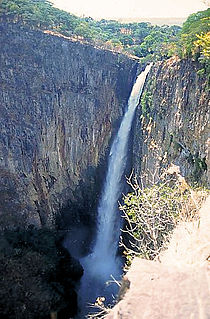
The Kalambo Falls on the Kalambo River is a 772-foot (235 m) single-drop waterfall on the border of Zambia and Rukwa Region, Tanzania at the southeast end of Lake Tanganyika. The falls are some of the tallest uninterrupted falls in Africa. Downstream of the falls is the Kalambo Gorge, which has a width of about 1 km and a depth of up to 300 m, running for about 5 km before opening out into the Lake Tanganyika rift valley. The Kalambo waterfall is the tallest waterfall in both Tanzania and Zambia. The expedition which mapped the falls and the area around it was in 1928 and lead by Enid Gordon-Gallien. Initially it was assumed that the height of falls exceeded 300 m, but measurements in the 1920s gave a more modest result, above 200 m. Later measurements, in 1956, gave a result of 221 m. After this several more measurements have been made, each with slightly different results. The width of the falls is 3.6–18 m.

Africa has the longest record of human habitation in the world. The first hominins emerged 6-7 million years ago, and among the earliest anatomically modern human skulls found so far were discovered at Omo Kibish, Jebel Irhoud, and Florisbad.

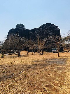
The Tsodilo Hills are a UNESCO World Heritage Site (WHS), consisting of rock art, rock shelters, depressions, and caves in southern Africa. It gained its WHS listing in 2001 because of its unique religious and spiritual significance to local peoples, as well as its unique record of human settlement over many millennia. UNESCO estimates there are over 4500 rock paintings at the site. The site consists of a few main hills known as the Child Hill, Female Hill, and Male Hill.

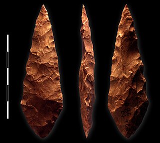
The Middle Stone Age was a period of African prehistory between the Early Stone Age and the Late Stone Age. It is generally considered to have begun around 280,000 years ago and ended around 50–25,000 years ago. The beginnings of particular MSA stone tools have their origins as far back as 550–500,000 years ago and as such some researchers consider this to be the beginnings of the MSA. The MSA is often mistakenly understood to be synonymous with the Middle Paleolithic of Europe, especially due to their roughly contemporaneous time span, however, the Middle Paleolithic of Europe represents an entirely different hominin population, Homo neanderthalensis, than the MSA of Africa, which did not have Neanderthal populations. Additionally, current archaeological research in Africa has yielded much evidence to suggest that modern human behavior and cognition was beginning to develop much earlier in Africa during the MSA than it was in Europe during the Middle Paleolithic. The MSA is associated with both anatomically modern humans as well as archaic Homo sapiens, sometimes referred to as Homo helmei. Early physical evidence comes from the Gademotta Formation in Ethiopia, the Kapthurin Formation in Kenya and Kathu Pan in South Africa.
The Klasies River Caves are a series of caves located to the east of the Klasies River mouth on the Tsitsikamma coast in the Humansdorp district of Eastern Cape Province, South Africa. The three main caves and two shelters at the base of a high cliff have revealed evidence of middle stone age-associated human habitation from approximately 125,000 years ago. The 20 metres (66 ft) thick deposits were accumulated from 125,000 years ago. Around 75,000 years ago, during cave remodelling, the stratigraphic sediments were moved out into external middens.

The Later Stone Age (LSA) is a period in African prehistory that follows the Middle Stone Age.
Makapansgat is an archaeological location within the Makapansgat and Zwartkrans Valleys, northeast of Mokopane in Limpopo province, South Africa. It is an important palaeontological site, with the local limeworks containing Australopithecus-bearing deposits dating to between 3.0 and 2.6 million years BP. The whole Makapan Valley has been declared a South African Heritage Site. Makapansgat belongs to the Cradle of Humankind.
Mumba Cave, located near the highly alkaline Lake Eyasi in Karatu District, Arusha Region, Tanzania. The cave is a rich archaeological site noted for deposits spanning the transition between the Middle Stone Age and Late Stone Age in Eastern Africa. The transitional nature of the site has been attributed to the large presence of its large assemblage of ostrich eggshell beads and more importantly, the abundance of microlith technology. Because these type artifacts were found within the site it has led archaeologists to believe that the site could provide insight into the origins of modern human behavior. The cave was originally tested by Ludwig Kohl-Larsen and his wife Margit in their 1934 to 1936 expedition. They found abundant artifacts, rock art, and burials. However, only brief descriptions of these findings were ever published. That being said, work of the Kohl-Larsens has been seen as very accomplished due to their attention to detail, especially when one considers that neither was versed in proper archaeological techniques at the time of excavation. The site has since been reexamined in an effort to reanalyze and complement the work that has already been done, but the ramifications of improper excavations of the past are still being felt today, specifically in the unreliable collection of C-14 data and confusing stratigraphy.
The Con Moong cave is located in the Cúc Phương National Park, just south of Mọ village, in the Thanh Hóa Province, northern Vietnam. The Department of Culture has issued a certificate that declares Con Moong prehistoric site and its surroundings as National Relics and is managed by the Cúc Phương National Park administration, along with a refuge for rare animals. Among these locations, the archaeological site of Con Moong cave is of central importance for the study of the Mesolithic Hoabinhian culture. In April and May 1976, Vietnamese archaeologists excavated the site.

Border Cave is a rock shelter on the western scarp of the Lebombo Mountains in KwaZulu-Natal near the border between South Africa and Eswatini. Border Cave has a remarkably continuous stratigraphic record of occupation spanning about 200 ka. Anatomically modern Homo sapiens skeletons together with stone tools and chipping debris were recovered. Dating by carbon-14, amino acid racemisation and electron spin resonance (ESR) places the oldest sedimentary ash at some 200 kiloannum.

The Hadži-Prodan's Cave is an archaeological site of the Paleolithic period and a national natural monument, located in the village Raščići around 7 km (4.3 mi) from Ivanjica in western central Serbia. The rather narrow and high entrance with at an altitude of 630 m (2,070 ft) above sea level sits about 40 m (130 ft) above the Rašćanska river valley bed and is oriented towards the south. The 345 m (1,132 ft) long cave was formed during the Late Cretaceous in "thick-bedded to massive" Senonian limestone. Prehistoric pottery shards and Pleistocene faunal fossils had already been collected by Zoran Vučićević from Ivanjica. Animal fossils especially Cave bear and Iron Age artifact discoveries during an unrelated areal survey were reportedly made at the cave entrance and in the main cavern. The site is named in honor of Hadži-Prodan, a 19th century Serbian revolutionary.
Haua Fteah is a large karstic cave located in the Cyrenaica in northeastern Libya. This site has been of significance to research on African archaeological history and anatomically modern human prehistory because it was occupied during the Middle and Upper Paleolithic, the Mesolithic and the Neolithic. Evidence of modern human presence in the cave date back to 200,000 BP.
The Gwisho hot-springs are an archaeological site in Lochinvar National Park, Zambia. The location is a rare site for its large quantity of preserved animal and plants remains. The site was first excavated by J. Desmond Clark in 1957, who found faunal remains and quartz tools in the western end of the site.
Elands Bay Cave is located near the mouth of the Verlorenvlei estuary on the Atlantic coast of South Africa's Western Cape Province. The climate has continuously become drier since the habitation of hunter-gatherers in the Later Pleistocene. The archaeological remains recovered from previous excavations at Elands Bay Cave have been studied to help answer questions regarding the relationship of people and their landscape, the role of climate change that could have determined or influenced subsistence changes, and the impact of pastoralism and agriculture on hunter-gatherer communities.
Melkhoutboom Cave is an archaeological site dating to the Later Stone Age, located in the Zuurberg Mountains, Cape Folded Mountain Belt, Sarah Baartman District Municipality in the Eastern Cape Province of South Africa.
Ngalue Cave is an archaeological site located in the Niassa province of Mozambique. Excavated primarily by Julio Mercader in 2007, Ngalue is a Middle Stone Age site. Due to its relatively dry environment and the shape of the cave, Ngalue had very good preservation and not only were stone tools and animal bones found. There were preserved starch grains on many of the stone tools as well. Overall, this site can help add to our knowledge of the Middle Stone Age site in the Niassa valley and to our understanding of the subsistence of Middle Stone Age peoples in Eastern Africa as a whole.
Rose Cottage Cave (RCC) is an archaeological site in the Free State, South Africa, situated only a few kilometers away from Ladybrand close to the Caledon River on the northern slopes of the Platberg. RCC is an important site because of its long cultural sequence, its roots of modern human behavior, and the movement of early modern humans out of Africa. Rose Cottage is the only site from the Middle Stone Age that can tell us about the behavioral variability of hunter-gatherers during the Late Pleistocene and Holocene. Berry D. Malan excavated the site between 1943 and 1946, shortly succeeded by Peter B. Beaumont in the early 1960s, and the most recent excavations occurred from 1987 to 1997 by Lyn Wadley, and Philip Harper in 1989 under Wadley's supervision. Humans have inhabited of Rose Cottage for over 100,000 years throughout the Middle and Later Stone Ages. Site formation and sediment formation processes at Rose Cottage appear to be primarily anthropogenic. Archaeological research focuses primarily on blade technology and tool forms from the Middle Stone Age and the implications of modern human behavior. Structurally, the cave measures more than 6 metres (20 ft) deep and about 20 by 10 metres. A boulder encloses the front, protecting the cave, but allowing a small opening for a skylight and narrow entrances on both the east and west sides.

Panga ya Saidi is an archaeological cave site located in Kilifi County, southeastern Kenya, about 15 km from the Indian Ocean in the Dzitsoni limestone hills. The cave site has rich archaeological deposits dating to the Middle Stone Age, Later Stone Age, and Iron Age. Excavated deposits preserve an unusually long record of human activities, from around 78,000 years ago until around 400 years ago, a chronology supported by radiocarbon dating and optically stimulated luminescence dating. This sequence puts Panga ya Saidi alongside other key sites such as Enkapune ya Muto, Mumba Rockshelter, and Nasera Rockshelter that are important for understanding the Late Pleistocene and the Middle to Later Stone Age transition in eastern Africa.

Mochena Borago is a rockshelter and archaeological site situated on the western slope of Mount Damota, nearest to the town of Wolaita Sodo in Ethiopia, located in the Southern Nations, Nationalities and Peoples Region. The site is well-dated, with 59 radiocarbon dates, which gives it one of the most secure chronologies among Late Pleistocene sites in the Horn of Africa and Eastern Africa. It is one of only a few African sites found with intact deposits dating to Marine Isotope Stage (MIS) 3 outside of South Africa, and was potentially a refugium for hunter-gatherering peoples during the cold and arid period of MIS 4. This makes it an important research site for testing the "refugium theory," which states that over the past 70,000 years, during cold, arid conditions, like those of the Last Glacial Maximum and MIS 4, humans sought refuge in the mountains of the southwest Ethiopian Highlands, which received higher rainfall, making them more habitable than the surrounding areas. Research at Mochena Borago is helping to reconstruct human behavior during the Late Pleistocene, and the paleoenvironment that Homosapiens would have inhabited at this time in the Horn of Africa.


