
The Nullarbor Plain is part of the area of flat, almost treeless, arid or semi-arid country of southern Australia, located on the Great Australian Bight coast with the Great Victoria Desert to its north. It is the world's largest single exposure of limestone bedrock, and occupies an area of about 200,000 square kilometres (77,000 sq mi). At its widest point, it stretches about 1,100 kilometres (684 mi) from east to west across the border between South Australia and Western Australia.
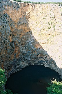
A sinkhole, also known as a cenote, sink, sink-hole, swallet, swallow hole, or doline, is a depression or hole in the ground caused by some form of collapse of the surface layer. Most are caused by karst processes – the chemical dissolution of carbonate rocks or suffosion processes. Sinkholes vary in size from 1 to 600 m both in diameter and depth, and vary in form from soil-lined bowls to bedrock-edged chasms. Sinkholes may form gradually or suddenly, and are found worldwide.

The Mendip Hills is a range of limestone hills to the south of Bristol and Bath in Somerset, England. Running east to west between Weston-super-Mare and Frome, the hills overlook the Somerset Levels to the south and the Chew Valley and other tributaries of the Avon to the north. The hills give their name to the local government district of Mendip, which administers most of the area. The higher, western part of the hills, covering 198 km2 (76 sq mi) has been designated an Area of Outstanding Natural Beauty (AONB), which gives it a level of protection comparable to a national park.

Russell Cave National Monument is a U.S. National Monument in northeastern Alabama, United States, close to the town of Bridgeport. The monument was established on May 11, 1961, when 310 acres (1.3 km2) of land were donated by the National Geographic Society to the American people. It is now administered and maintained by the National Park Service. The National Monument was listed on the National Register of Historic Places on October 15, 1966.

Mount Gambier is the second most populated city in South Australia with an estimated urban population of 29,639. The city is located on the slopes of Mount Gambier (volcano) in the south east of the state, about 450 kilometres (280 mi) south-east of the capital Adelaide and just 17 kilometres (11 mi) from the Victorian border, it is the most important settlement in the Limestone Coast region and the seat of government for both the City of Mount Gambier and the District Council of Grant.

The Limestone Coast is a name used since the early twenty-first century for a South Australian government region located in the south east of South Australia which immediately adjoins the continental coastline and the Victorian border. The name is also used for a tourist region and a wine zone both located in the same part of South Australia.
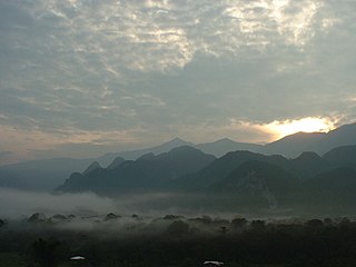
The Gunung Mulu National Park is a national park in Miri Division, Sarawak, Malaysia. It is a UNESCO World Heritage Site that encompasses caves and karst formations in a mountainous equatorial rainforest setting. The park is famous for its caves and the expeditions that have been mounted to explore them and their surrounding rainforest, most notably the Royal Geographical Society Expedition of 1977–1978, which saw over 100 scientists in the field for 15 months. This initiated a series of over 20 expeditions now named the Mulu Caves Project.
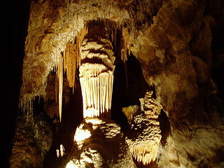
The Jenolan Caves are limestone caves located within the Jenolan Karst Conservation Reserve in the Central Tablelands region, west of the Blue Mountains, in Jenolan, Oberon Council, New South Wales, in eastern Australia. The caves and 3,083-hectare (7,620-acre) reserve are situated approximately 175 kilometres (109 mi) west of Sydney, 20 kilometres (12 mi) east of Oberon and 30 kilometres (19 mi) west of Katoomba.
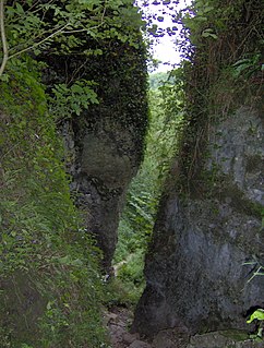
Ebbor Gorge is a limestone gorge in Somerset, England, designated and notified in 1952 as a 63.5-hectare (157-acre) biological Site of Special Scientific Interest in the Mendip Hills. It was donated to the National Trust in 1967 and is now managed by Natural England as a national nature reserve.

Buchan is a town in the east Gippsland region of Victoria, Australia. The town is situated adjacent to the Buchan River, in the Shire of East Gippsland, upstream from the river's junction with the Snowy River. At the 2011 census, Buchan and the surrounding area had a population of 385. The town is probably best known for the limestone Buchan Caves.
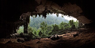
Niah National Park, located within Miri Division, Sarawak, Malaysia, is the site of the Niah Caves limestone cave and archeological site.

Mole Creek is a town in the upper Mersey Valley, in the central north of Tasmania, Australia. Mole Creek is well known for its honey and accounts for about 35 percent of Tasmania's honey production.

The Buchan Caves are a group of limestone caves that include the Royal Cave and the Fairy Cave, located south-west of Buchan, in the East Gippsland region of the Australian state of Victoria. They have a total length of between 3 and 4 kilometres, and six entrances.

Koonalda Cave is a cave in the Australian state of South Australia, on the Nullarbor Plain in the locality of Nullarbor. It is notable as an archeological site.
The Nambung River is a river in the Wheatbelt region of Western Australia, 170 kilometres (106 mi) north of Perth. The river drains an area between the towns of Cervantes and Badgingarra. In its lower reaches the Nambung River forms a chain of waterholes in the Nambung Wetlands where it disappears underground into a limestone karst system 5.5 kilometres (3 mi) from the Indian Ocean.
The Cave Divers Association of Australia (CDAA) is a cave diving organisation which was formed in September 1973 to represent the interests of recreational scuba divers who dive in water‐filled caves and sinkholes principally in the Lower South East of South Australia (SA) and secondly in other parts of Australia. Its formation occurred after a series of diving fatalities in waterfilled caves and sinkholes in the Mount Gambier region between 1969 and 1973 and in parallel to a South Australian Government inquiry into these deaths. The CDAA's major achievement has been the dramatic reduction of fatalities via the introduction of a site rating scheme and an associated testing system which was brought in during the mid-1970s. While its major area of operation is in the Limestone Coast region of SA, it administers and supports cave diving activity in other parts of Australia including the Nullarbor Plain and Wellington, New South Wales.

Agnes Milowka was an Australian technical diver, underwater photographer, author, maritime archaeologist and cave explorer. She gained international recognition for penetrating deeper than previous explorers into cave systems across Australia and Florida, and as a public speaker and author on the subjects of diving and maritime archaeology. She died aged 29 while diving in a confined space.

Little Blue Lake is a water-filled doline in the Australian state of South Australia located in the state's south-east in the locality of Mount Schank about 20 kilometres (12 mi) south of the municipal seat of Mount Gambier. It is notable locally as a swimming hole and nationally as a cave diving site. It is managed by the District Council of Grant and has been developed as a recreational and tourism venue.

The Cliefden Caves ia heritage-listed geoheritage site in Mandurama, Cowra Shire, New South Wales, Australia. The caves comprises Ordovician fossil localities, limestone caves, a spring and tufa dams, and a site where limestone was first discovered in inland Australia.
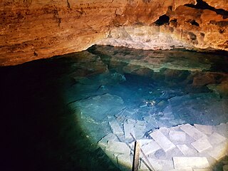
Engelbrecht Cave is a cave system in the Australian state of South Australia consisting of a sinkhole with two major passages located under the Mount Gambier urban area. It is owned by the local government area of City of Mount Gambier and has been developed as a tourism venue. Its dry extent is notable as a show cave while its water-filled extent is notable as two separate cave diving sites.


