This article is about the demographic features of the population of Botswana, including population density, ethnicity, education level, health of the populace, economic status, religious affiliations and other aspects of the population.

Gaborone is the capital and largest city of Botswana with a population of 231,626 based on the 2011 census, about 10% of the total population of Botswana. Its agglomeration is home to 421,907 inhabitants at the 2011 census.

Kgalagadi is a district in southwest Botswana, lying along the country's border with Namibia and South Africa. The administrative center is Tsabong. The district of Kgalagadi covers a large part of the Kalahari Desert. It has a total area of 105,200 km² and has a population of 42,000 (2001). More than one-third of the district is covered by the Kgalagadi Transfrontier Park, which extends into South Africa, and which is a major tourist attraction.

The North-East District is one of the administrative districts of Botswana. Its capital is Francistown. In 2011, North-East had a population of 60,264 people. The district is predominantly occupied by Kalanga-speaking people, the BaKalanga. The district is administered by a district administration and district council, which are responsible for local administration.

Kweneng is one of the districts of Botswana and is the recent historical homeland of the Bakwena people, the first group in Botswana converted to Christianity by famed missionary David Livingstone. Various landmarks, including Livingstone's Cave, allude to this history. The seat of the district's government is Molepolole, Botswana's most populous village.

The North-West District or Ngamiland is one of the first-level administrative subdivisions of Botswana. For census and administrative purposes Ngamiland is subdivided into Ngamiland East, Ngamiland West and Ngamiland Delta (Okavango). It is governed by a District Commissioner, appointed by the national government, and the elected North-West District Council. The administrative centre is Maun.

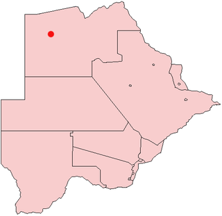
Gumare or Gomare is a rural village located in the North-West District of Botswana, near the Okavango Delta. The population of Gumare was 6,067 in 2001 census, but had risen to 8,532 iby the 2011 census.

Kasane is a town in Botswana, close to Africa's 'Four Corners', where four countries almost meet: Botswana, Namibia, Zambia and Zimbabwe. It is at the far north-eastern corner of Botswana where it serves as the administrative center of the Chobe District. The population of Kasane was 9,244 in 2011 census.

Manyana is a small town on the South Coast of New South Wales, Australia in the City of Shoalhaven. At the 2016 census, it had a population of 521. Manyana borders with Bendalong and Cunjurong Point.
Charles Hill is a village in Ghanzi District of Botswana. It is located close to the Namibian border. Charles Hill is the second-largest village in Ghanzi District, with a population of 3,591 in 2011 census.
Gabane is a village in Kweneng District of Botswana. It is located 15 km (10 mi) west of Gaborone, the capital of Botswana. The population was 10,399 in 2001 census, making it the fourth largest settlement in Kweneng. Its population was 14,842 at the 2011 census. It's now part of Gaborone agglomeration home to 421,907 inhabitants at the 2011 census.
Mmopane is a village in the Kweneng District of Botswana. The village is located around 15 km from Gaborone, the capital of Botswana. The population was 3,512 in 2001 census and 14,655 at the 2011 census. It's now part of Gaborone agglomeration home to 421,907 inhabitants at the 2011 census.
Mmankgodi is a village in Kweneng District of Botswana. It is located 35 km from Gaborone and around 30 km from the border with South Africa. The population of Mmankgodi was 6,802 in 2011 census.
Kopong is a small village in Kweneng District of Botswana. It is located around 25 km north of Gaborone, the capital of Botswana. The population was 5,571 in 2001 census and 9,520 at the 2011 census, making it the sixth largest settlement in Kweneng. It is now becoming a suburb of Gaborone agglomeration home to 421,907 inhabitants at the 2011 census.
Dutlwe is a village in Kweneng District of Botswana. The population of Dutlwe was 1,055 in 2011 census.
Dinokwe is a village located in the Central District of Botswana. The town has about 1,200 inhabitants and is situated along the main road between the capital Gaborone and the second largest city Francistown. Dinokwe has a cattle railway station. The underground water reserves of Botswana are at. Before the construction of North side carrier project, it was supplying Mahalapye with water.
Mmathethe is a village located in the Southern District of Botswana. It had 5,078 inhabitants at the 2011 census.
Makaleng is a village in the North-East district of Botswana, roughly 60 km from Francistown.

The Manyana Rock Paintings are a collection of rock art and caves located at the Kolobeng hills, neighbouring Manyana, Southern District, Botswana. It is believed that the artworks were made by the Khoikhoi or the San people between 1100 AD and 1700 AD. The paintings are found on five cliff areas around the rocky hill. Today, the site is fenced and protected as a National Monument.
Manyana is a village located in Nokha tehsil of Bikaner district of Rajasthan state, India.


