
The Salzach is a river in Austria and Germany. It is 227 kilometres (141 mi) in length and is a right tributary of the Inn, which eventually joins the Danube. Its drainage basin of 6,829 km2 (2,637 sq mi) comprises large parts of the Northern Limestone and Central Eastern Alps. 83% of its drainage basin lies in Austria, the remainder in Germany (Bavaria). Its largest tributaries are Lammer, Berchtesgadener Ache, Saalach, Sur and Götzinger Achen.

The Dornbirner Ach is a 29.9 km (18.6 mi) long stream in Vorarlberg, Austria, and a tributary of Lake Constance and the Rhine, respectively. It flows through two gorges in its upper part, the Alploch Gorge and the Rappenloch Gorge.

Gail is the name of a river in southern Austria, the largest right tributary of the Drava. Its drainage basin is 1,413.9 km2 (545.9 sq mi).

Leda is a river in north-western Germany in the state of Lower Saxony.
The Mürz is a river in Styria, Austria, with a length of 84 km (52 mi). Its drainage basin is 1,505 km2 (581 sq mi).

The Piesting is a river in southern Lower Austria. A left tributary of the Fischa, its drainage basin is 348 km2 (134 sq mi).

The Traisen is a river in Lower Austria. Its drainage basin is 915 km2 (353 sq mi).
The Gurk is a river in the Austrian state of Carinthia, a left tributary of the Drava. With a length of 156 km (97 mi) it is the longest river that flows entirely within Carinthia. Its drainage basin is 2,585.1 km2 (998.1 sq mi), which covers about 27% of the state's territory.

The Steyr is a river in Upper Austria. Its length is approx. 68 km (42 mi). Its drainage basin is 917 km2 (354 sq mi).

The Gurglbach is a river of Tyrol, Austria.

The Frutz is a river of Vorarlberg, Austria, a tributary of the Rhine.

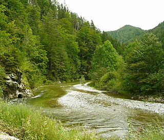
The Ötztaler Ache is a river in the district of Imst, Tyrol state of Austria. It is a right tributary of the Inn. It flows through the Ötztal valley, a southern branch the Inntal. Including its source rivers Venter Ache and Rofenache, it is 66.5 kilometres (41.3 mi) long. The Rofenache is the runoff of the Hintereisferner, a glacier at the foot of the Weißkugel, Ötztal Alps. At Vent, near Sölden, it takes up the Niedertalbach and its name changes to Venter Ache. At the confluence with the Gurgler Ache in Zwieselstein, Sölden, the Ötztaler Ache proper is formed. It flows through Sölden, Längenfeld, Umhausen and Oetz before joining the Inn 8 kilometres (5.0 mi) east of Imst. The river is one of its bigger tributaries.

Aurach is a river in the Austrian state of Upper Austria.
The Leoganger Ache is a river of Salzburg, Austria, a left tributary of the Saalach.
The Sanna is a river of Tyrol, Austria, a left tributary of the Inn.

The Großache is a river, 79 kilometres (49 mi) long, in the east of the Austrian state of Tyrol and the Bavarian region of Chiemgau.

The Leutascher Ache is a river of Tyrol, Austria and of Bavaria, Germany, a left tributary of the Isar.

The Polgolla Barrage is a barrage built across the Mahaweli River at Polgolla, in the Central Province of Sri Lanka. The barrage is used to increase the volume of water, for transfer to the hydroelectric power station located 8 km (5 mi) north, via penstock.
Erlauf is a river of Lower Austria and of Styria, Austria. Its drainage basin is 632 km2 (244 sq mi).
This page is based on this
Wikipedia article Text is available under the
CC BY-SA 4.0 license; additional terms may apply.
Images, videos and audio are available under their respective licenses.
