
Kaitoke, part of Upper Hutt City, is a locality in the southern North Island of New Zealand. It is located at the northern end of the Hutt Valley, 45 kilometres northeast of Wellington City and six kilometres from the northern end of the Upper Hutt urban area. It also lies at the southern end of the Tararua Ranges.

The Akatarawa River is in the lower North Island of New Zealand.

The Rangitīkei River is one of New Zealand's longest rivers, 185 kilometres (115 mi) long.

The Taieri River is the fourth-longest river in New Zealand and is in Otago in the South Island. Rising in the Lammerlaw Range, it initially flows north, then east around the Rock and Pillar range before turning southeast, reaching the sea 30 kilometres (19 mi) south of Dunedin.

Palliser Bay is at the southern end of the North Island of New Zealand, to the southeast of Wellington. It runs for 40 kilometres along the Cook Strait coast from Turakirae Head at the southern end of the Rimutaka Ranges to Cape Palliser, the North Island's southernmost point.
The Kaiwhata River is a river of the southern North Island of New Zealand. It rises in rough hill country to the southeast of Masterton, flowing southeast to reach the Pacific Ocean 12 kilometres (7 mi) south of Riversdale Beach.
The Moawhango River is a tributary of the Rangtikei River and is located the central North Island of New Zealand.
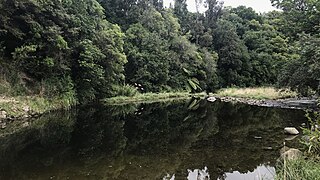
The Pahaoa River is a river of the Wairarapa, in the Wellington Region of New Zealand's North Island. It winds through rough hill country to the southwest of Masterton, initially flowing southwest before turning southeast to reach the Pacific Ocean 25 kilometres (16 mi) southeast of Martinborough.
The Rahu River is a river of the Tasman Region of New Zealand's South Island. It rises in two branches within Victoria Forest Park. From the junction of these two branches, the Rahu flows initially southeast before turning north to flow into the Maruia River five kilometres north of Springs Junction. State Highway 7 follows the upper course of the Rahu to the northwest of Springs Junction, crossing the Rahu Saddle into the valley of the Inangahua River.
The Rerewhakaaitu River is a river of the Wellington Region of New Zealand's North Island. It flows southeast from its sources in rough hill country southeast of Martinborough, reaching the Pacific Ocean 40 kilometres (25 mi) northeast of Cape Palliser.
The Ruakokoputuna River is a river of the Wairarapa, in the Wellington Region of New Zealand's North Island. It flows northeast from its sources within Haurangi Forest Park to the east of Palliser Bay, reaching the Huangarua River 10 kilometres (6 mi) south of Martinborough.
The Tauanui River is a river of the South Wairarapa District of the Wellington Region of New Zealand's North Island. It flows northwest from its source in the Aorangi Range to reach the Ruamahanga River close to the southern end of Lake Wairarapa.
The Tokomaru River is a river of the Manawatū-Whanganui Region of the North Island of New Zealand. It rises to the southeast of Shannon and initially flows northeast down a long valley in the Tararua Range before turning northwest to reach the edge of the Manawatū Plain near the town of Tokomaru. From here it turns southwest, reaching the Manawatū River 3 kilometres (2 mi) north of Shannon.

The Waingawa River is a river of the Greater Wellington Region of New Zealand's North Island and a major tributary of the Ruamahanga River.
The Wainuioru River is a river of the Wellington Region of New Zealand's North Island. A major tributary of the Pahaoa River, it follows a twisting generally southwestward course from its origins 25 kilometres east of Masterton, reaching the Pahaoa 20 kilometres (12 mi) southeast of Martinborough.
The Whakatahine River is a river of the Wellington Region of New Zealand's North Island. It flows generally northwest from its source in rough hill country southeast of Masterton before turning southwest to reach the Wainuiora River.
The Whakatikei River is a river of the Wellington Region of New Zealand's North Island. It flows generally southeast from its sources close to the west coast, 5 kilometres (3 mi) southeast of Paekakariki, and reaches the Hutt River at Upper Hutt.

Koriniti is a settlement 47 kilometres (29 mi) upriver from Whanganui, New Zealand, home to the Ngāti Pāmoana hapū of the iwi Te Āti Haunui-a-Pāpārangi.

Tauherenikau Racecourse is a racecourse near Featherston, New Zealand best known for its meetings held at Easter and on New Year's Day. It is owned by The Wairarapa Racing Club

Featherston Military Camp, on a "windswept grassy plain" 3 kilometres north of Featherston, New Zealand was built —after the announcement of National Registration of all military-aged men— to supplement Trentham Military Camp on the other side of the Rimutaka hill. The National Registration actually took place in October and November 1915 but the bill empowering conscription by the government did not pass until 1 August 1916.
