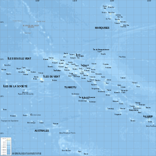
French Polynesia is located in Oceania. It is a group of six archipelagos in the South Pacific Ocean, about halfway between South America and Australia. Its area is about 4,167 km2, of which 3,827 km2 is land and 340 km2 is (inland) water. It has a coastline of 2,525 km but no land borders with other countries.
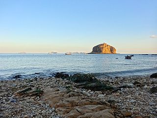
An islet is a very small, often unnamed island. Most definitions are not precise, but some suggest that an islet has little or no vegetation and cannot support human habitation. It may be made of rock, sand and/or hard coral; may be permanent or tidal ; and may exist in the sea, lakes, rivers or any other sizeable bodies of water.

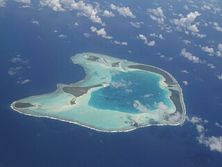
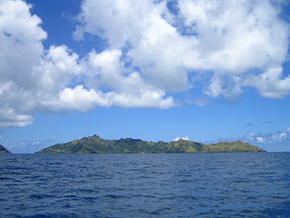
Bora Bora is an island group in the Leeward Islands. The Leeward Islands comprise the western part of the Society Islands of French Polynesia, which is an overseas collectivity of the French Republic in the Pacific Ocean. Bora Bora has a total land area of 30.55 km2 (12 sq mi). The main island, located about 230 kilometres northwest of Papeete, is surrounded by a lagoon and a barrier reef. In the center of the island are the remnants of an extinct volcano, rising to two peaks, Mount Pahia and Mount Otemanu; the highest point is at 727 m (2,385 ft). Bora Bora is part of the Commune of Bora-Bora, which also includes the atoll of Tūpai. The languages spoken in Bora Bora are Tahitian and French. However, due to the high tourism population, many natives of Bora Bora have learned to speak English.
Tetiʻaroa is an atoll in the Windward group of the Society Islands of French Polynesia, an overseas territorial collectivity of France in the Pacific Ocean. Once the vacation spot for Tahitian royalty, the islets are under a 99-year lease contracted by Marlon Brando and are home to The Brando Resort.

Mangareva is the central and largest island of the Gambier Islands in French Polynesia. It is surrounded by smaller islands: Taravai in the southwest, Aukena and Akamaru in the southeast, and islands in the north. Mangareva has a permanent population of 1,239 (2012) and the largest village on the island, Rikitea, is the chief town of the Gambier Islands.
The Gambier Islands are an archipelago in French Polynesia, located at the southeast terminus of the Tuamotu archipelago. They cover an area of 27.8 km2 or 10.7 sq mi, and are made up of the Mangareva Islands, a group of high islands remnants of a caldera along with islets on the surrounding fringing reef, and the uninhabited Temoe atoll, which is located 45 km south-east of the Mangareva Islands. The Gambiers are generally considered a separate island group from Tuamotu both because their culture and language (Mangarevan) are much more closely related to those of the Marquesas Islands, and because, while the Tuamotus comprise several chains of coral atolls, the Mangareva Islands are of volcanic origin with central high islands.

Rikitea is a small town on Mangareva, which is part of the Gambier Islands in French Polynesia. A majority of the islanders live in Rikitea. The island was a protectorate of France in 1871 and was annexed in 1881.
Taravai is the second largest island in the Gambier Islands of French Polynesia, at 5.7 km2. Taravai is about 1.5 km southwest of Mangareva and about 300 m north of the island of Angakauitai. Off its eastern shore lies the tiny rock Îlot Motu-o-ari.

Motu One is the name of a small sandbank with no vegetation, located on the western edge of a coral reef; the only atoll in the Marquesas Islands. The reef is approximately 5 kilometres (3.1 mi) in diameter, and the islet has a surface area of less than one hectare, rising only a few feet above sea level and changing shape regularly as the action of the currents deposits and removes sand.
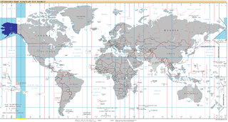
UTC−09:00 is an identifier for a time offset from UTC of −09:00. This time is used in:
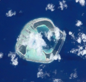
Motu One, also known as Bellinghausen, is an atoll in the Leeward group of the Society Islands. Motu One is located 550 km northwest from Tahiti and 72 km northeast of Manuae, its closest neighbor.
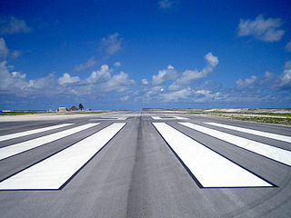
Totegegie Airport is an airport on Totegegie Island in the Gambier Islands, French Polynesia. It is 9 km northeast of the village of Rikitea.

This page list topics related to French Polynesia.

Kamaka is an island in the Gambier Islands of French Polynesia, 11.7 km south of Mangareva within the same lagoon. Kamaka is about one kilometre in length, 700 metres wide, and has an area of 0.5 square kilometres. The highest point is 166 metres above sea level. There are no permanent springs on the island.

Makaroa is an island in the Gambier Islands of French Polynesia, 8.5 km south of Mangareva within the same lagoon. Makaroa is about 1.3 km (1 mi) in length and has a small rocky islet off its NW point.
Motu-O-Ari is an island of the Gambier Islands of French Polynesia.
Motu Teiku is an island of the Gambier Islands of French Polynesia.
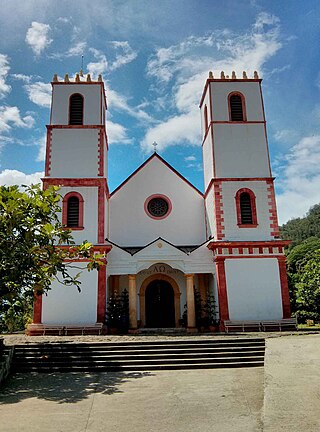
St. Michael's Cathedral, also known as the Rikitea Cathedral, is a parish of the Catholic Church located on Mangareva Island in the Gambier Islands of French Polynesia.

Te Maputeoa was a monarch of the Polynesian island of Mangareva and the other Gambier Islands. He was the King or ʻAkariki, as well as the penultimate king of the island of Mangareva, and other Gambier Islands including Akamaru, Aukena, Taravai and Temoe. He reigned from 1830 until his death in 1857.


