Dacrydium cupressinum, commonly known as rimu, is a large evergreen coniferous tree endemic to the forests of New Zealand. It is a member of the southern conifer group, the podocarps.

This article relates to the flora of New Zealand, especially indigenous strains. New Zealand's geographical isolation has meant the country has developed a unique variety of native flora. However, human migration has led to the importation of many other plants as well as widespread damage to the indigenous flora, especially after the advent of European colonisation, due to the combined efforts of farmers and specialised societies dedicated to importing European plants & animals.

Hakarimata Range is a range of hills on the western edge of Ngāruawāhia township, in the Waikato region of New Zealand, overlooking the confluence of the Waikato and Waipā Rivers. The Hakarimata Range is separated from the Taupiri Range by the Taupiri Gorge, through which the Waikato River flows.

Mount Pirongia is an extinct stratovolcano located in the Waikato region of New Zealand's North Island. It rises to 959 m (3,146 ft) and is the highest peak around the Waikato plains. Pirongia's many peaks are basaltic cones created by successive volcanic eruptions between the late Pliocene and early Pleistocene, about 2.5 million years ago. In the adjacent picture, the characteristic profile of the mountain can be seen, along with a prominent accessory cone to the right.

Beilschmiedia tawa, the tawa, is a New Zealand broadleaf tree common in the central parts of the country. Tawa is often the dominant canopy tree species in lowland forests in the North Island and the north east of the South Island, but will also often form the subcanopy in primary forests throughout the country in these areas, beneath podocarps such as kahikatea, matai, miro and rimu. Individual specimens may grow up to 30 metres or more in height with trunks up to 1.2 metres in diameter, and they have smooth dark bark. The Māori word "tawa" is the name for the tree.

Although not as prominent as its eastern namesake, Northland's Mount Hikurangi is also of note. At 625 m (2,051 ft), this peak overlooks central Northland and is a prominent peak on the skyline at the Bay of Islands, the area of the first permanent European settlement in New Zealand.
Northland College is a small co-educational secondary school in Kaikohe.

Whirinaki Te Pua-a-Tāne Conservation Park is a publicly accessible conservation park in the North Island of New Zealand. The park is centered on the town of Minginui and part of the eastern boundary flanks Te Urewera. The Whirinaki Forest is one of the world's last prehistoric rainforests.

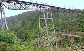
The Makatote River is a river of the centre of New Zealand's North Island. It flows west from the slopes of Mount Ruapehu, and from the Hauhungatahi Wilderness Area, before entering rough hill country, veering southwest and entering a gorge cut almost 100 m (330 ft) into the volcanic rocks. It joins with the waters of several smaller streams to become the Manganui o te Ao River, part of the Whanganui River system.

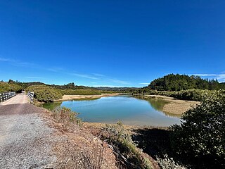
The Whangae River is a short river of the Northland Region of New Zealand's North Island. It flows generally northeast to reach a southwestern arm of the Bay of Islands. The estuary is about 2 km (1.2 mi) and the river about 5 km (3.1 mi) long. Like much of the coast north of Whangārei, the valley is formed of Waipapa greywacke.

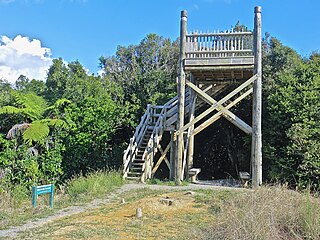
Pureora Forest Park is a 760-square-kilometre (290 sq mi) protected area in the North Island of New Zealand. Within its rich rainforest are an abundance of 1,000-year-old podocarp trees. It is "recognised as one of the finest rain forests in the world". Established in 1978, after a series of protests and tree sittings, the park is one of the largest intact tracts of native forest in the North Island and has high conservation value due to the variety of plant life and animal habitats. New Zealand's largest totara tree is located nearby on private land.

The North Island temperate forests, also known as the Northland temperate forests, is a temperate broadleaf and mixed forests ecoregion on New Zealand’s North Island.

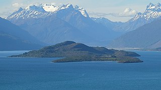
Pigeon Island / Wāwāhi Waka is an island in the northern reaches of New Zealand's Lake Wakatipu, near the township of Glenorchy. It is 170 hectares in size and is the largest island in the lake. In 1884, during Queen Victoria's reign, it was gifted by the Crown as a reserve to the people of Queenstown district for their use and enjoyment.
Fairfield Intermediate, sometimes shortened to FIS, is a year 7-8 school located in Fairfield, Hamilton, New Zealand. It has a roll of 957 as of August 2024 and has a decile rating of 5. The principal is Angela Walters.

Waitetuna is a rural community in the Waikato District and Waikato region of New Zealand's North Island. It is located on the valley of the Waitetuna River, upstream from the Raglan Harbour.

Tāwharanui Regional Park is a regional park on the Tāwharanui Peninsula in the Auckland Region of New Zealand's North Island. It is located in Rodney, east of Warkworth and north of Auckland.
Puketahā is a proposed wildlife sanctuary to be established in a water catchment reserve in Wainuiomata, New Zealand.

Lake Ellery is a glacially-formed lake in South Westland on the West Coast of New Zealand's South Island. It has a steep and entirely forested catchment, with a diverse flora and fauna, and is accessible only by foot or boat. Sediments laid down by its tributaries have preserved a 2,000-year record of ruptures of the nearby Alpine fault.


