
Bryn Mawr-Skyway is a census-designated place (CDP) in King County, Washington, United States. The population was 17,397 at the 2020 census.

The Duwamish River is the name of the lower 12 miles (19 km) of Washington state's Green River. Its industrialized estuary is known as the Duwamish Waterway. In 2009, the Duwamish Longhouse and Cultural Center was opened on the west bank of the river as part of the tribe's reassertion of its historic rights in the area and its continuing struggle for federal recognition of tribal status.
Longfellow Creek is a stream in the Delridge district of West Seattle, in Seattle, Washington. It runs about 3.38 miles (5.4 km) from Roxhill Park north to the Duwamish West Waterway at Elliott Bay. The Duwamish called the creek "Smelt", denoting smelt fish. The creek was a traditional fishery dating back to the 14th century.

Thornton Creek is 18 miles (29 km) of urban creeks and tributaries from southeast Shoreline through northeast Seattle to Lake Washington. Its 12-square-mile (31 km2) watershed, the largest in Seattle, exhibits relatively dense biodiversity for an urban setting; it is home to frogs, newts, ducks, herons, and beavers, in addition to more than 75,000 people. From west of Jackson Park Golf Course in Shoreline, from Sunny Walter-Pillings Pond in Licton Springs–North College Park, and north Northgate Thornton Creek flows through Maple Leaf and Lake City, including the Victory Heights, Meadowbrook, and Matthews Beach neighborhoods, and empties into the lake at Matthews Beach Park.

The Cedar River is a river in the U.S. state of Washington. About 45 miles (72 km) long, it originates in the Cascade Range and flows generally west and northwest, emptying into the southern end of Lake Washington. Its upper watershed is a protected area called the Cedar River Watershed, which provides drinking water for the greater Seattle area.

The Napa River is a river approximately 55 miles (89 km) long in the U.S. state of California. It drains a famous wine-growing region called the Napa Valley, in the mountains north of the San Francisco Bay. Milliken Creek and Mt. Veeder watersheds are a few of its many tributaries. The river mouth is at Vallejo, where the intertidal zone of fresh and salt waters flow into the Carquinez Strait and the San Pablo Bay.

The Elwha River is a 45-mile (72 km) river on the Olympic Peninsula in the U.S. state of Washington. From its source at Elwha snowfinger in the Olympic Mountains, it flows generally north to the Strait of Juan de Fuca. Most of the river's course is within the Olympic National Park.
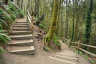
Puget Creek is a small urban creek in the U.S. state of Washington, in the north end of Tacoma, It rises in Puget Park and flows north to Commencement Bay, part of Puget Sound. Its course follows a steep ravine containing Puget Gardens Park. The creek's course is mostly contained within the 66-acre (270,000 m2) natural area of Puget Gulch. Puget Creek is the focus of restoration work by the Puget Creek Restoration Society and community volunteers. One of the restoration goals is the reestablishment of regular runs of coho and chum salmon, as well as sea-run coastal cutthroat trout.

Rainier Beach is a set of neighborhoods in Seattle, Washington that are mostly residential. Also called Atlantic City, Rainier Beach can include Dunlap, Pritchard Island, and Rainier View neighborhoods.
Strawberry Creek is the principal watercourse running through the city of Berkeley, California. Two forks rise in the Berkeley Hills of the California Coast Ranges, and form a confluence at the campus of the University of California, Berkeley. The creek then flows westward across the city to discharge into San Francisco Bay.

Alameda Creek is a large perennial stream in the San Francisco Bay Area. The creek runs for 45 miles (72 km) from a lake northeast of Packard Ridge to the eastern shore of San Francisco Bay by way of Niles Canyon and a flood control channel. Along its course, Alameda Creek provides wildlife habitat, water supply, a conduit for flood waters, opportunities for recreation, and a host of aesthetic and environmental values. The creek and three major reservoirs in the watershed are used as water supply by the San Francisco Public Utilities Commission, Alameda County Water District and Zone 7 Water Agency. Within the watershed can be found some of the highest peaks and tallest waterfall in the East Bay, over a dozen regional parks, and notable natural landmarks such as the cascades at Little Yosemite and the wildflower-strewn grasslands and oak savannahs of the Sunol Regional Wilderness. After an absence of half a century, ocean-run steelhead trout are able to return to Alameda Creek to mingle with remnant rainbow trout populations. Completion of a series of dam removal and fish passage projects, along with improved stream flows for cold-water fish and planned habitat restoration, enable steelhead trout and Chinook salmon to access up to 20 miles (32 km) of spawning and rearing habitat in Alameda Creek and its tributaries. The first juvenile trout migrating downstream from the upper watershed through lower Alameda Creek toward San Francisco Bay was detected and documented in April 2023.

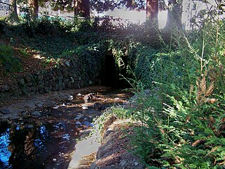
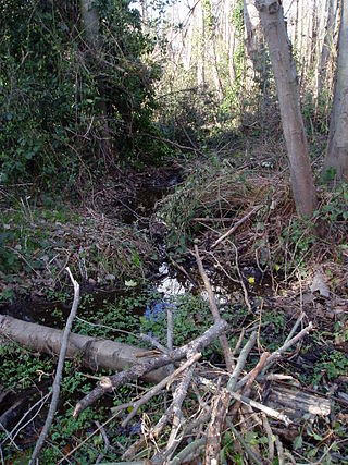
Daylighting is the opening up and restoration of a previously buried watercourse, one which had at some point been diverted below ground. Typically, the rationale behind returning the riparian environment of a stream, wash, or river to a more natural above-ground state is to reduce runoff, create habitat for species in need of it, or improve an area's aesthetics. In the United Kingdom, the practice is also known as deculverting.
Lakeridge is a hillside neighborhood near Lake Washington located mostly in unincorporated Skyway/West Hill in King County, Washington, and partially in the southeast portion of the City of Seattle's Rainier Beach neighborhood. Its boundaries extend from Seattle's Rainier Beach neighborhood on the north, to Lake Washington on the east, to unincorporated Bryn Mawr on the southeast and unincorporated Skyway on the southwest.
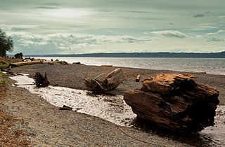
Seahurst Park, in Burien, Washington, is a 178-acre (0.72 km2) park with forests and a beach on Puget Sound. Originally a King County park, it was given to the newly incorporated city of Burien in 1996. The beach is about 2,000 feet (610 m) long, and the upper part of the beach has been made into a sea wall.

Johnson Creek is a 25-mile (40 km) tributary of the Willamette River in the Portland metropolitan area of the U.S. state of Oregon. Part of the drainage basin of the Columbia River, its catchment consists of 54 square miles (140 km2) of mostly urban land occupied by about 180,000 people as of 2012. Passing through the cities of Gresham, Portland, and Milwaukie, the creek flows generally west from the foothills of the Cascade Range through sediments deposited by glacial floods on a substrate of basalt. Though polluted, it is free-flowing along its main stem and provides habitat for salmon and other migrating fish.

The Elwha Ecosystem Restoration Project is a 21st-century project of the U.S. National Park Service to remove two dams on the Elwha River on the Olympic Peninsula in Washington state, and restore the river to a natural state. It is the largest dam removal project in history and the second largest ecosystem restoration project in the history of the National Park Service, after the Restoration of the Everglades. The controversial project, costing about $351.4 million, has been contested and periodically blocked for decades. It has been supported by a major collaboration among the Lower Elwha Klallam Tribe, and federal and state agencies.
Crystal Springs Creek, a 2.7-mile (4.3 km) tributary of Johnson Creek, flows entirely within the city of Portland in the U.S. state of Oregon. The stream rises from springs near the Reed College campus in the southeastern part of the city and runs generally southwest to meet Johnson Creek in the Portland neighborhood of Sellwood.

Boeing Creek is a stream in the U.S. state of Washington, located in the city of Shoreline, just north of Seattle. It is about 1.6 miles (2.6 km) long and empties into Puget Sound. The creek is heavily modified along its course, and in many places has been diverted into culverts. The watershed of Boeing Creek is about 11.2 square miles (29 km2) in size, with two main tributaries aside from the mainstem. The creek takes its name from William Boeing, who built a mansion along the creek in 1913. Despite the river modifications and stormwater pollution, the creek supports a variety of riparian habitats, native animals and fishes.
Yesler Creek is a stream that originates in the Bryant and Wedgwood neighborhoods of Seattle, Washington, and flows southward to empty into Union Bay of Lake Washington. Portions are daylighted, such as those flowing between 39th and 40th Avenue NE and through Burke Gilman Park. The stream also continues underground underneath Seattle Children's Hospital.
McAleer Creek is an urban creek approximately six miles long, flowing from Lake Ballinger in southern Snohomish County to Lake Washington. It drains an approximately 8.9-square-mile (23 km2) watershed. It is a salmon-bearing stream that also provides habitat to cutthroat trout, as well as watering a series of riparian areas, mostly in Lake Forest Park.

