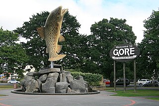
Gore is a town and district in the Southland region of the South Island of New Zealand.
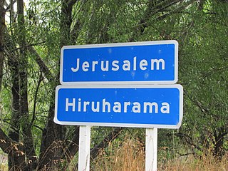
Jerusalem, named for the Biblical Jerusalem, is a settlement 66 kilometres (41 mi) up the Whanganui River from Whanganui, New Zealand. Originally called Patiarero, it was one of the largest settlements on the Whanganui River in the 1840s, with several hundred Ngāti Hau inhabitants of the iwi Te Āti Haunui-a-Pāpārangi. Unlike other Whanganui River settlements given transliterated place names by Reverend Richard Taylor in the 1850s, Jerusalem is usually referred to using the English version of its name. It grew into several small settlements, including Roma and Peterehama, founded by the remains of Taylor's congregation after the majority converted to Catholicism when a Roman Catholic mission was built in 1854.

Patea is the third-largest town in South Taranaki District, New Zealand. It is on the western bank of the Pātea River, 61 kilometres north-west of Whanganui on State Highway 3. Hāwera is 27 km to the north-west, and Waverley 17 km to the east. The Pātea River flows through the town from the north-east and into the South Taranaki Bight.

Ngāpuhi is a Māori iwi associated with the Northland region of New Zealand and centred in the Hokianga, the Bay of Islands, and Whangārei.
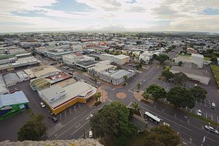
Hāwera is the second-largest centre in the Taranaki region of New Zealand's North Island, with a population of 10,150. It is near the coast of the South Taranaki Bight. The origins of the town lie in a government military base that was established in 1866, and the town of Hāwera grew up around a blockhouse in the early 1870s.

Kawakawa is a small town in the Bay of Islands area of the Northland Region of New Zealand. Kawakawa developed as a service town when coal was found there in the 1860s, but coal mining ceased in the early 20th century. The economy is now based on farming. The town is named after the kawakawa shrub.

Raetihi, a small town in the center of New Zealand's North Island, is located at the junction of State Highways 4 and 49 in the Manawatū-Whanganui region. It lies in a valley between Tongariro and Whanganui National Parks, 11 kilometres west of Ohakune's ski fields.

Matatā is a town in the Bay of Plenty in the North Island of New Zealand, 24 kilometres (15 mi) to the north-west of Whakatāne. Much of the town was relocated between the years 2006 and 2021 due to increased natural threats arising from climate change. As an example of forced retreat, Matatā is seen as providing lessons for future actions elsewhere.

St. Mary's Basilica is a Catholic Church in Invercargill, New Zealand. It was designed by the celebrated New Zealand architect, Francis Petre and was opened in 1905. The Basilica, named such because of its style of architecture, it rises 37M above the ground and is one of the most prominent landmarks in Invercargill, it was once described as the "Prettiest church in Australasia". is located near St Josephs School, the Otepuni Gardens and Te Tomairangi Marae. The building is listed as a Category I Historic Place.
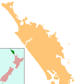
Waimate North is a small settlement in Northland, New Zealand. It is situated between Kerikeri and Lake Omapere, west of the Bay of Islands.
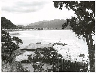
Te Araroa is a town in the Gisborne Region of the North Island of New Zealand. It is situated 175 km north of Gisborne city, along State Highway 35 between Tokata and Awatere. Te Araroa is the birthplace of noted Māori politician Sir Āpirana Ngata. Māori in the area are generally associated with the Ngāti Porou iwi. It is 100 metres from its local beach.

Māngere Lagoon is a lagoon in the Manukau Harbour, New Zealand. It occupies a volcanic crater or maar which is part of the Auckland volcanic field. Oval and about 600m long, it has a small restored scoria island remaining in the centre.

Mooning is the act of displaying one's bare buttocks by removing clothing, e.g., by lowering the backside of one's trousers and underpants, usually bending over, and also potentially exposing the genitals. Mooning is used in the English-speaking world to express protest, scorn, disrespect, or for provocation, but mooning can be done for shock value, for fun, as a joke or as a form of exhibitionism. The Māori have a form of mooning known as Whakapohane that is a form of insult.

Clifford Hamilton Whiting was a New Zealand Māori artist, heritage advocate and teacher. Whiting was born and raised in Te Kaha, New Zealand, and affiliated to the Te Whānau-ā-Apanui tribe.

Bruce Bay is a bay and settlement in South Westland, New Zealand on the Tasman Sea. It is located on State Highway 6, 74 kilometres (46 mi) northwest of Haast and 45 kilometres (28 mi) southwest of Fox Glacier. The small settlement of Bruce Bay is located just south of the mouth of Mahitahi River. The bay is a nesting ground for the Fiordland crested penguin, and endemic Hector's dolphins and southern right whales can be observed from the shore on occasion. Some of the bush around the bay has been cleared for farming, and quartz stones can be found on the beach.

Fairton is a town in the Ashburton District, New Zealand. According to the 2001 New Zealand census it had a population of 1185, of which 612 were male and 573 were female.

Ivan Mercep was a New Zealand architect.
Heidelberg is a suburb of the southern New Zealand city of Invercargill. It is located to the southeast of the city centre.

Kaiwhaiki is a settlement 18 kilometres (11 mi) upriver from Whanganui, New Zealand.

Te Puea Memorial Marae is a marae located in Māngere Bridge, Auckland, New Zealand. Opened in 1965, it was the first urban marae in Auckland, built for ngā hau e whā, but in particular as a community centre for local Urban Māori communities around Onehunga and Māngere, and for the Waikato Tainui iwi. The marae is named for Māori leader and relative of King Mahuta, Te Puea Hērangi, and is known by the whakataukī (proverb) te kei o te waka o Tainui, as it is the northernmost Waikato Tainui marae.


