Temnitzquell

Last updated
Temnitzquell
Katerbow church 2016 NW.JPG
Church in Katerbow
Location of Temnitzquell within Ostprignitz-Ruppin district
Temnitzquell in OPR.png
Germany adm location map.svg
Red pog.svg
Temnitzquell
Brandenburg location map.svg
Red pog.svg
Temnitzquell
Coordinates: 53°00′52″N12°38′54″E / 53.01444°N 12.64833°E / 53.01444; 12.64833 Coordinates: 53°00′52″N12°38′54″E / 53.01444°N 12.64833°E / 53.01444; 12.64833
Country Germany
State Brandenburg
District Ostprignitz-Ruppin
Municipal assoc. Temnitz
Government
   Mayor (201924) Bernd Müller [1]
Area
  Total65.47 km2 (25.28 sq mi)
Elevation
60 m (200 ft)
Population
 (2019-12-31) [2]
  Total772
  Density12/km2 (31/sq mi)
Time zone UTC+01:00 (CET)
  Summer (DST) UTC+02:00 (CEST)
Postal codes
16818
Dialling codes 033924
Vehicle registration OPR

Temnitzquell is a municipality in the Ostprignitz-Ruppin district, in Brandenburg, Germany.

Demography

Development of population since 1875 within the current boundaries (Blue line: Population; Dotted line: Comparison to population development of Brandenburg state; Grey background: Time of Nazi rule; Red background: Time of communist rule) Bevolkerungsentwicklung Temnitzquell.pdf
Development of population since 1875 within the current boundaries (Blue line: Population; Dotted line: Comparison to population development of Brandenburg state; Grey background: Time of Nazi rule; Red background: Time of communist rule)
Temnitzquell: Population development
within the current boundaries (2013) [3]
YearPop.±% p.a.
1875 1,249    
1890 1,280+0.16%
1910 1,214−0.26%
1925 1,187−0.15%
1933 1,176−0.12%
1939 1,217+0.57%
1946 2,017+7.48%
1950 1,783−3.04%
1964 1,163−3.01%
1971 1,088−0.95%
1981 921−1.65%
1985 908−0.35%
1989 881−0.75%
1990 897+1.82%
1991 876−2.34%
1992 860−1.83%
1993 846−1.63%
1994 857+1.30%
1995 845−1.40%
1996 853+0.95%
YearPop.±% p.a.
1997 858+0.59%
1998 865+0.82%
1999 875+1.16%
2000 852−2.63%
2001 848−0.47%
2002 860+1.42%
2003 867+0.81%
2004 862−0.58%
2005 857−0.58%
2006 831−3.03%
2007 821−1.20%
2008 825+0.49%
2009 819−0.73%
2010 811−0.98%
2011 786−3.08%
2012 772−1.78%
2013 761−1.42%
2014 736−3.29%
2015 756+2.72%
2016 755−0.13%

Related Research Articles

Ostprignitz-Ruppin is a Kreis (district) in the northwestern part of Brandenburg, Germany. Neighboring are the districts Müritz and Mecklenburg-Strelitz in Mecklenburg-Western Pomerania, the districts Oberhavel and Havelland, the district Stendal in Saxony-Anhalt, and the district Prignitz.

Havelland (district) District in Brandenburg, Germany

Havelland is a district or county in Brandenburg, Germany. It is bounded by the districts of Ostprignitz-Ruppin and Oberhavel, the city-state of Berlin, the district of Potsdam-Mittelmark, the city of Brandenburg and the state of Saxony-Anhalt.

Neustadt (Dosse) Place in Brandenburg, Germany

Neustadt (Dosse) is a town in the district of Ostprignitz-Ruppin, Brandenburg, Germany with a population of 3,575. It has a total area of 75.43 km², and lies close to the river Dosse.

Rheinsberg Place in Brandenburg, Germany

Rheinsberg is a town and a municipality in the Ostprignitz-Ruppin district, in Brandenburg, Germany. It is located on lake Grienericksee and the river Rhin, approximately 20 km north-east of Neuruppin and 75 km north-west of Berlin.

Kyritz Place in Brandenburg, Germany

Kyritz is a town in the Ostprignitz-Ruppin district, in Brandenburg, Germany. It is situated 28 km west of Neuruppin and 28 km southeast of Pritzwalk. The town has 9,260 inhabitants (2019).

Wusterhausen Place in Brandenburg, Germany

Wusterhausen is a municipality in the Ostprignitz-Ruppin district, in northwestern Brandenburg, Germany. It is situated on the river Dosse, 7 km southeast of Kyritz, and 75 km northwest of Berlin.

Breddin Place in Brandenburg, Germany

Breddin is a municipality in the Ostprignitz-Ruppin district, in Brandenburg, Germany.

Dabergotz Place in Brandenburg, Germany

Dabergotz is a municipality in the Ostprignitz-Ruppin district, in Brandenburg, Germany.

Dreetz Place in Brandenburg, Germany

Dreetz is a municipality in the Ostprignitz-Ruppin district, in Brandenburg, Germany.

Heiligengrabe Place in Brandenburg, Germany

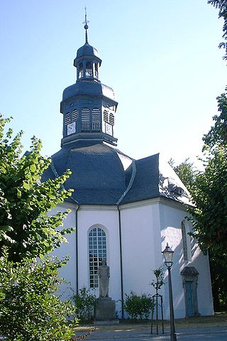
Heiligengrabe is a municipality in the Ostprignitz-Ruppin district, in Brandenburg, Germany.

Herzberg, Ostprignitz-Ruppin Place in Brandenburg, Germany

Herzberg is a municipality in the Ostprignitz-Ruppin district, in Brandenburg, Germany.

Märkisch Linden Place in Brandenburg, Germany

Märkisch Linden is a municipality in the Ostprignitz-Ruppin district, in Brandenburg, Germany.

Rüthnick Place in Brandenburg, Germany

Rüthnick is a municipality in the Ostprignitz-Ruppin district, in Brandenburg, Germany.

Sieversdorf-Hohenofen Place in Brandenburg, Germany

Sieversdorf-Hohenofen is a municipality in the Ostprignitz-Ruppin district, in Brandenburg, Germany.

Storbeck-Frankendorf Place in Brandenburg, Germany

Storbeck-Frankendorf is a municipality in the Ostprignitz-Ruppin district, in Brandenburg, Germany.

Stüdenitz-Schönermark Place in Brandenburg, Germany

Stüdenitz-Schönermark is a municipality in the Ostprignitz-Ruppin district, in Brandenburg, Germany.

Temnitztal Place in Brandenburg, Germany

Temnitztal is a municipality in the Ostprignitz-Ruppin district, in Brandenburg, Germany.

Vielitzsee Place in Brandenburg, Germany

Vielitzsee is a municipality in the Ostprignitz-Ruppin district, in Brandenburg, Germany.

Walsleben Place in Brandenburg, Germany

Walsleben is a municipality in the Ostprignitz-Ruppin district, in Brandenburg, Germany.

Zernitz-Lohm Place in Brandenburg, Germany

Zernitz-Lohm is a municipality in the Ostprignitz-Ruppin district, in Brandenburg, Germany.

References

  1. Landkreis Ostprignitz-Ruppin Wahl der Bürgermeisterin / des Bürgermeisters, accessed 2 July 2021.
  2. "Bevölkerung im Land Brandenburg nach amtsfreien Gemeinden, Ämtern und Gemeinden 31. Dezember 2019". Amt für Statistik Berlin-Brandenburg (in German). July 2020.
  3. Detailed data sources are to be found in the Wikimedia Commons.Population Projection Brandenburg at Wikimedia Commons