
Greene County is a county located on the eastern border of the U.S. state of Tennessee. As of the 2020 census, the population was 70,152. Its county seat is Greeneville. Greene County comprises the Greeneville, TN Micropolitan Statistical Area.

Baileyton is a town in northern Greene County, Tennessee, United States. The population was 431 at the 2010 census, down from 504 at the 2000 census. Baileyton is located 13 miles (21 km) north of Greeneville and 18 miles (29 km) southeast of Rogersville.

Tusculum is a city in Greene County, Tennessee, United States. The population was 3,298 at the 2020 census. It is the site of Tusculum University, the oldest university in Tennessee and the 28th oldest in the United States. Tusculum is a suburb of nearby Greeneville. The population of both Greeneville and Tusculum combined was approximately 18,777 at the 2020 census.

U.S. Route 45 is a major north-south United States highway and a border-to-border route, from Lake Superior to the Gulf of Mexico. A sign at the highway's northern terminus notes the total distance as 1,297 miles (2,087 km).

U.S. Route 43 (US 43) is a 410-mile-long (660 km) north–south United States Highway in the Southern states of Alabama and Tennessee. It travels from Prichard, Alabama, to Columbia, Tennessee. The highway's southern terminus is in Prichard, at an intersection with US 90, and its northern terminus is in Columbia at an intersection with US 31/US 412/US 412 Bus.

State Route 3 (SR 3) is a 351-mile-long (565 km) state highway that travels south-to-north through portions of the western part of the U.S. state of Georgia, roughly paralleling Interstate 75 (I-75). The highway travels from its southern terminus at the Florida state line, where SR 3 and SR 300 both reach their southern terminus, concurrent with US 19. Here, US 19 travels concurrent with State Road 57, 12 miles (19 km) south-southeast of Thomasville. SR 3 travels through portions of Thomas, Mitchell, Dougherty, Lee, Sumter, Schley, Taylor, Upson, Pike, Spalding, Henry, Clayton, Fulton, Cobb, Bartow, Gordon, Whitfield, and Catoosa counties to its northern terminus at the Tennessee state line, in East Ridge, where US 41/US 76 continue, concurrent with State Route 8. It travels through Thomasville, Albany, Griffin, Atlanta, Calhoun, and Dalton.

U.S. Route 11W (US 11W), locally known as Bloody 11W, is a divided highway of US 11 in the U.S. states of Tennessee and Virginia. The United States Numbered Highway, which is complemented by US 11E to the south and east, runs 110.28 miles (177.48 km) from US 11, US 11E, and US 70 in Knoxville, Tennessee, north and east to US 11, US 11E, US 19, and US 421 in Bristol, Virginia. US 11W connects Knoxville and the twin cities of Bristol, Virginia, and Bristol, Tennessee, with the East Tennessee communities of Rogersville and Kingsport. The U.S. Highway has an unsigned concurrency with State Route 1 (SR 1) for its whole length in Tennessee. In 2021, the route in its entirety was labeled among the top 25 deadliest highways in the U.S.

State Route 70 is a state-maintained highway in East Tennessee, beginning at the border with North Carolina in the midst of the Cherokee National Forest and the Great Smoky Mountains and ending at the Virginia border in the extremely rural and mountainous terrain of Hancock County.

State Route 107 is a 78.77-mile (126.77 km) state highway in eastern Tennessee, United States. It begins at an intersection with Round Mountain Road south of Del Rio and ends at the North Carolina state line east of Unicoi, where it becomes NC 226.

Six special routes of U.S. Route 412 exist.
Warrensburg is an unincorporated community in western Greene County, Tennessee. Warrensburg is located on Tennessee State Route 340.

State Route 172 is a state highway in Greene County, Tennessee. It begins at a partially unsigned intersection with US 321 near downtown Greeneville and it is signed starting at its intersection with US 11E/US 321 Truck and ends at Interstate 81 in Baileyton.

State Route 351 is a state highway in Greene County, Tennessee. It begins at State Routes 70 and 107 in southern Greene County and ends at State Route 93 in northern Greene County. It forms a half loop around Greeneville and Tusculum.

State Route 348 is a 12-mile-long (19 km) state highway in western Greene County, Tennessee. It serves the town of Mosheim and the communities of Midway, McDonald, Mohawk and Warrensburg.

State Route 340 is a state highway in the eastern portion of the U.S. state of Tennessee. It travels south-to-north through portions of Cocke, Greene and Hamblen counties.

State Route 53 (SR 53) is a north–south state highway that traverses six counties in Middle Tennessee. It is 113.5 miles (182.7 km) long.

State Route 35 is a north–south state highway in East Tennessee. The 81.35 miles (130.92 km) long state highway traverses Blount, Sevier, a small portion of Jefferson, Cocke, and Greene Counties. Most of the route is a secret, or hidden designation, as it runs concurrently with U.S. Highways in the area.

State Route 105 is a 44.34-mile-long (71.36 km) east–west state highway in West Tennessee. It traverses mainly rural areas and farmland.

State Route 190 is a 55.3 mile long north-south state highway that traverses the farmland of West Tennessee. It connects Trezevant and South Fulton via Pillowville, Gleason, Palmersville, and Latham.
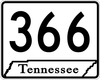
State Route 366 is the unsigned designation for the 5.48-mile-long (8.82 km) northern beltway around the city of Humboldt in Gibson County, Tennessee. Throughout its length, the highway is signed as U.S. Route 45W, US 70A Bypass, and US 79 Bypass.

