Tennyson Trail

Last updated

The Tennyson Trail
Tennyson Trail, Isle of Wight, UK (3).jpg
Fine views west along the trail from the top of Mottistone Down. Tennyson Down can be seen in the distance (white chalk cliffs).
Length14 mi (23 km)
Location Isle of Wight
Trailheads Carisbrooke
50°41′27″N1°19′09″W / 50.6907°N 1.3193°W / 50.6907; -1.3193 (Tennysone Trail, eastern end)
The Needles
50°40′00″N1°33′57″W / 50.6666°N 1.5658°W / 50.6666; -1.5658 (Tennysone Trail, western end)
UseHiking
Hiking details
Trail difficultyModerate
SeasonAll year
Sights The Needles Battery

The Tennyson Trail is a 14-mile walk from Carisbrooke to The Needles on the Isle of Wight. The route goes through Bowcombe Down, Brighstone Forest, Mottistone Down, Brook Down, Afton Down, Freshwater Bay, Tennyson Down, and West High Down to Alum Bay. [1] The name of the trail comes from poet Alfred Lord Tennyson, a former resident of the Isle of Wight.

Contents

There are several points of interest along the walk, including The Tennyson Monument on Tennyson Down, Farringford House and The Needles Batteries which overlook The Needles. [2]

Much of the trail, being a public byway, was formerly open to all traffic, including motor vehicles. By the early 2000s, off-road vehicles had become an increasing problem, and were damaging tracks, archaeological sites and wildlife habitats. [3] In response, in 2006, the Isle of Wight council banned all motor vehicles from the entire length of the trail. [4]

View of Carisbrooke Castle from the trail; looking east Carisbrooke Castle from the west.jpg
View of Carisbrooke Castle from the trail; looking east
Looking west along the trail above Bowcombe, with Rowridge Transmitter in the distance. Tennyson Trail, Isle of Wight, UK.jpg
Looking west along the trail above Bowcombe, with Rowridge Transmitter in the distance.
The trail through Brighstone Forest. Looking south west. Tennyson Trail, Isle of Wight, UK (2).jpg
The trail through Brighstone Forest. Looking south west.
View east from Brook Down towards Mottistone Down. Brook Down, Isle of Wight, UK.jpg
View east from Brook Down towards Mottistone Down.
Descending towards Freshwater Bay. Tennyson Trail, Isle of Wight, UK (4).jpg
Descending towards Freshwater Bay.
Monument to Tennyson at the top of Tennyson Down. Tennyson Monument, Tennyson Down, IW, UK.jpg
Monument to Tennyson at the top of Tennyson Down.

The route can be joined at any point, or walked in either direction; however, below it is described from Carisbrooke to Alum Bay. [5]

Carisbrooke to Brighstone

The route starts from Carisbrooke near Newport. The sign for the Tennyson Trail is present on Nodgham Lane. After this, the trail follows a steep hill in a south-westerly direction along an ancient road with banks on each side. Views to the left show Carisbrooke Castle, leading on to Bowcombe Valley. The route later crosses bridleways N125 and N127 and later passes N140 where a television mast is visible. At this point the path starts to descend before crossing a gate to a crossing track at the bottom. After crossing this, the route travels along Bridleway N136a to Brighstone Forest to another gate around 80 metres further ahead. An overhead electrical cable will later pass overhead and will follow a narrow beech plantation to the left. After passing Bridleway N198 the trail continues straight ahead and uphill through open fields before levelling off at a gate which levels off and follows the sign for Bridleway N139 to Brook and Freshwater. As the track continues, it slowly becomes enclosed in trees through Brighstone Forest.

Brighstone to Brook

On reaching Brighstone Forest, signs for the Tennyson Trail appear. After following these signs the track starts to descend and crosses Bridleway BS58 shortly before reaching a five-way crossing. After continuing straight at the crossing, a signpost appears showing the Worsley Trail and Shorwell to the left and the Tennyson Trail to the right. Following this leads to Brighstone Down. The trail continues west along this track with sea views to the left before descending steadily to exit at a picnic area onto Lynch Lane. Turning right, then left will lead through the National Trust Jubilee Car Park and onto the National Trust information board. After passing the Forestry Commission Brighstone Forest entrance, the trail follows the down following the ancient road to the summit. After leaving National Trust land through a gate and continuing ahead on level ground, the path will immediately pass ancient burial mounds on the right. The track then descends to a further gate into a field where the Tennyson Trail is signposted. It will then descend through the field to reach the B3399 road to Freshwater and Yarmouth to the right and Brook to the left.

Brook to Freshwater

After turning right onto the road towards Freshwater, the path immediately restarts to the left by a bus stop and car park onto Compton Down. This track begins to immediately climb steeply passing a chalk pit on the right then bears right to avoid overhead electric cables. The trail continues ahead, steadily gaining height towards Afton Down. It then travels through the golf course on Afton Down with the track later descending to Freshwater Bay.

Freshwater to Alum Bay

From here, the Tennyson Trail joins the westbound Coastal path next to a block of public toilets on the lane to Fort Redoubt. This lane then turns sharply left passing through two sets of stiles onto Tennyson Down. From here the trail continues along the coastline, continuing to rise to the Tennyson Monument. After reaching the monument, the ground starts to descend. At the bottom of Tennyson Down will be a stile leading on to West High Down which has a steady incline until a radio aerial comes into view. After crossing a stile by the aerial, the trail then continues right onto a tarmac road. From here to the left, The Needles Battery can be seen. The road passes a row of cottages where it turns sharply left. Here there is a stile with a descending path and another stile back onto the road. This road continues downwards to Alum Bay, marking the end of the trail.

Related Research Articles

Alum Bay

Alum Bay is a bay near the westernmost point of the Isle of Wight, England, within close sight of the Needles rock formation. Of geological interest and a tourist attraction, the bay is noted for its multi-coloured sand cliffs. The waters and adjoining seabed form part of the Needles Marine Conservation Zone and the shore and heath above are part of the Headon Warren and West High Down Site of Special Scientific Interest.

Pennine Way Long distance footpath in England

The Pennine Way is a National Trail in England, with a small section in Scotland. The trail stretches for 268 miles (431 km) from Edale, in the northern Derbyshire Peak District, north through the Yorkshire Dales and Northumberland National Park and ends at Kirk Yetholm, just inside the Scottish border. The path runs along the Pennine hills, sometimes described as the "backbone of England". Although not the United Kingdom's longest National Trail, it is according to The Ramblers "one of Britain's best known and toughest".

Yarmouth, Isle of Wight Human settlement in England

Yarmouth is a town, port and civil parish in the west of the Isle of Wight, off the south coast of England. The town is named for its location at the mouth of the small Western Yar river. The town grew near the river crossing, originally a ferry, which was replaced with a road bridge in 1863.

Golden Hill Fort

Golden Hill Fort was a defensible barracks at Freshwater, Isle of Wight, England, built as part of the Palmerston defences by the 1859 Royal Commission on the Defence of the United Kingdom to provide manpower to man the defences at the western end of the Isle of Wight, England. Built in hexagonal form, it accommodated 8 officers and 128 men, and had its own hospital.

Freshwater, Isle of Wight Human settlement in England

Freshwater is a large village and civil parish at the western end of the Isle of Wight, England. The southern, coastal part of the village is Freshwater Bay, named for the adjacent small cove. Freshwater sits at the western end of the region known as the Back of the Wight or the West Wight, a popular tourist area.

Carisbrooke Human settlement in England

Carisbrooke is a village on the south western outskirts of Newport, Isle of Wight and is best known as the site of Carisbrooke Castle. It also has a medieval parish church. St Mary's Church, began life as part of a Benedictine priory, established by French monks about 1150. The priory was dissolved by King Henry V of England in 1415 during the French Wars. Neglect over the centuries took its toll, but in 1907 the church was restored to its full glory. Its most striking feature is the 14th century tower, rising in five stages with a turret at one corner and a battlemented and pinnacled crown.

Totland Human settlement in England

Totland is a village, civil parish and electoral ward on the Isle of Wight. Besides the village of Totland, the civil parish comprises the western tip of the Isle of Wight, and includes The Needles, Tennyson Down and the hamlet of Middleton.

Brook, Isle of Wight Human settlement in England

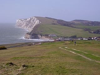
Brook is a village on the Isle of Wight, England. According to the Post Office the 2011 census population was included in the civil parish of Brighstone.

Farringford House

Farringford House, in the village of Freshwater Bay, Isle of Wight, was the home of the poet Alfred, Lord Tennyson, from 1853 until his death in 1892. The main house dates from 1806 with gothic embellishments and extensions added from the 1830s. Of particular historical importance is the second library built by his wife Emily Tennyson in 1871 with a play room below connected by a turreted winding staircase. The grounds are laid to lawn, rose borders and informal planting. Evidence remains of Tennyson's planting schemes together with a section of the walled garden and wooden footpaths.

Bay Trail (Australia)

The Bay Trail is a shared use path for cyclists and pedestrians which follows the coastline of Port Phillip Bay through the south-eastern suburbs of Melbourne, Victoria, Australia.

Tennyson Down

Tennyson Down is a hill at the west end of the Isle of Wight just south of Totland. Tennyson Down is a grassy, whale-backed ridge of chalk which rises to 482 ft/147m above sea level. Tennyson Down is named after the poet Lord Tennyson who lived at nearby Farringford House for nearly 40 years. The poet used to walk on the down almost every day, saying that the air was worth 'sixpence a pint'.

Meanwood Valley Trail

The Meanwood Valley Trail is a waymarked footpath and the title of an annual (March/April) footrace that takes place on parts of the trail in Leeds, West Yorkshire, England. It runs for a distance of 7 miles (11 km) from the statue of Henry Rowland Marsden, 1878, on Woodhouse Moor, close to the University of Leeds, through Headingley, Meanwood and Adel to Breary Marsh, Golden Acre Park, where it meets the Leeds Country Way. For most of its route it is the official Leeds link to the Dales Way. Along the way are signs giving information about the local wildlife.

Isle of Wight Coastal Path Long-distance footpath on the Isle of Wight, England

The Isle of Wight Coastal Path is a circular long-distance footpath of 70 miles (113 km) around the Isle of Wight, UK. It follows public footpaths and minor lanes, with some sections along roads.

Cateran Trail

The Cateran Trail is a 103-kilometre (64 mi) circular long-distance walking route in central Scotland. The trail has no official beginning or end and can be joined at any stage. The route was established, way-marked and is now maintained by, the Perth & Kinross Countryside Trust. A variety of terrain is covered by the trail including farmland, mountains and forest. The path itself follows old drovers' roads, minor paved roads and farm tracks and can be walked in 4 or 5 days. It is now designated as one of Scotland's Great Trails by NatureScot. As of 2018 it was estimated that around 8,000 people were using the trail each year.

The New Lipchis Way is a 60.8 kilometres (37.8 mi) long distance footpath which runs from Liphook in Hampshire to West Wittering in West Sussex. Running north–south across the Western Weald and South Downs to the Sussex coastal plain and Chichester Harbour the path crosses several geological rock strata and their associated soils and habitats. Landmarks on the route include Cowdray ruins, Goodwood Racecourse, the Trundle, Chichester Cathedral and the city walls, and East Head at West Wittering.

Freshwater Redoubt

Freshwater Redoubt, also known as Fort Redoubt is an old Palmerston fort built in Freshwater Bay on the western end of the Isle of Wight. Construction work for the fort began in 1855 and was completed in 1856. It was finally sold in 1928 and has now been converted into a private residence.

Back of the Wight

Back of the Wight is an area on the Isle of Wight in England. The area has a distinct historical and social background, and is geographically isolated by the chalk hills, immediately to the North, as well as poor public transport infrastructure. Primarily agricultural, the Back of the Wight is made up of small villages spread out along the coast, including Brighstone, Shorwell and Mottistone.

Geology of the Isle of Wight

The geology of the Isle of Wight is dominated by sedimentary rocks of Cretaceous and Paleogene age. This sequence was affected by the late stages of the Alpine Orogeny, forming the Isle of Wight monocline, the cause of the steeply-dipping outcrops of the Chalk Group and overlying Paleogene strata seen at The Needles, Alum Bay and Whitecliff Bay.

Peak District Boundary Walk Long distance footpath in England

The Peak District Boundary Walk is a circular 190-mile (310 km) walking trail, starting and finishing at Buxton and broadly following the boundary of the Peak District, Britain's first national park. The route was developed by the Friends of the Peak District and was launched on 17 June 2017.

References

  1. "Tennyson Trail". WightCam. Retrieved 18 June 2009.
  2. "BBC Hampshire – Historic walks – The Tennyson Trail". BBC . Retrieved 18 June 2009.
  3. Payne, Stewart (28 December 2002). "Off-roaders threaten to destroy Tennyson's trail". The Daily Telegraph . London. Retrieved 18 June 2009.
  4. "VEHICLE BAN FOR TENNYSON TRAIL". www.iwcp.co.uk. Archived from the original on 13 March 2018.
  5. "The Long Distance Walkers Association – The Tennyson Trail" (PDF). ldwa.org.uk. Retrieved 18 June 2009.
Map all coordinates using: OpenStreetMap  
Download coordinates as: KML