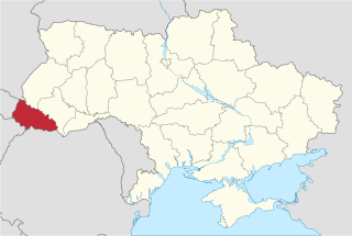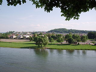
The San is a river in southeastern Poland and western Ukraine, a tributary of the Vistula River, with a length of 458 km and a basin area of 16,877 km2.
Szabolcs-Szatmár-Bereg is an administrative county in north-eastern Hungary, bordering Slovakia, Ukraine, and Romania. It shares borders with the Hungarian counties Hajdú-Bihar and Borsod-Abaúj-Zemplén. The capital of Szabolcs-Szatmár-Bereg county is Nyíregyháza.

The Körös is a river in eastern Hungary and western Romania. Its length is 128.6 km (79.9 mi) from the confluence of its two source rivers Fehér-Körös and Fekete-Körös to its outflow into the Tisza. Its drainage basin area is 27,537 km2 (10,632 sq mi). It has three source rivers, all of which have their origin in the Apuseni Mountains in Transylvania, Romania: Crișul Alb (Fehér-Körös), Crișul Negru (Fekete-Körös) and Crișul Repede (Sebes-Körös). The confluence of the rivers Fehér-Körös and Fekete-Körös is near the town Gyula. The Körös downstream from Gyula is also called the Kettős-Körös. 37.3 km further downstream, near Gyomaendrőd, the Sebes-Körös joins the Criș/Körös. The section downstream from Gyomaendrőd is also called the Hármas-Körös. The Körös flows into the Tisza River near Csongrád.

The Târnava is a river in Romania. It is formed by the confluence of the Târnava Mare and Târnava Mică in the town of Blaj. The Târnava flows into the Mureș after 23 km, near the town of Teiuş. Tributaries of the Târnava, besides its two source rivers Târnava Mare and Târnava Mică, are the Tiur, Izvorul Iezerului and Secaș from the left and the Șoimuș from the right. Its drainage basin covers an area of 6,253 km2 (2,414 sq mi).

The Crasna (Romanian) or Kraszna (Hungarian) is the name of a river in northwestern Romania and northeastern Hungary. The Crasna is a left tributary of the Tisza. Its source is in Transylvania, Romania, near the village of Crasna. It flows through the Romanian counties Sălaj and Satu Mare and the Hungarian county Szabolcs-Szatmár-Bereg. It flows into the Tisza in Vásárosnamény. Cities along the Crasna are Șimleu Silvaniei in Romania, Nagyecsed and Mátészalka in Hungary.

The Pannonian Basin, or Carpathian Basin, is a large basin in Central Europe. The geomorphological term Pannonian Plain is more widely used for roughly the same region though with a somewhat different sense, with only the lowlands, the plain that remained when the Pliocene Epoch Pannonian Sea dried out.

The Someș, located in northwestern Romania, is a left tributary of the Tisza in Hungary. It has a length of 415 km (258 mi), of which 50 km are in Hungary. The Someș is the fifth river as length and debit in Romania. The hydrographic basin forms by the confluence at Mica, a commune about 4 km upstream of Dej, of Someșul Mare and Someșul Mic rivers. Someșul Mic originates in the Apuseni Mountains, and Someșul Mare springs from the Rodna Mountains.

Čierna nad Tisou is a town and municipality in the Trebišov District in the Košice Region of extreme south-eastern Slovakia, near the Tisa (Tisza) river.
Northern Maramuresh is a geographic-historical region comprising roughly the eastern half of the Zakarpattia Oblast in southwestern Ukraine, near the border with Romania. Until 1920, it was part of the Maramureş of Transylvania, at which time the former Máramaros County was divided into a northern part, and a southern part. Alternative names for the regions are Northern Máramaros, Northern Maramureş, Northern Maramorshchyna, Northern Marmatia.
The Tur is a tributary of the Tisza River. Its sources are located in the Oaș Mountains in Romania. The Tur starts at the confluence of its headwaters, the Gorova and Turișor. It then flows through Satu Mare County in Romania. The main town on the Tur is Turulung, The river then forms the border between Romania and Ukraine on a reach of 5.2 km, and the border between Romania and Hungary for 1.1 km. The Tur joins the Tisza river near Szatmárcseke in Hungary. Its basin size is 1,144 km2 (442 sq mi).
The Bic is a left tributary of the river Tisza in Romania. It discharges into the Tisza near Teresva, on the border with Ukraine.
The Batar is a river in Ukraine and Hungary. It is a left tributary of the river Tisza, which it joins at Tiszabecs. Its source is near the village Cherna, about 10 kilometres (6 mi) east of Korolevo, in Vynohradiv Raion. It flows through the villages Cherna, Hudia, Kholmovets and Magosliget.

The Anartes a.k.a. Anarti, Anartii or Anartoi were Celtic tribes, or, in the case of those sub-groups of Anartes which penetrated the ancient region of Dacia, Celts culturally assimilated by the Dacians.
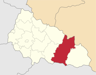
Tiachiv Raion is a raion in Zakarpattia Oblast in western Ukraine. Its administrative center is Tiachiv. Population: 175,257 (2016 est.).
Teresva is an urban-type settlement in Tiachiv Raion (district) of Zakarpattia Oblast (region) in western Ukraine. It is situated at the confluence of the rivers Tisza and Teresva. The town's population was 7,554 at the 2001 Ukrainian Census. Current population: 7,617 (2016 est.).

Transcarpathian Lowland or Tysa Lowland is a lowland in the southwestern portion of the Zakarpattia Oblast in the drainage basin of Tisza river and located on its right banks. The plain stretches along the Hungary-Ukraine border.

The Borzhava is a right tributary of the river Tisza in the Zakarpattia Oblast, western Ukraine. Its basin covers an area of 1,450 km2 (560 sq mi). It rises in the Eastern Carpathians. It discharges into the Tisza near Vary, on the border with Hungary.

The Rika is a right tributary of the river Tisza in the Zakarpattia Oblast, western Ukraine. Its basin covers an area of 1,145 km2 (442 sq mi). It rises in the Eastern Carpathians. It flows through the town Mizhhirya and discharges into the Tisza near Khust.