Termesse

Last updated
Termesse
Sub-prefecture and town
Guinea adm location map.svg
Red pog.svg
Termesse
Location in Guinea
Coordinates: 12°19′N12°47′W / 12.317°N 12.783°W / 12.317; -12.783
CountryFlag of Guinea.svg  Guinea
Region Boké Region
Prefecture Koundara Prefecture
Population (2014)
  Total 15,264
Time zone GMT (UTC+0)

Termesse is a town and sub-prefecture in the Koundara Prefecture in the Boké Region of northern Guinea. [1] As of 2014 it had a population of 15,264 people. [2]

Town settlement that is bigger than a village but smaller than a city

A town is a human settlement. Towns are generally larger than villages but smaller than cities, though the criteria to distinguish them vary considerably between different parts of the world.

Sub-prefectures of Guinea

The sub-prefectures are the third-level administrative divisions in Guinea. As of 2009 there were 303 rural communes of Guinea and 38 urban communes, 5 of which compose the Conakry greater urban area; Kaloum, Dixinn, Matam, Ratoma and Matoto.

Koundara Prefecture Prefecture in Boké Region, Guinea

Koundara is a prefecture located in the Boké Region of Guinea. The capital is Koundara. The prefecture covers an area of 5,238 km.² and has a population of 130,205.

Related Research Articles

Niagassola Sub-prefecture and town in Kankan Region, Guinea

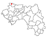
Niagassola is a town and sub-prefecture in the Siguiri Prefecture in the Kankan Region of north-eastern Guinea.It is located near the border with Mali. It has no electricity and three water pumps.

Sama is a town in the Kouka Department of Banwa Province in western Burkina Faso. As of 2005 it had a population of 3,853.

Tamita Sub-prefecture and town in Boké Region, Guinea

Tamita is a town and sub-prefecture in the Boffa Prefecture in the Boké Region of western Guinea. As of 2014 it had a population of 14,443 people.

Kankama Sub-prefecture and town in Faranah Region, Guinea

Kankama is a town and sub-prefecture in the Dabola Prefecture in the Faranah Region of Guinea. As of 2014 it had a population of 13,262 people.

Koba, Mamou Sub-prefecture and town in Mamou Region, Guinea

Koba is a town and sub-prefecture in the Dalaba Prefecture in the Mamou Region of western Guinea.

Mitty, Guinea Sub-prefecture and town in Mamou Region, Guinea

Mitty, Guinea is a town and sub-prefecture in the Dalaba Prefecture in the Mamou Region of western Guinea.

Beindou, Faranah Sub-prefecture and town in Faranah Region, Guinea

Beindou is a town and sub-prefecture in the Faranah Prefecture in the Faranah Region of Guinea. As of 2014 it had a population of 16,521 people.

Marela Sub-prefecture and town in Faranah Region, Guinea

Marela is a town and sub-prefecture in the Faranah Prefecture in the Faranah Region of Guinea. As of 2014 it had a population of 32,638 people.

Passayah Sub-prefecture and town in Faranah Region, Guinea

Passayah is a town and sub-prefecture in the Faranah Prefecture in the Faranah Region of Guinea. As of 2014 it had a population of 19,849 people.

Fermessadou-Pombo Sub-prefecture and town in Faranah Region, Guinea

Fermessadou-Pombo is a town and sub-prefecture in the Kissidougou Prefecture in the Faranah Region of Guinea. As of 2014 it had a population of 19,489 people.

Firawa Sub-prefecture and town in Faranah Region, Guinea

Firawa is a town and sub-prefecture in the Kissidougou Prefecture in the Faranah Region of Guinea. As of 2014 it had a population of 11,407 people.

Yombiro Sub-prefecture and town in Faranah Region, Guinea

Yombiro is a town and sub-prefecture in the Kissidougou Prefecture in the Faranah Region of Guinea. As of 2014 it had a population of 14,340 people.

Babila Sub-prefecture and town in Kankan Region, Guinea

Babila is a town and sub-prefecture in the Kouroussa Prefecture in the Kankan Region of eastern-central Guinea. As of 2014 it had a population of 16,290 people.

Sanguiana Sub-prefecture and town in Kankan Region, Guinea

Sanguiana is a town and sub-prefecture in the Kouroussa Prefecture in the Kankan Region of eastern-central Guinea. As of 2014 it had a population of 23,809 people.

Sengbédou Sub-prefecture and town in Nzérékoré Region, Guinea

Sengbédou is a town and sub-prefecture in the Macenta Prefecture in the Nzérékoré Region of south-eastern Guinea.

Doko, Guinea Sub-prefecture and town in Kankan Region, Guinea

Doko is a town and sub-prefecture in the Siguiri Prefecture in the Kankan Region of northern Guinea.

Kollet, Labé Sub-prefecture and town in Labé Region, Guinea

Kollet is a town and sub-prefecture in the Tougué Prefecture in the Labé Region of northern-central Guinea.

Kaalan, Guinea Sub-prefecture and town in Labé Region, Guinea

Kaalan is a town and sub-prefecture in the Labé Prefecture in the Labé Region of northern-central Guinea.

Channel Glacier glacier in Antarctica

Channel Glacier is a through glacier, 1.5 nautical miles (3 km), extending in an east-west direction across Wiencke Island, between Nipple Peak and Wall Range, in the Palmer Archipelago. It was discovered by the Belgian Antarctic Expedition under Gerlache 1897–99. The name appears on a chart based on a 1927 survey by DI personnel on the Discovery.

References

  1. "Subprefectures of Guinea". Statoids. Retrieved April 19, 2009.
  2. "Guinea". Institut National de la Statistique, Guinea, accessed via Geohive. Retrieved 27 August 2014.

Coordinates: 12°19′N12°47′W / 12.317°N 12.783°W / 12.317; -12.783

Geographic coordinate system Coordinate system

A geographic coordinate system is a coordinate system that enables every location on Earth to be specified by a set of numbers, letters or symbols. The coordinates are often chosen such that one of the numbers represents a vertical position and two or three of the numbers represent a horizontal position; alternatively, a geographic position may be expressed in a combined three-dimensional Cartesian vector. A common choice of coordinates is latitude, longitude and elevation. To specify a location on a plane requires a map projection.