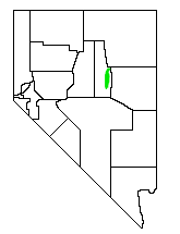
Mineral County is a county located in the U.S. state of Nevada. As of the 2020 census, the population was 4,554, making it the fifth-least populous county in Nevada. Its county seat is Hawthorne.

Battle Mountain is an unincorporated town in and the county seat of Lander County, Nevada, United States. The population was 3,705 at the 2020 census. Its primary economic base is gold mining and, to a lesser extent, legalized gambling.
The Sand Springs Range is a short mountain range located in western Nevada in the United States within the Great Basin. It is approximately 10 miles (16 km) long and is in Churchill County. It separates Salt Wells from Fairview Valley. To the north, it is separated from the Stillwater Range by Sand Springs Pass. To the south is Gabbs Valley.

Sequoia National Forest is located in the southern Sierra Nevada mountains of California. The U.S. National Forest is named for the majestic Giant Sequoia trees which populate 38 distinct groves within the boundaries of the forest.

Loch Leven is the name of several lakes in California, United States, in the Sierra Nevada.
Churchill County High School is located in Fallon, Churchill County, Nevada. The building was built in 1917, and was opened in 1920.

The Wassuk Range is located in west-central Nevada in the United States. It is found to the west of Walker Lake in Mineral County.

Diamond Valley is a valley basin between the Sulphur Spring Range and the Diamond Mountains, in central Nevada, the Western United States.
Fish Lake Valley is a ghost town located in the geographic Fish Lake Valley, within Esmeralda County, Nevada and Inyo County, California.
The Hot Springs Mountains are a range of rocky hills located in Northern Nevada, in Churchill County, between the cities of Fallon, Lovelock, and Fernley. The area was recently volcanically active, is underlain by hot rocks, and is the site of several geothermal electric power plants. It is an arid, rough terrain, uninhabited. These mountains are adjacent to the Lahontan Valley, which contains the Forty Mile Desert, a daunting section of the 19th century California emigrant trail. During the Pleistocene epoch this range of mountains was an island in the now extinct Lake Lahontan.
The Ossipee Mountains are a small mountain range in the New England state of New Hampshire, United States. The remains of an ancient volcanic ring dike, they lie north of Lake Winnipesaukee, east of Squam Lake, and south of the Sandwich Range, the southernmost of the White Mountains. 2,990 ft (910 m) Mount Shaw is their highest point.
The Paiute-Shoshone Tribe of the Fallon Reservation and Colony is a federally recognized tribe of Northern Paiute and Western Shoshone Indians in Churchill County, Nevada. Their autonym is Toi Ticutta meaning "Cattail Eaters."
Fairview Peak may refer to

Newark Valley is a north–south trending endorheic valley in western White Pine County, Nevada. The valley contains the dry Newark Lake bed, which is approximately 23 km (14 mi) by 3.5 km (2.2 mi). To the west, the Diamond Mountains border the valley and to the east, various minor mountains separate the Newark from Long Valley. To the north across a relatively low divide lies Huntington and Ruby valleys.
Allen Russell is the 32nd or 33rd largest giant sequoia in the world. It is also the largest tree in Balch County Park, and is part of the Mountain Home Grove, a sequoia grove located in the southern Sierra Nevada mountains of California, United States. It is the 34th largest giant sequoia in the world, and could be considered either the 33rd or 32nd largest depending on how badly Ishi Giant and Black Mountain Beauty have atrophied following devastating wildfires in 2015 and 2017, respectively.

The Mason Valley is a valley in western Nevada, between the Singatse Range and the Wassuk Range in Lyon County, Nevada.
Belknap Mountain State Forest is a 1,300-acre (530 ha) state forest in central New Hampshire within the Belknap Mountains. The forest contains the summit and surrounding slopes of 2,382-foot (726 m) Belknap Mountain, the highest point in Belknap County, as well as lands to the east extending to Round Pond. The forest is bordered to the north by Gunstock Mountain and Gunstock Mountain Resort, a downhill ski area. A lookout tower is at the top of Belknap Mountain, and there is an extensive trail network in the forest.

Ragged Top Mountain is a summit located in the Trinity Range in the U.S. state of Nevada. The elevation is 6,316 feet (1,925 m).
South Mountains are a range of mountains primarily in White Pine County, Nevada and partially to the east in Juab County, Utah. The range is sometimes referred to as the Deep Creek Mountains, or the Ibenpah Mountains. The South Mountains are divided from the Kern Mountains to the south by Tippett Canyon on the west and Pleasant Valley to the east. They are divided from the Deep Creek Range to the east in Utah by Johnson Canyon, on the north, and by Water Canyon on the south. The range is bounded on the north by Spring Creek Flat and on the west by Antelope Valley.
Pleasant Valley, is a valley in two counties in two states adjacent states, White Pine County, Nevada and Juab County, Utah. Its mouth is located at an elevation of 5,682 feet in Utah. Its head is at 39°44′09″N114°09′53″W at an elevation of 6,965 feet in Nevada. It lies between the Kern Mountains on the south, and South Mountains to the northwest and the Deep Creek Range on the north.


