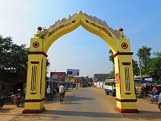
Taulihawa, also known as Kapilavastu, is one of the oldest municipality and administrative center of Kapilvastu District in Province No. 5 of southern Nepal. Taulihawa is located roughly 25 kilometres (16 mi) to the south-west of Lumbini, a UNESCO World Heritage Site and the birthplace of Gautama Buddha.

Bhimdatta, is a municipality in Kanchanpur District of Sudurpashchim Pradesh, Nepal. The city and the municipality were named Mahendranagar in the honour of late king Mahendra of Nepal. After becoming a republic in 2008, the Mahendranagar municipality name was changed to Bhimdatta municipality in honour of the revolutionary farmer leader Bhimdatta Panta, killed in 1953 by Indian forces inside the borders of Nepal. It is surrounded by Bedkot Municipality in the east, Dadeldhura District in the north, Shuklaphanta National Park in the south and Uttarakhand, India in the west.

Budhabare, more specifically Hadiya Budhabare, is a village and former Village Development Committee that is now part of Buddhashanti Rural Municipality in Jhapa district of Province No. 1 in south-eastern Nepal. The latest official data, 2011 Nepal Census, puts the total population of the VDC at 22,936. Owing to this average population size, the VDC has been divided into nine wards.
Barakot is a ward in Dasharathchanda municipality, in Baitadi District in Sudurpashchim Pradesh of western Nepal. Earlier it was a village development committee (VDC). At the time of the 1991 Nepal census it had a population of 2,389 and had 462 houses in the village.
Baseri is a village in Dhading District in the Bagmati Zone of central Nepal. At the time of the 1991 Nepal census it had a population of 6264 and had 1196 houses in it. It is 60 kilometers away from the district headquarter Dhadingbesi. The main occupation of the people here is agriculture. The people of the village are Brahmin and Chhetri in the lower part and Ghale and Gurung in the upper part. In Baseri VDC there is 3 Secondary Schools and they are Shree Mahalaxmi Higher Secondary School, Shree Baseri Secondary School and Shree Shivalaya Secondary School. Shree Mahalaxmi School is located at central of Baseri VDC. Destinations of Baseri : Tinsure Gumba, Nange Chour, Shivalaya Mandir, Annapurna Temple, Ramche Dhunga and Kaliruwa. Official Facebook Page Baseri Dhading.

Ramkot is a village and former Village Development Committee that is now part of Nagarjun Municipality in Province No. 3 of central Nepal. At the time of the 1991 Nepal census it had a population of 5327 and had 972 households in it. Ramkot is almost isolated area of Kathmandu when it comes to publicity. Ramkot was named to signify that Lord Ram was here during his exile.According to legends,Lord Ram left his coat here. Another legends defines the Lord Ram built a building to keep his weapons Sitapaila, an attached VDC is named to show Lordess Sita, wife of Lord Ram was here too. Presently,there is one temple of goddess Sita which contains her footprints.

Borlang is a village development committee in northern-central Nepal. As of the 1991 Nepal census it had a population of 4,737 and had 837 houses.
Shikhar Ambote is a village development committee in Kavrepalanchok District in the Bagmati Zone of central Nepal.At the Center of this Village,there is a popular public School named Shree Devi Secondary School.At least 700 Students from different parts of that village are facilatated to get basic Education. At the time of the 1991 Nepal census it had a population of 3995 in 702 individual households.
Aslewa is a village development committee (VDC) in Gulmi District in the Lumbini Zone of central Nepal. At the time of the 1991 Nepal census it had a population of 8088 persons living in 992 individual households. The village has a temple called Rudra Beni Dhaam and a school for higher level study, the Shree Janata Higher Secondary School.
Wamitaksar (Nepali:वामीटक्सार) is a town and Village Development Committee in Gulmi District in the Lumbini Zone of central Nepal. At the time of the 1991 Nepal census it had a population of 6421. It is located 128.54 kilometers of the capital of Nepal Kathmandu.
Lumle is a sub-urban and Village Development Committee in Kaski District in the Gandaki Zone of northern-central Nepal
- East side of this VDC is Paudhur Village,
- Sallyan village on south.
Lunkhu Deurali is a Village Development Committee in Parbat District in the Dhawalagiri Zone of central Nepal. At the time of the 2011 Nepal census it had a population of 2546 people living in 503 individual households.

Joshipur is Rural Municipality in Kailali District of Sudurpashchim Pradesh established by merging Bauniya and Joshipur two existing village development committees. Joshipur lies 75 km east of Dhangadhi and 61 3 km west of the capital, Kathmandu. It is surrounded by Lamki Chuha Municipality, Tikapur Municipality and Janaki Rural Municipality in the East, Ghodaghodi Municipality and Bhajani Municipality in the West, Bardagoriya Rural Municipality in the North and Bhajani Municipality in the South.

Matihani is a town situated in Mahottari district of Nepal. The village is well known for its historical significance and its way of celebrating any festival. It was formed in as a municipality in 2016 occupying current 9 sections (wards) from previous 9 former VDCs. It occupies an area of 29.02 sq. km with a total population of 31,026.
Mirchaiya formerly known as Ramnagar Mirchaiya is a municipality in Siraha District in the Sagarmatha Zone of south-eastern Nepal. The municipality was established on 18 May 2014 by merging the existing Rampur Birta, Malhaniyakhori, Radhopur, Ramnagar Mirchaiya, Phulbariya, Sitapur PraDa and Maheshpur Gamharia Village Development Committees. At the time of the 2017 municipality records, it had a population of approx. 52,000 people living in approx 8,496 individual households. This is one of the main business markets for Katari and the southern part of the Siraha district. Raw material produced here includes padday, miazem, and sugar cane. Frequently used Language of Mirchaiya is Maithali. However, People of this locality is well educated they can speak English, Nepali, Hindi and some other local language according to their ethnicity. The famous festival of Mirchaiya is Durgapuja, Jhanda Mela, Holi, Chhat puja, Shreepanchami, Dipawali. The mode of transportation mostly used include: bus, car, bike, bicycle, rickshaw, tempo, and mini bus.
Bhardaha is a village development committee in Saptari District in the Sagarmatha Zone of south-eastern Nepal. At the time of the 2011 Nepal census it had a population of 7,124 people living in 1,245 individual households.

Bhadrapur is a town and municipality in Jhapa District in the Mechi Zone of southeastern Nepal. It lies on the right bank of the Mechi River, Nepal's eastern municipality borders with Bihar state, India on south and West Bengal state on north. There is a border crossing with customs office for goods. Galgalia village in Kishanganj District borders with Bhadrapur
Kopawa is a village development committee in Kapilvastu District in the Lumbini Zone of southern Nepal. At the time of the 1991 Nepal census it had a population of 7269 people living in 1142 individual households.Now from 2073 B.S kopawa is mixed with Banganga municipality ward no. 11 .

Letang, "लेटाङ " is a Municipality in Morang District in the Province No. 1 of south-eastern Nepal. It was formed by merging the existing Village Development Committees of Letang, Janta, Warrangi and Bhogateni.
Naya Belhani is a village development committee in Nawalparasi District in the Lumbini Zone of western Nepal. At the time of the 1991 Nepal census it had a population of 9786 people living in 1795 individual households. Naya Belhani is divided into 9 wards, among which ward number 9, Arunkhola is the center of the VDC, which is considered one of an emerging business market of the Nawalparasi district. The VDC's main interesting factor is divided into two parts by Aarungkhola river and East West highway. The river is partition 6, 7 & 9 ward east region and 1,2,3,4,5,8 west region.

