Texas Forest Trail

Last updated
Texas Forest Trail
Founder Texas Historical Commission
Focus Tourism, Economic Development and Historical Preservation
Location
Website www.texasforesttrail.com

The Texas Forest Trail is a non-profit organization which promotes heritage tourism, economic development, and historic preservation. The organization is one of ten driving trail regions which make up the award-winning Heritage Trails Program of the Texas Historical Commission. [1]

Contents

History

In 1968 Texas hosted the World's fair, known as HemisFair '68, in San Antonio, Texas. In connection with this boost in international attention, the Texas Department of Transportation designated ten 650-mile circular driving regions that encompassed the entire state of Texas. These trails saw little attention after their creation until in the late 1990s when the Texas Historical Commission adopted these trails as their Heritage Trail Program. The Texas Forts Trail was the first of the ten trails to be reinstated. [2]

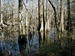
The 35-county Forest Trail Region historically is known for people such as the Caddo Indians and Spanish explorer Alonso de Leon. The region has been called the gateway to Texas, with borders with Oklahoma, Arkansas and Louisiana. The region is named for the four national and five state forests located in this region. [3]

Also located within the region is the site of the first Spanish mission in East Texas, Mission San Francisco de los Tejas. Established in 1690 on San Pedro Creek near the Neches River by Franciscan friars, the purpose of the mission was twofold. Aside from the primary objective of converting the local Nabedache Indians to Christianity, the mission functioned additionally as bulwark against any potential French attempt to claim the region as their own. The mission was ultimately unsuccessful due to steadily declining relations between the Spanish and the Nabedache, who blamed the Spanish for bringing sickness to their tribe. This prompted the Spanish to destroy the mission. [4]

Big Thicket National Preserve Big thicket.jpg
Big Thicket National Preserve

Forests

Related Research Articles

Maverick County, Texas County in Texas, United States

Maverick County is a county located in the U.S. state of Texas. As of the 2020 census, its population was 57,887. Its county seat is Eagle Pass. The county was created in 1856 and organized in 1871. It is named for Samuel Maverick, cattleman and state legislator.

Hasinai Indigenous southeastern Texas tribe

The Hasinai Confederacy was a large confederation of Caddo-speaking Native Americans who occupied territory between the Sabine and Trinity rivers in eastern Texas. Today, their descendants are enrolled in the Caddo Nation of Oklahoma.

Old San Antonio Road Historic roadway in the U.S. states of Texas and Louisiana

The Old San Antonio Road was a historic roadway located in the U.S. states of Texas and Louisiana. Parts of it were based on traditional Native American trails. Its Texas terminus was about 35 miles (56 km) southeast of Eagle Pass at the Rio Grande in Maverick County, and its northern terminus was at Natchitoches, Louisiana. The road continued from Texas through Monclova to Mexico City.

Los Adaes United States historic place

Los Adaes was the capital of Tejas on the northeastern frontier of New Spain from 1729 to 1770. It included a mission, San Miguel de Cuellar de los Adaes, and a presidio, Nuestra Señora del Pilar de Los Adaes. The name Adaes represents the indigenous Adai people, who were to be served by the mission.

Spanish missions in Texas 17th to 19th-century Catholic religious outposts

The Spanish Missions in Texas comprise a series of religious outposts established by Spanish Catholic Dominicans, Jesuits, and Franciscans to spread the Catholic doctrine among area Native Americans, but with the added benefit of giving Spain a toehold in the frontier land. The missions introduced European livestock, fruits, vegetables, and industry into the Texas area. In addition to the presidio and pueblo (town), the misión was one of the three major agencies employed by the Spanish crown to extend its borders and consolidate its colonial territories. In all, twenty-six missions were maintained for different lengths of time within the future boundaries of the state of Texas.

Mission San Francisco de la Espada

Mission San Francisco de la Espada is a Roman Rite Catholic mission established in 1690 by Spain and relocated in 1731 to present-day San Antonio, Texas, in what was then known as northern New Spain. The mission was built in order to convert local Native Americans to Christianity and solidify Spanish territorial claims in the New World against encroachment from France. Today, the structure is one of four missions that comprise San Antonio Missions National Historical Park.

Domingo Terán de los Ríos served as the first governor of Texas from 1691 to 1692. He also governed Coahuila, in the modern-day Mexico.

Texas Historical Commission Agency of the State of Texas, United States

The Texas Historical Commission is an agency dedicated to historic preservation within the state of Texas. It administers the National Register of Historic Places for sites in Texas.

The Texas Brazos Trail is a non-profit organization which promotes heritage tourism, economic development, and historic preservation. It is one of ten regions which make up the Texas Heritage Trails Program of the Texas Historical Commission.

The Forts of Texas include a number of historical and operational military installations. For over two hundred years, various groups fought over access to or control over the region that is now Texas. Possession of the region was claimed and disputed by the European powers of Spain and France, and the continental countries of Mexico, the United States, the Republic of Texas, and the Confederate States of America. Ownership of specific lands was claimed and disputed by different ethnic groups, including numerous Native American tribes, Mexican residents, Anglo- and African-American settlers, and European immigrants. Access to and control of resources were claimed and disputed by various economic groups, including indigenous hunter/gatherers, farmers, herders, ranchers, colonists, settlers, buffalo hunters, traders, bandits, smugglers, pirates, and revolutionaries. Over the centuries, claims and disputes were enforced by Native American warriors, Spanish conquistadors, French cavaliers, Texas Rangers, local militias, and uniformed regular army regiments of Spain, Mexico, Texas, the United States, and the Confederacy.

El Camino Real de los Tejas National Historic Trail

The El Camino Real de los Tejas National Historic Trail is a national historic trail covering the U.S. section of El Camino Real de Los Tejas, a thoroughfare from the 18th-century Spanish colonial era in Spanish Texas, instrumental in the settlement, development, and history of Texas. The National Park Service designated El Camino Real de los Tejas National Historic Trail as a unit in the National Trails System in 2004.

History of San Antonio Aspect of Texas history

The City of San Antonio is one of the oldest Spanish settlements in Texas and was, for decades, its largest city. Before Spanish colonization, the site was occupied for thousands of years by varying cultures of indigenous peoples. The historic Payaya Indians were likely those who encountered the first Europeans.

Presidio San Antonio de Béxar United States historic place

Presidio de Béxar was a Spanish fort built near the San Antonio River, located in what is now San Antonio, Texas, in the United States. It was designed for protection of the mission San Antonio de Valero and the Villa de Bejar. The Presidio de Bejar was founded on May 5, 1718 by Spanish colonial official Martin de Alarcon, and his party of thirty-five soldiers. The Villa de Bejar is known for being the first Spanish settlement of San Antonio and consisted of the families of the Presidio Soldiers and those of the prior expeditions. It also served to secure Spain's claim to the region against possible encroachment from other European powers.

Mission Tejas State Park State park in Texas, United States

Mission Tejas State Park is a 660-acre (270 ha) state park located along Texas State Highway 21 in Houston County, Texas, originally constructed in 1935 and transferred to Texas Parks and Wildlife in 1957. The closest major town is Crockett, Texas. The park is open year-round.

The Texas Forts Trail is a nonprofit organization chartered in 1999 which promotes heritage tourism, economic development, and historic preservation. It is one of 10 driving trail regions which make up the award-winning Texas Heritage Trails Program of the Texas Historical Commission. The driving trail is 650 miles (1,050 km) long.

The Texas Hill Country Trail is a non-profit organization which promotes heritage tourism, economic development, and historic preservation. It is one of ten regions which make up the Texas Heritage Trails Program of the Texas Historical Commission.

The Texas Independence Trail is a non-profit organization which promotes heritage tourism, economic development, and historic preservation. It is one of ten regions which make up the Texas Heritage Trails Program of the Texas Historical Commission.

The Texas Lakes Trail is a non-profit organization which promotes heritage tourism, economic development, and historic preservation. It is one of ten regions which make up the Texas Heritage Trails Program of the Texas Historical Commission.

Mission Dolores State Historic Site United States historic place

Mission Dolores State Historic Site (41SA25) is a 36-acre historic site including a 9-acre (3.6 ha) archaeological site listed on the National Register of Historic Places in San Augustine County, Texas that preserves the location of a Franciscan mission originally established in 1721. The site is located on the original El Camino Real de los Tejas trail. The site has no above ground remains of the mission but the mission's location is confirmed through archeological excavations. It is located half a mile south of San Augustine in the Piney Woods region of east Texas. Operated by the Texas Historical Commission, the site includes a campground, museum, gift shop and hiking trails.

Comanche Springs (Texas)

Comanche Springs was an aquifer of six artesian springs geographically located between the Edwards Plateau and the Trans-Pecos regions of West Texas. The groundwater source originated from a Comanchean limestone fault combined within the bountiful Edwards Aquifer and the Glass Mountains.

References

  1. Texas Forest Trail Region: Exploring the Heritage of East Texas. Austin, TX: Texas Historical Commission. 2005. p. 23.
  2. Bluthardt, Bob (21 September 2012). "Trail offers more than forts". San Angelo Standard-Times. Retrieved 5 December 2013.
  3. Turner, Mary (16 January 2012). "Texas Forest Trail Region hosts photo contest with case prize". The Atascocita Observer. Retrieved 5 December 2013.
  4. Bowman, Bob (August 12, 2001). "Mission Tejas". Texas Escapes. Retrieved November 6, 2020.{{cite web}}: CS1 maint: url-status (link)