
U.S. Route 290 is an east–west U.S. Highway located entirely within the state of Texas. Its western terminus is at Interstate 10 southeast of Segovia, and its eastern terminus is at Interstate 610 in northwest Houston. It is the main highway between Houston and Austin and is a cutoff for travelers wanting to bypass San Antonio on Interstate 10. Throughout its length west of Austin, US 290 cuts across mountainous hills comprising the Texas Hill Country and the Edwards Plateau; between Austin and Houston, the highway then travels through gradually hilly grasslands and pine forests comprising the Gulf Coastal Plains.

U.S. Route 224 (US 224) is a spur of US 24 that runs through the states of Indiana, Ohio and Pennsylvania. It currently runs for 289 miles (465 km) from US 24 in Huntington, Indiana, east to US 422 Business and Pennsylvania Route 18 (PA 18) in New Castle, Pennsylvania. It goes through the cities of Canfield, Ohio, Akron, Ohio, and Findlay, Ohio. In Northeast Ohio, US 224 is located a short distance north of the Western Reserve's southern boundary.

State Highway 7 (SH 7) is an east–west state highway in the U.S. state of Texas that runs from Interstate 35 at Eddy to U.S. Highway 84 about 3 miles (4.8 km) west of the Louisiana state line. Between Crockett and Nacogdoches, SH 7 passes through the Davy Crockett National Forest. Commissioned on April 4, 1917, SH 7 is one of the original state highways established in Texas, and has been re-routed several times since its original conception. In earlier years, SH 7 mostly followed present day U.S. Highway 84, U.S. Highway 67, U.S. Highway 70 among other highways between northwest Texas and the Louisiana state line. By 1939, most of the mileage belonging to SH 7 was transferred to the U.S. Highway System, leaving the highway extant only within eastern Texas. SH 7 subsequently went through several other major reroutings, truncations and extensions between 1939 and 1990, before becoming the highway it is today.

State Highway 17 runs from Marfa to Pecos in west Texas. The road is maintained by the Texas Department of Transportation (TxDOT).

State Highway 31 runs from U.S. 84 northeast of Waco via Corsicana, Athens, Tyler, Kilgore to U.S. 80 in Longview.

Pennsylvania Route 29 is a 118-mile-long (190 km) north–south state highway that runs through most of eastern Pennsylvania.

State Highway 107 is a state highway in the U.S. state of Texas that runs from Mission to Combes in Deep South Texas.
Belt Line Road is a loop road that traverses 92 miles (148 km) through 16 cities in Dallas County, Texas. Belt Line Road is the outer complete loop which encircles Dallas, in contrast with I-635 which forms a partial inner loop, Loop 12 which forms a complete inner loop, and President George Bush Turnpike, a partial outer loop.

Farm to Market Road 1765 is a 7.969-mile (12.825 km) farm to market road in the U.S. state of Texas. It begins at FM 2004 in La Marque and heads east to Spur 197 in Texas City. The portion of the route from SH 3 to Spur 197 was designated as SH 348 from June 10, 1943 until the two routes were combined on November 29, 1990.

Pennsylvania Route 910 is an east–west state highway in Allegheny County, Pennsylvania, in the Pittsburgh Metropolitan Area. It travels nineteen miles (30 km) between Interstate 79 (I-79) in Wexford and Freeport Road in Harmarville.
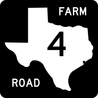
Farm to Market Road 4 is a farm to market road in the U.S. state of Texas, maintained by the Texas Department of Transportation (TxDOT), that runs between the cities of Grandview and Jacksboro. The route was designated in March 1942. As of 2012, FM 4 is one of the longest Farm to Market Roads in the state of Texas.

U.S. Route 40 (US 40) is a part of the U.S. Highway System that travels from Silver Summit, Utah, to Atlantic City, New Jersey. In the U.S. state of Colorado, US 40 is a major east–west route. It crosses the Rocky Mountains, passing over the Continental Divide at Berthoud Pass before descending to the Front Range. It then traverses through the Denver Metro Area, then exits by following Interstate 70 (I-70) and US 287. It is concurrent with US 287 for about 145 miles to Kit Carson. US 40 exits into Kansas east of Arapahoe in Cheyenne. At a length of almost 500 miles, US 40 is the longest numbered route in the state.
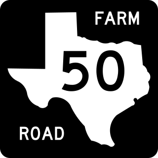
Farm to Market Road 50 is a Farm to Market Road in the U.S. state of Texas maintained by the Texas Department of Transportation (TxDOT). The 52.9-mile (85.1 km) route begins at State Highway 105 near Brenham and passes to the north through Independence to U.S. Route 79 and U.S. Route 190 near Hearne. The road has a brief concurrency with SH 21 along a bridge crossing the Brazos River. The road is in Washington, Burleson, Brazos, and Robertson counties.

Mississippi Highway 198 is a state highway in the U.S. state of Mississippi. The highway is the designation for six former segments of U.S. Highway 98 that have been bypassed by newer alignments. These six segments are located in Tylertown, Columbia, Hattiesburg, Beaumont, McLain, and Lucedale. Five of the six sections of MS 198 are two-lane undivided roads that pass through small towns; the exception is the Hattiesburg section which is a four-lane divided highway running through developed areas of the city. The total length of the six sections of MS 198 is 24.937 miles (40.132 km).

Interstate business routes are roads connecting a central or commercial district of a city or town with an Interstate bypass. These roads typically follow along local streets often along a former U.S. Route or state highway that had been replaced by an Interstate. Interstate business route reassurance markers are signed as either loops or spurs using a green shield shaped and numbered like the shield of the parent Interstate highway.
At least 13 special routes of U.S. Route 84 have existed.

