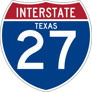
Interstate 27 (I-27) is an Interstate Highway, entirely in the US state of Texas, running north from Lubbock to I-40 in Amarillo. These two cities are the only control cities on I-27; other cities and towns served by I-27 include New Deal, Abernathy, Hale Center, Plainview, Kress, Tulia, Happy, and Canyon. In Amarillo, I-27 is commonly known as the Canyon Expressway, although it is also called Canyon Drive on its access roads. I-27 was officially designated the Marshall Formby Memorial Highway after former attorney and State Senator Marshall Formby in 2005. The entire length of I-27 replaced US Highway 87 (US 87) for through traffic. An extension of I-27 north to Raton, New Mexico, and south to Laredo, Texas was approved in 2022.

U.S. Route 80 or U.S. Highway 80 (US 80) is a major east–west United States Numbered Highway in the Southern United States, much of which was once part of the early auto trail known as the Dixie Overland Highway. As the "0" in the route number indicates, it was originally a cross-country route, from the Pacific Ocean to the Atlantic Ocean. Its original western terminus was at Historic US 101 in San Diego, California. However, the entire segment west of Dallas, Texas, has been decommissioned in favor of various Interstate Highways and state highways. Currently, the highway's western terminus is at an interchange with Interstate 30 (I-30) on the Dallas–Mesquite city line. Its eastern terminus is in Tybee Island, Georgia near the Atlantic Ocean. Between Jonesville, Texas and Kewanee, Mississippi, US 80 runs parallel to or concurrently with Interstate 20. It also currently runs through Dallas, Texas; Shreveport, Louisiana; Jackson, Mississippi; Montgomery, Alabama; Columbus, Georgia; Macon, Georgia; and Savannah, Georgia.

U.S. Route 190 (US 190) is an east–west United States Highway in Louisiana and Texas. Segments of US 190 will be upgraded to Interstate 14 (I-14); the first 24.8-mile (39.9 km) segment was opened on January 26, 2017.
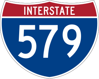
Interstate 579 (I-579) is a north–south Interstate Highway entirely within Pittsburgh, Pennsylvania. The highway is 2.73 miles (4.39 km) long. I-579 is also known as the Crosstown Boulevard since it crosses the backside of Downtown Pittsburgh.

Loop 1604 is the outer highway loop encircling San Antonio, Texas, spanning approximately 95.6 miles (153.9 km). Originally constructed as a two-lane highway, the northern segment of the route, from US 90 in western San Antonio to Kitty Hawk Road in northeastern Bexar County, has been upgraded to a four-lane freeway. Loop 1604 is designated the Charles W. Anderson Loop in honor of former Bexar County Judge Charles W. Anderson, who died from cancer in 1964 after serving for 25 years.

In the US state of Texas, Interstate 40 (I-40) runs west–east through the panhandle in the northwest part of the state. The only large city it passes through is Amarillo, where it meets the north end of I-27. The entire section of I-40 in Texas is designated as a Purple Heart Trail route.

U.S. Highway 90 Alternate is an alternate route to U.S. Highway 90 in the U.S. state of Texas, running from west of Seguin east via Seguin, Gonzales, Hallettsville, Eagle Lake, Rosenberg and Sugar Land to northeastern Houston. South of Downtown Houston, US 90 Alternate is built to freeway and near-freeway standards along a section of South Main Street.

U.S. Route 51 (US 51), mostly overlapped by the unsigned State Route 3 (SR 3), is a north–south state highway in the U.S. state of Tennessee, that is 135.9 miles (218.71 km) long, completely within West Tennessee. It begins in Shelby County and ends in Obion County. The SR 3 designation is seen largely on mileposts.

Pennsylvania Route 65 is a major 51-mile-long (82 km) state highway located in western Pennsylvania, United States. The route, traveling north–south from the Interstate 279/U.S. Route 19 Truck concurrency in Pittsburgh north to the PA 108/PA 168 concurrency in New Castle, connects downtown Pittsburgh to the northwestern portion of the Pittsburgh Metropolitan Area. PA 65 is similar in its purpose to PA 18 and PA 51, both of which run parallel to PA 65 at one point or another; however, the three routes pass through different cities for most of their respective alignments.

Pennsylvania Route 222 is a 4.482 mi (7.213 km)-long state highway located in Allentown and its surrounding suburbs in the Lehigh Valley region in eastern Pennsylvania.

Delaware Route 202 (DE 202), also known as Concord Avenue, is a short state highway mostly within Wilmington, Delaware. It runs from U.S. Route 13 Business north to a modified cloverleaf interchange with Interstate 95 (I-95) and US 202 just beyond the northern city limits. North of the interchange, the route becomes US 202 northbound, also known as the Concord Pike. The road is two lanes and undivided for most of its length except for the part just south of the I-95 interchange, which is four lanes and divided. DE 202 was a part of US 202 until that highway was truncated to the I-95 interchange in 1970. DE 202 was designated by 1981.

In the U.S. state of Texas, U.S. Highway 87 is a north–south U.S. Highway that begins near the Gulf Coast in Port Lavaca, Texas and heads north through San Antonio, Lubbock, Amarillo, and Dalhart to the New Mexico state line near Texline.

U.S. Route 13 (US 13) is a United States Numbered Highway running from Fayetteville, North Carolina, north to Morrisville, Pennsylvania. The route runs for 49.359 miles (79.436 km) through the Delaware Valley in the U.S. state of Pennsylvania. The route enters the state from Delaware in Marcus Hook, Delaware County. It continues northeast through Delaware County, passing through the city of Chester before heading through suburban areas along Chester Pike to Darby. US 13 enters the city of Philadelphia on Baltimore Avenue and runs through West Philadelphia to University City, where it turns north along several city streets before heading east across the Schuylkill River along Girard Avenue. The route turns north and heads to North Philadelphia, where it runs northeast along Hunting Park Avenue. US 13 becomes concurrent with US 1 on Roosevelt Boulevard, continuing into Northeast Philadelphia. US 13 splits southeast on a one-way pair of streets before heading northeast out of the city on Frankford Avenue. The route continues into Bucks County as Bristol Pike, heading northeast to Bristol, where it turns into a divided highway. US 13 becomes a freeway in Tullytown and continues north to its terminus at US 1 in Falls Township, near Morrisville. US 13 roughly parallels Interstate 95 (I-95) through its course in Pennsylvania.

There have been 22 special routes of U.S. Route 66.
The following special routes exist or existed parallel to U.S. Route 87 (US 87) in Texas, primarily along former alignments. They are varyingly designated by the Texas Department of Transportation (TxDOT) as business routes of US 87, state highway loops and spurs, and business loops of Interstate 27 (I-27).

Interstate business routes are roads connecting a central or commercial district of a city or town with an Interstate bypass. These roads typically follow along local streets often along a former U.S. Route or state highway that had been replaced by an Interstate. Interstate business route reassurance markers are signed as either loops or spurs using a green shield shaped sign and numbered like the shield of the parent Interstate highway.

Route 151 was a short, one-way pair state highway in the city of Camden, New Jersey from Dr. Martin Luther King Jr. Boulevard to County Route 537 in the city. There was also an interchange with U.S. Route 30, and the entire roadway was near Interstate 676's Interchange 5A. Route 151 ran along South Tenth Street for eastbound traffic and South Eleventh Street for westbound traffic west of Mount Ephraim Avenue. From there, South Tenth was known as Flanders Avenue and South Eleventh was known as Memorial Avenue. At U.S. Route 30, the route continued bi-directionally as Flanders Avenue until its end at County Route 537.
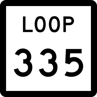
Loop 335 is a highway loop that encircles the city of Amarillo, Texas, United States. Loop 335 connects to every major highway in the city and passes close to Amarillo International Airport on the east side of the city. Loop 335 is not currently a continuous freeway. Instead, the highway has interchanges at select junctions and short segments of freeway such as its southeastern section.

Farm to Market Road 1719 is a farm to market road in the Amarillo metropolitan area of the Texas Panhandle.

Interstate business routes are roads connecting a central or commercial district of a city or town with an Interstate bypass. These roads typically follow along local streets often along a former U.S. Route or state highway that had been replaced by an Interstate. Interstate business route reassurance markers are signed as either loops or spurs using a green shield shaped and numbered like the shield of the parent Interstate highway.

