
Interstate 37 (I-37) is a 143-mile (230 km) Interstate Highway located within the southern portion of the US state of Texas. The highway was first designated in 1959 as a route between Corpus Christi and San Antonio. Construction in the urban areas of Corpus Christi and San Antonio began in the 1960s, and the segments of the Interstate Highway in rural areas were completed by the 1980s. Prior to I-37, the route between Corpus Christi and San Antonio was served by a combination of State Highway 9 (SH 9) from Corpus Christi to Three Rivers and US Highway 281 (US 281) from Three Rivers to San Antonio. As a result of the construction of I-37, SH 9 was removed from the State Highway System.

Interstate 45 (I-45) is a major Interstate Highway located entirely within the U.S. state of Texas. While most primary Interstate routes which have numbers ending in "5" are cross-country north–south routes, I-45 is comparatively short, with the entire route located within Texas. Additionally, it has the shortest length of all the primary Interstates that have numbers ending in a "5". It connects the cities of Dallas and Houston, continuing southeast from Houston to Galveston over the Galveston Causeway to the Gulf of Mexico.
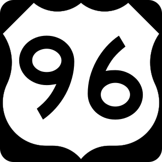
U.S. Highway 96 (US 96) is a north–south United States Numbered Highway that runs for about 117.11 miles (188.47 km) entirely in the U.S state of Texas. Its number is a violation of the standard numbering convention, as even-numbered two-digit highways are east–west routes by rule. As of 2004, the highway's southern terminus is in Port Arthur at an intersection with State Highway 87 (SH 87). Its northern terminus is in Tenaha at an intersection with US 59 /(Future I-369) and US 84.
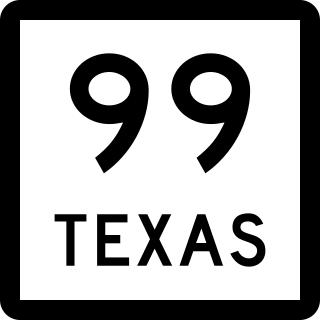
State Highway 99, also known as the Grand Parkway, is a beltway in the U.S. state of Texas. Its first section opened on August 31, 1994. When the route is completed, it will be the longest beltway in the U.S., the world's seventh-longest ring road, and the third (outer) loop of the Houston–The Woodlands–Sugar Land metropolitan area, with Interstate 610 being the first (inner) loop and Beltway 8 being the second (middle) loop. The proposed 176.6-mile (284.2 km) loop has been divided into 11 separate segments for construction and funding purposes. In May 2019, the Texas Department of Transportation gave the Grand Parkway a secondary designation as the Mayor Bob Lanier Memorial Parkway, honoring Bob Lanier, who served as the mayor of Houston from 1992 to 1998 and who had spearheaded the creation of the Grand Parkway.

Beltway 8 (BW8), the Sam Houston Parkway, along with the Sam Houston Tollway, is an 88-mile (142 km) beltway around the city of Houston, Texas, United States, lying entirely within Harris County.

State Highway 3 is a state highway in the U.S. state of Texas that runs from Interstate 45 in Houston near William P. Hobby Airport to State Highway 146, 9.9 miles (15.9 km) northwest of Galveston. For most of its length, SH 3 parallels I-45 and runs alongside the former Galveston, Houston and Henderson Railroad lines.

State Highway 7 (SH 7) is an east–west state highway in the U.S. state of Texas that runs from Interstate 35 at Eddy to U.S. Highway 84 about 3 miles (4.8 km) west of the Louisiana state line. Between Crockett and Nacogdoches, SH 7 passes through the Davy Crockett National Forest. Commissioned on April 4, 1917, SH 7 is one of the original state highways established in Texas, and has been re-routed several times since its original conception. In earlier years, SH 7 mostly followed present day U.S. Highway 84, U.S. Highway 67, U.S. Highway 70 among other highways between northwest Texas and the Louisiana state line. By 1939, most of the mileage belonging to SH 7 was transferred to the U.S. Highway System, leaving the highway extant only within eastern Texas. SH 7 subsequently went through several other major reroutings, truncations and extensions between 1939 and 1990, before becoming the highway it is today.

State Highway 9 (SH 9) is a highway near Copperas Cove, Texas. It connects Interstate 14 (I-14), U.S. Route 190 (US 190), and U.S. Highway 190 Business outside of Copperas Cove to Farm to Market Road 116 (FM 116) on the north side of Copperas Cove. The highway opened on February 20, 2014 with a ribbon cutting at 2:00 p.m.

State Highway 46 is a 71.4-mile (114.9 km) state highway in the U.S. state of Texas that runs from SH 16 east of Bandera to the intersection of SH 123 and SH 123 Business just south of Seguin.

State Highway 183 is a state highway in the Dallas–Fort Worth metroplex in Texas. Its most heavily used section is designated Airport Freeway where it serves the southern entrance of DFW Airport.

Interstate 10 (I-10) is the major east–west Interstate Highway in the Southern United States. In the U.S. state of Texas, it runs east from Anthony, at the border with New Mexico, through El Paso, San Antonio, and Houston to the border with Louisiana in Orange. At just under 880 mi (1,420 km), the Texas segment of I-10, maintained by the Texas Department of Transportation, is the longest continuous untolled freeway in North America that is operated by a single authority. It is also the longest stretch of Interstate Highway with a single designation within a single state. Mile marker 880 and its corresponding exit number in Orange, Texas, are the highest-numbered mile marker and exit on any freeway in North America. Since widening was completed in 2008, a portion of the highway west of Houston is now also believed to be the widest in the world, at 26 lanes when including feeders.
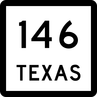
State Highway 146 (SH 146) is a north–south highway in southeastern Texas beginning at I-45 near La Marque and Texas City. It then crosses over the Fred Hartman Bridge over the Houston Ship Channel which carries SH 146 traffic. It then continues north towards Dayton, where it meets US 90 and then heads north and terminates in Livingston at US 59.

State Highway 225 is an east–west freeway in the Houston area between the Interstate 610 Loop in Houston and State Highway 146/future State Highway 99 in La Porte. It is identified as the La Porte Freeway over its entire length. The freeway passes near several refineries, chemical plants, and tank farms as it passes through La Porte and Deer Park.

State Highway 242 is a Texas state highway connecting The Woodlands and Patton Village in southeast Texas.

U.S. Route 281 (US 281) is a United States Numbered Highway that runs from the Mexican border in the Rio Grande Valley to the Canadian border near Dunseith, North Dakota. In the state of Texas, the highway is a major south–north corridor, connecting Brownsville to the Oklahoma state line at the Red River in Burkburnett. Several segments of U.S. 281 are concurrent with Interstate routes, including I-69C in the Rio Grande Valley, I-37 in San Antonio, and I-44 north of Wichita Falls.

U.S. Route 80 is a U.S. highway that begins in the state of Texas in Dallas at an interchange with I-30. US 80 runs in an east–west direction for most of its length from Dallas to Louisiana. Before the advent of the Interstate Highway System, US 80 through Texas was once a vital link in a major transcontinental highway with the national western terminus being in San Diego, California rather than Dallas. Since 1991, most of US 80 in Texas has been decommissioned in favor of I-10, I-20 and I-30 between the New Mexico state line and its current western terminus.

