
Interstate 37 (I-37) is a 143-mile (230 km) Interstate Highway located within the southern portion of the US state of Texas. The highway was first designated in 1959 as a route between Corpus Christi and San Antonio. Construction in the urban areas of Corpus Christi and San Antonio began in the 1960s, and the segments of the Interstate Highway in rural areas were completed by the 1980s. Prior to I-37, the route between Corpus Christi and San Antonio was served by a combination of State Highway 9 (SH 9) from Corpus Christi to Three Rivers and US Highway 281 (US 281) from Three Rivers to San Antonio. As a result of the construction of I-37, SH 9 was removed from the State Highway System.

U.S. Highway 181 is a south–north U.S. Highway located entirely in the state of Texas. Both termini are at Interstate 37, the road that it mainly parallels to the east. US 181 begins in Corpus Christi, Texas at mile marker 0 to the south, through south-central Texas to just south of San Antonio to the north, for a total length of 137 miles (220 km).

U.S. Route 290 is an east–west U.S. Highway located entirely within the state of Texas. Its western terminus is at Interstate 10 southeast of Segovia, and its eastern terminus is at Interstate 610 in northwest Houston. It is the main highway between Houston and Austin and is a cutoff for travelers wanting to bypass San Antonio on Interstate 10. Throughout its length west of Austin, US 290 cuts across mountainous hills comprising the Texas Hill Country and the Edwards Plateau; between Austin and Houston, the highway then travels through gradually hilly grasslands and pine forests comprising the Gulf Coastal Plains.

Interstate 410 (I-410), colloquially Loop 410, is an auxiliary route of I-10 around San Antonio, Texas. It is identified as the Connally Loop in honor of former Texas Governor John Connally.

State Highway 16 is a south–north state highway in the U.S. state of Texas that runs from Zapata on the boundary with Mexico to U.S. Highway 281 24 miles (39 km) south of Wichita Falls. It is the longest state highway in Texas at almost 542 miles (872 km), but is only the ninth-longest of any highway classification in the state.

Texas state highways are a network of highways owned and maintained by the U.S. state of Texas. The Texas Department of Transportation (TxDOT) is the state agency responsible for the day-to-day operations and maintenance of the system. Texas has the largest state highway system, followed closely by North Carolina's state highway system. In addition to the nationally numbered Interstate Highways and U.S. Highways, the highway system consists of a main network of state highways, loops, spurs, and beltways that provide local access to the other highways. The system also includes a large network of farm to market roads that connect rural areas of the state with urban areas and the rest of the state highway system. The state also owns and maintains some park and recreational roads located near and within state and national parks, as well as recreational areas. All state highways, regardless of classification, are paved roads. The Old San Antonio Road, also known as the El Camino Real, is the oldest highway in the United States, first being blazed in 1691. The length of the highways varies from US 83's 893.4 miles (1,437.8 km) inside the state borders to Spur 200 at just 0.05 miles long.

Loop 1604 is the outer highway loop encircling San Antonio, Texas, spanning approximately 95.6 miles (153.9 km). Originally constructed as a two-lane highway, the northern segment of the route, from US 90 in western San Antonio to Kitty Hawk Road in northeastern Bexar County, has been upgraded to a four-lane freeway. Loop 1604 is designated the Charles W. Anderson Loop in honor of former Bexar County Judge Charles W. Anderson, who died from cancer in 1964 after serving for 25 years.

U.S. Route 281 (US 281) is a United States Numbered Highway that runs from the Mexican border in the Rio Grande Valley to the Canadian border near Dunseith, North Dakota. In the state of Texas, the highway is a major south–north corridor, connecting Brownsville to the Oklahoma state line at the Red River in Burkburnett. Several segments of U.S. 281 are concurrent with Interstate routes, including I-69C in the Rio Grande Valley, I-37 in San Antonio, and I-44 north of Wichita Falls.

The following special routes exist or existed parallel to U.S. Route 87 (US 87) in Texas, primarily along former alignments. They are varyingly designated by the Texas Department of Transportation (TxDOT) as business routes of US 87, state highway loops and spurs, and business loops of Interstate 27 (I-27).

Loop 13 is a 21.684-mile (34.897 km) partial loop route around the city of San Antonio in the U.S. state of Texas. Prior to I-410, Loop 13 served as the primary loop for the city. Part of the road was eventually turned into part of I-410. It follows Military Drive from US 90 through the south side of the city. It then follows W.W. White Road after it turns to the north through the east side of San Antonio before ending at I-410. The road is still a major arterial for the city, providing access to Lackland Air Force Base, Kelly USA, and Brooks City-Base.

Spur 345 is a 5.1-mile-long (8.2 km) route in Greater San Antonio in the U.S. state of Texas, maintained by the Texas Department of Transportation (TxDOT). It follows a former route of U.S. Route 87 (US 87) through Balcones Heights and northwest San Antonio. Known locally as Fredericksburg Road, it is a major arterial for the cities of San Antonio and Balcones Heights, providing access to the headquarters of United Services Automobile Association (USAA) and to the South Texas Medical Center.

Loop 353 is a 7.875-mile-long (12.674 km) loop route in the U.S. state of Texas that follows a former route of U.S. Highway 81 (US 81) in San Antonio. Loop 353 follows New Laredo Highway from Interstate 35 (I-35) on the southwest side of San Antonio towards the northeast and follows Nogalitos Street before ending at another point on I-35 just southwest of Downtown San Antonio. The road is still a major arterial for the city, providing access to Kelly USA.
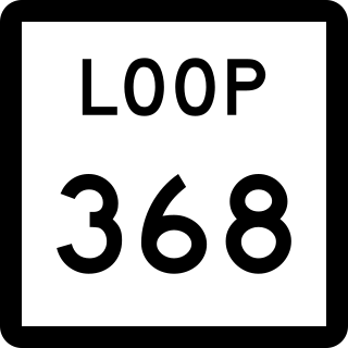
Loop 368 is a state highway loop in the U.S. state of Texas that follows a former route of US 81 in San Antonio. 8.115 miles (13.060 km) in length, the route is a major arterial in the city, providing access to Brackenridge Park, the San Antonio Zoo, and the University of the Incarnate Word.

Spur 122 is a 5.664-mile (9.115 km) spur route in the U.S. state of Texas that follows a former route of U.S. Highway 181 (US 181) in San Antonio. Spur 122 follows Presa Street from US 181 near the city limits on the southeast side of San Antonio towards the northwest ending at Loop 13 just east of the San Antonio River. The spur provides access to Mission San Francisco de la Espada and other parks along the banks of the San Antonio River.

Farm to Market Road 2696 is a 16-mile (26 km) farm to market road in Bexar County, Texas. It is known in Greater San Antonio as Blanco Road, a major north–south thoroughfare.

State Highway Spur 536 is a state highway spur in San Antonio, Texas.

State Highway Spur 422 is a state highway spur in San Antonio, Texas. It is known locally as the Poteet-Jourdanton Freeway.

Farm to Market Road 471 is an FM highway in the San Antonio area of Texas. The highway is known as Culebra Road within Bexar County.

