
Interstate 45 (I-45) is a major Interstate Highway located entirely within the US state of Texas. While most Interstate routes which have numbers ending in "5" are cross-country north–south routes, I-45 is comparatively short, with the entire route located in Texas. Additionally, it has the shortest length of all the interstates that end in a "5." It connects the cities of Dallas and Houston, continuing southeast from Houston to Galveston over the Galveston Causeway to the Gulf of Mexico.

U.S. Route 75 is a major north–south U.S. Highway that extends 1,239 miles (1,994 km) in the central United States. The highway's northern terminus is in Noyes, Minnesota, at the Canadian border, where it once continued as Manitoba Highway 75 on the other side of the now-closed border crossing. Its southern terminus is at Interstate 30 (I-30) and I-45 in Dallas, where it is known as North Central Expressway.
State Highway 6 (SH 6) runs from the Red River, the Texas–Oklahoma state line, to northwest of Galveston, where it is known as the Old Galveston Highway. In Sugar Land and Missouri City, it is known as Alvin-Sugarland Road and runs perpendicular to Interstate 69/U.S. Highway 59 (I-69/US 59). In the Houston area, it runs north to Farm to Market Road 1960 (FM 1960), then northwest along USS 290 to Hempstead, and south to Westheimer Road and Addicks, and is known as Addicks Satsuma Road. In the Bryan–College Station area, it is known as the Earl Rudder Freeway. In Hearne, it is known as Market Street. In Calvert, it is known as Main Street. For most of its length, SH 6 is not a limited-access road. In 1997, the Texas Legislature designated SH 6 as the Texas Korean War Veterans Memorial Highway.

Texas state highways are a network of highways owned and maintained by the U.S. state of Texas. The Texas Department of Transportation (TxDOT) is the state agency responsible for the day-to-day operations and maintenance of the system. Texas has the largest state highway system, followed closely by North Carolina's state highway system. In addition to the nationally numbered Interstate Highways and U.S. Highways, the highway system consists of a main network of state highways, loops, spurs, and beltways that provide local access to the other highways. The system also includes a large network of farm to market roads that connect rural areas of the state with urban areas and the rest of the state highway system. The state also owns and maintains some park and recreational roads located near and within state and national parks, as well as recreational areas. All state highways, regardless of classification, are paved roads. The Old San Antonio Road, also known as the El Camino Real, is the oldest highway in the United States, first being blazed in 1691. The length of the highways varies from US 83's 893.4 miles (1,437.8 km) inside the state borders to Spur 200 at just 0.05 miles long.

State Highway 288 (SH 288) is a north–south highway in the southeastern portion of the U.S. state of Texas, between I-45 in downtown Houston and Freeport, where it terminates on FM 1495. The route was originally designated by 1939, replacing the southern portion of SH 19.
The Loop is a 21.4-mile-long (34.4 km) beltway around Texarkana, TX and Texarkana, AR, which are twin cities in the U.S. states of Arkansas and Texas. Consisting of a section of Interstate 49 (I-49) in Arkansas, and Loop 151 and a section of I-369 and U.S. Route 59 (US 59) in Texas, it forms a three-quarter loop around the east, south and west sides of the city. The Loop is built to Interstate Highway standards.

State Highway 91 is a state highway in the U.S. state of Texas that runs 13.6 miles (21.9 km) from Sherman through Denison to the Oklahoma border at Denison Dam at Lake Texoma. This route was designated in 1994, the northern segment replacing State Highway 75A) and the southern segment designating the old route of U.S. Highway 75 which was rerouted and upgraded to freeway status. The highway is known locally as Texoma Parkway for much of its length, except through some parts of Denison. It is one of the main commercial strips in the Sherman-Denison metropolitan area.

State Highway 225 is an east–west freeway in the Houston area between the Interstate 610 Loop in Houston and State Highway 146/future State Highway 99 in La Porte. It is identified as the La Porte Freeway over its entire length except for Pasadena where it is called the Pasadena Freeway. The freeway passes near several refineries, chemical plants, and tank farms as it passes through Pasadena and Deer Park.
State Highway 78 is 60-mile (97 km) long (97 km) state highway in southern Oklahoma. It runs from the Red River to Tishomingo. It has no lettered spur routes.
Loop 20, also known as the Bob Bullock Loop and Cuatro Vientos Road, is a highway loop that runs to the north and east of the city of Laredo, Texas. Loop 20 extends from the World Trade International Bridge at its northern point to Mangana-Hein Road at its southern point. The current route varies in construction from a 2-lane road to a freeway with frontage roads.

U.S. Route 69 is a north–south United States highway that runs from Port Arthur, Texas to Albert Lea, Minnesota. In Texas, US 69 runs from Port Arthur near the Gulf of Mexico to the Texas–Oklahoma state line just north of Denison.

In the U.S. state of Texas, U.S. Route 82 (US 82) is a U.S. Highway that begins on the New Mexico border and heads east through West Texas and Lubbock to the Arkansas border at Texarkana.

U.S. Route 80 is a U.S. highway that begins in the state of Texas in Dallas at an interchange with I-30. US 80 runs in an east–west direction for most of its length from Dallas to Louisiana. Before the advent of the Interstate Highway System, US 80 through Texas was once a vital link in a major transcontinental highway with the national western terminus being in San Diego, California rather than Dallas. Since 1991, most of US 80 in Texas has been decommissioned in favor of I-10, I-20 and I-30 between the New Mexico state line and its current western terminus.
U.S. Highway 75 (US 75) is a part of the U.S. Highway System that travels from Interstate 345 (I-345) in Dallas, Texas northward to the Canadian border at Noyes, Minnesota. In the state of Texas it runs from I-345 in Dallas and heads north to the Oklahoma state line.
U.S. Route 69 is a major north-south U.S. Highway in the U.S. state of Oklahoma. It extends the corridor formed by U.S. Route 75 in Texas, from Dallas northeast via McAlester and Muskogee to the Will Rogers Turnpike near Vinita. From Vinita to the Kansas state line, US-69 generally parallels the turnpike along old U.S. Highway 66.
Spur 69 is a short, unsigned, four-lane state-maintained roadway in Austin, Texas. It is 1.2 miles (1.9 km) in length and is named Koenig Lane. It forms a link between RM 2222 and US 290 at I-35. Spur 69 is signed over its entire length as RM 2222, rather than as Spur 69.
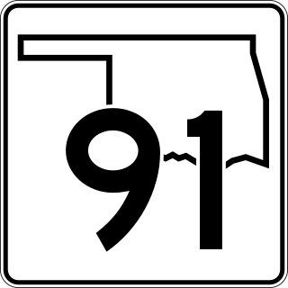
State Highway 91 is a state highway in the U.S. state of Oklahoma. It runs for 13.58 miles (21.85 km), entirely within Bryan County. SH-91 has no lettered spur routes.

