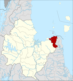
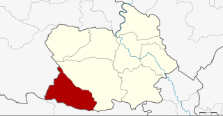
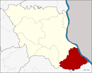
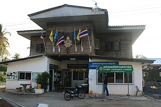
Tha Kham (Thai : ท่าข้าม) is a town in southern Thailand. As of 2006 it covered an area of 14.10 km² and had a population of 20,349. It covers parts of the subdistrict ( tambon ) Tha Kham of Phunphin District, Surat Thani Province. It is on the shores of the Tapi River. The Surat Thani Railway Station is in town center.
Thai, Central Thai or Ayutthaya or Siamese, is the sole official and national language of Thailand and the first language of the Central Thai people and vast majority of Thai of Chinese origin. It is a member of the Tai group of the Kra–Dai language family. Over half of Thai vocabulary is derived from or borrowed from Pali, Sanskrit, Mon and Old Khmer. It is a tonal and analytic language.
Thailand, officially the Kingdom of Thailand and formerly known as Siam, is a country at the center of the Southeast Asian Indochinese peninsula composed of 76 provinces. At 513,120 km2 (198,120 sq mi) and over 68 million people, Thailand is the world's 50th largest country by total area and the 21st-most-populous country. The capital and largest city is Bangkok, a special administrative area. Thailand is bordered to the north by Myanmar and Laos, to the east by Laos and Cambodia, to the south by the Gulf of Thailand and Malaysia, and to the west by the Andaman Sea and the southern extremity of Myanmar. Its maritime boundaries include Vietnam in the Gulf of Thailand to the southeast, and Indonesia and India on the Andaman Sea to the southwest. Although nominally a constitutional monarchy and parliamentary democracy, the most recent coup in 2014 established a de facto military dictatorship.
Tambon is a local governmental unit in Thailand. Below district (amphoe) and province (changwat), they form the third administrative subdivision level. As of 2016 there were 7,255 tambons, not including the 180 khwaeng of Bangkok, which are set at the same administrative level, thus every district contains eight to ten tambon. Tambon is usually translated as "township" or "subdistrict" in English — the latter is the recommended translation, though also often used for king amphoe, the designation for a subdistrict acting as a branch of the parent district. Tambon are further subdivided into 69,307 villages (muban), about ten per tambon. Tambon within cities or towns are not subdivided into villages, but may have less formal communities called chumchon (ชุมชน) that may be formed into community associations.
The town dates back to the sanitary district ( sukhaphiban ), Tha Kham, which was created on 17 September 1955. [1] It was upgraded to a township ( thesaban tambon ) on 14 April 1986, [2] and further upgraded to a town ( thesaban mueang ) on 20 December 2000. [3]
Sukhaphiban were administrative divisions of Thailand.
The seal of the town shows the Tapi River railway bridge.
Surat Thani is a city in Amphoe Mueang Surat Thani, Surat Thani Province, southern Thailand. It lies 651 km south of Bangkok. It is the capital of Surat Thani Province. The city has a population of 128,179 (2009), and an area of 68.97 square kilometers. The city's population density is 1,858.47 inhabitants per km².
Phunphin is a district (amphoe) in Surat Thani Province in the south of Thailand. Tha Kham is the principal town of the district. In 2014, the population was 73,067.
Don Sak is a district (amphoe) in eastern Surat Thani Province. The two principal ferry companies offering service to Samui Island leave from piers in the district.
Mueang Surat Thani, formerly named the Ban Don District, is the capital district of Surat Thani Province in southern Thailand.
Vibhavadi is a district (amphoe) in the west of Surat Thani Province, southern Thailand.
Khiri Rat Nikhom is a district (amphoe) in the west of Surat Thani Province of southern Thailand.
Ban Ta Khun is an amphoe in the west of Surat Thani Province of southern Thailand. It is both the largest district of the province and the one with the lowest population density.
Plai Phraya is a district (amphoe) in Krabi Province, Thailand.
Wiang Sa is a district (amphoe) of Surat Thani Province, Thailand.
Ban Na Doem is a district (amphoe) of Surat Thani Province, Thailand.
Suk Samran is a district (amphoe) of Ranong Province, southern Thailand.
Noen Kham is the southwesternmost district (amphoe) of Chai Nat Province, central Thailand.
Nopphitam is a district (amphoe) of Nakhon Si Thammarat Province, southern Thailand.
Thung Yai is the westernmost district (amphoe) of Nakhon Si Thammarat Province, southern Thailand.
Nong Kung Si is a district (amphoe) in the western part of Kalasin Province, northeastern Thailand.
Don Tan is the southeastern-most district (amphoe) of Mukdahan Province, northeastern Thailand.
Lamae is a district (amphoe) in the southern part of Chumphon Province, southern Thailand.
Sam Chai is a district (amphoe) in the northern part of Kalasin Province, northeastern Thailand.
Kham Muang is the northernmost district (amphoe) of Kalasin Province, northeastern Thailand.
Ko Samui officially City of Ko Samui is a city in Surat Thani, Southern Thai, Thailand.
Coordinates: 9°6′21″N99°13′57″E / 9.10583°N 99.23250°E
A geographic coordinate system is a coordinate system that enables every location on Earth to be specified by a set of numbers, letters or symbols. The coordinates are often chosen such that one of the numbers represents a vertical position and two or three of the numbers represent a horizontal position; alternatively, a geographic position may be expressed in a combined three-dimensional Cartesian vector. A common choice of coordinates is latitude, longitude and elevation. To specify a location on a plane requires a map projection.