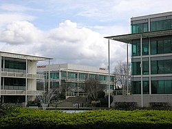
Location | Reading, Berkshire, UK |
---|---|
Address | Thames Valley Park Reading RG6 1AD |
Coordinates | 51°27′41″N0°55′52″W / 51.4615°N 0.9312°W |
Developer | Argent Group |
Website | thamesvalleypark |
Thames Valley Park (also known as TVP) is a high-tech business park adjacent to the River Thames on the eastern outskirts of Reading in Berkshire, England. Companies based at the park include BBC Radio Berkshire, Steria, SGI, Regus, Websense, Oracle, Microsoft, OpenText and ING Direct. [1] The site had formerly been Earley Power Station, which had been operational from the early 1940s until the early 1970s.[ citation needed ]
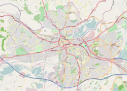
TVP is at the northern terminus of the A3290 (formerly part of the A329(M)) giving good connections to the M4 and A4. Originally the A329(M) was supposed to follow the river west from the park towards a junction with Vastern Road.[ citation needed ] A free bus service links TVP to Reading railway station, and the latter has good connections for London and Heathrow Airport. [2]
A railway station to serve the park was proposed in the 1998 Reading Borough Local Plan, [3] but this was never built.
Reading is a town and borough in Berkshire, England. Most of its built-up area lies within the Borough of Reading, although some outer suburbs are parts of neighbouring local authority areas. Located in the Thames Valley at the confluence of the rivers Thames and Kennet, Reading is 40 miles (64 km) east of Swindon, 25 miles (40 km) south of Oxford, 40 miles (64 km) west of London and 16 miles (26 km) north of Basingstoke.
Slough is a town in Berkshire, England, in the Thames Valley 20 miles (32 km) west of central London and 19 miles (31 km) north-east of Reading, at the intersection of the M4, M40 and M25 motorways. It is part of the historic county of Buckinghamshire. In 2021 Census, the population of the town was 143,184. In 2021, the wider Borough of Slough had a population of 158,500. Slough borders the ceremonial counties of Greater London and Buckinghamshire.
The Royal County of Berkshire, commonly known as simply Berkshire, is a ceremonial county in South East England. It is bordered by Oxfordshire to the north, Buckinghamshire to the north-east, Greater London to the east, Surrey to the south-east, Hampshire to the south, and Wiltshire to the west. Reading is the largest settlement and the county town.
Colnbrook is a village in the Slough district in Berkshire, England. It lies within the historic boundaries of Buckinghamshire, and straddles two distributaries of the Colne, the Colne Brook and Wraysbury River. These two streams have their confluence just to the southeast of the village. Colnbrook is centred 3 miles (4.8 km) southeast of the Slough town centre, 4 miles (6.4 km) east of Windsor, and 19 miles (31 km) west of central London.
Wokingham is a market town and civil parish in Berkshire, England, 37 miles (60 km) west of London, 7 miles (11 km) southeast of Reading, 8 miles (13 km) north of Camberley and 4 miles (6 km) west of Bracknell. It is the main administrative centre of the wider Borough of Wokingham. In 2011 it had a population of 50,320.
Maidenhead is a market town in the Royal Borough of Windsor and Maidenhead in the county of Berkshire, England, on the southwestern bank of the River Thames. In the 2021 Census, it had an estimated population of 70,374 and forms part of the border with southern Buckinghamshire. The town is situated 27 miles (43 km) west of Charing Cross, London and 13 miles (21 km) east-northeast of the county town of Reading. The town differs from the Parliamentary constituency of Maidenhead, which includes a number of outer suburbs and villages, including villages which form part of the Borough of Wokingham such as Twyford, Charvil, Remenham, Ruscombe and Wargrave.
Bracknell is a town and civil parish in Berkshire, England, the westernmost area within the Greater London Urban Area and the administrative centre of the borough of Bracknell Forest. It lies 11 miles (18 km) to the east of Reading, 9 miles (14 km) south of Maidenhead, 10 miles (16 km) southwest of Windsor and 25 miles (40 km) west of central London. Bracknell is the third largest town in Berkshire.
Thames Valley Police is the territorial police force responsible for policing the Thames Valley region, covering the counties of Berkshire, Buckinghamshire and Oxfordshire in South East England. It is the largest non-metropolitan police force in England and Wales, covering 2,218 square miles (5,740 km2) and a population of 2.42 million people.
Windsor is a historic town in the Royal Borough of Windsor and Maidenhead in Berkshire, England. It is the site of Windsor Castle, one of the official residences of the British monarch. The town is situated 21.8 miles (35.1 km) west of Charing Cross, central London, 5.8 miles (9.3 km) southeast of Maidenhead, and 15.8 miles (25.4 km) east of the modern county town of Reading. It is immediately south of the River Thames, which forms its boundary with its smaller, ancient twin town of Eton. The village of Old Windsor, just over 2 miles (3 km) to the south, predates what is now called Windsor by around 300 years. In the past, Windsor was formally referred to as New Windsor to distinguish the two.it is also close to Slough
Earley is a town and civil parish in the Borough of Wokingham, Berkshire, England. Along with the neighbouring town of Woodley, the Office for National Statistics places Earley within the Reading/Wokingham Urban Area; for the purposes of local government it falls within the Borough of Wokingham, outside the area of Reading Borough Council. Its name is sometimes spelt Erleigh or Erlegh and consists of a number of smaller areas, including Maiden Erlegh and Lower Earley, and lies some 3 miles (5 km) south and east of the centre of Reading, and some 4 miles (6 km) northwest of Wokingham. It had a population of 32,036 at the 2011 Census.
Tilehurst is a suburb of the town of Reading in the county of Berkshire, England. It lies to the west of the centre of Reading; it extends from the River Thames in the north to the A4 road in the south.
The North Wessex Downs are an area of chalk downland landscapes located in the English counties of Berkshire, Hampshire, Oxfordshire and Wiltshire. The North Wessex Downs has been designated as a National Landscape since 1972.
Theale is a village and civil parish in West Berkshire, England. It is 5 miles (8 km) southwest of Reading and 10 miles (16 km) east of Thatcham. The compact parish is bounded to the south and south-east by the Kennet & Avon Canal, to the north by a golf course, to the east by the M4 motorway and to the west by the A340 road.
Purley on Thames is a village and civil parish in Berkshire, England. Purley is centred 3 miles (4.8 km) north-west of Reading, 1 mile (1.6 km) east of Pangbourne, and 22 miles (35 km) south-east of Oxford. Historically, Purley comprised three separate manors and associated settlements. In the centre there is an historic area named variously Lething or Burley (Domesday) which accommodated traders and craftsmen alongside the main Reading to Oxford road.
Winnersh is a large suburban village and civil parish in the borough of Wokingham in Berkshire, England. The village is located around 2 miles (3.2 km) northwest of Wokingham town centre and around 4 miles (6.4 km) southeast of central Reading. It is roughly bounded by the M4 motorway to the south, the A329(M) motorway to the north, and the River Loddon to the west. The parish extends beyond the M4 to cover the estate village of Sindlesham.
Tilehurst railway station serves the suburb and former village of Tilehurst, west of Reading, Berkshire, England. The station is on the extreme northern edge of Tilehurst and at a much lower level than most of that suburb. The railway line and station occupy a strip of land between the A329 road and the River Thames, with the up relief platform on an embankment above the river bank.
Winnersh Triangle railway station is one of two railway stations in Winnersh, Berkshire, England. It is served by South Western Railway services between London Waterloo and Reading. The station is on the west side of Winnersh, 39 miles 35 chains (63.5 km) from London Waterloo and 6.4 kilometres (4.0 mi) from Reading. It is situated on an embankment by which the railway crosses the valley of the River Loddon, and is some 500 metres (1,600 ft) east of the bridge across that river.
Lower Basildon is a small English village in the civil parish of Basildon, near Pangbourne, in the county of Berkshire.
The A329(M) is a motorway in Berkshire, England. It is 4 miles (6.4 km) long and runs from the west of Bracknell to the north west of Winnersh. It is one of a small number of parts of the motorway system in England that are managed by the local highway authority, in this case Wokingham Borough Council, rather than National Highways.
Reading's location in the Thames Valley at the confluence of the River Thames and River Kennet, and on both the Great Western Main Line and the M4 motorway, some 40 miles (64 km) west of London has made the town an important location in the nation's transport system.