[[M4 motorway]]"},"previous_type":{"wt":"AM"},"previous_route":{"wt":"308"},"next_route":{"wt":"404"},"next_type":{"wt":"AM"}},"i":0}}]}" id="mwCw">.mw-parser-output .hlist dl,.mw-parser-output .hlist ol,.mw-parser-output .hlist ul{margin:0;padding:0}.mw-parser-output .hlist dd,.mw-parser-output .hlist dt,.mw-parser-output .hlist li{margin:0;display:inline}.mw-parser-output .hlist.inline,.mw-parser-output .hlist.inline dl,.mw-parser-output .hlist.inline ol,.mw-parser-output .hlist.inline ul,.mw-parser-output .hlist dl dl,.mw-parser-output .hlist dl ol,.mw-parser-output .hlist dl ul,.mw-parser-output .hlist ol dl,.mw-parser-output .hlist ol ol,.mw-parser-output .hlist ol ul,.mw-parser-output .hlist ul dl,.mw-parser-output .hlist ul ol,.mw-parser-output .hlist ul ul{display:inline}.mw-parser-output .hlist .mw-empty-li{display:none}.mw-parser-output .hlist dt::after{content:":"}.mw-parser-output .hlist dd::after,.mw-parser-output .hlist li::after{content:" ·";font-weight:bold}.mw-parser-output .hlist dd:last-child::after,.mw-parser-output .hlist dt:last-child::after,.mw-parser-output .hlist li:last-child::after{content:none}.mw-parser-output .hlist dd dd:first-child::before,.mw-parser-output .hlist dd dt:first-child::before,.mw-parser-output .hlist dd li:first-child::before,.mw-parser-output .hlist dt dd:first-child::before,.mw-parser-output .hlist dt dt:first-child::before,.mw-parser-output .hlist dt li:first-child::before,.mw-parser-output .hlist li dd:first-child::before,.mw-parser-output .hlist li dt:first-child::before,.mw-parser-output .hlist li li:first-child::before{content:" (";font-weight:normal}.mw-parser-output .hlist dd dd:last-child::after,.mw-parser-output .hlist dd dt:last-child::after,.mw-parser-output .hlist dd li:last-child::after,.mw-parser-output .hlist dt dd:last-child::after,.mw-parser-output .hlist dt dt:last-child::after,.mw-parser-output .hlist dt li:last-child::after,.mw-parser-output .hlist li dd:last-child::after,.mw-parser-output .hlist li dt:last-child::after,.mw-parser-output .hlist li li:last-child::after{content:")";font-weight:normal}.mw-parser-output .hlist ol{counter-reset:listitem}.mw-parser-output .hlist ol>li{counter-increment:listitem}.mw-parser-output .hlist ol>li::before{content:" "counter(listitem)"\a0 "}.mw-parser-output .hlist dd ol>li:first-child::before,.mw-parser-output .hlist dt ol>li:first-child::before,.mw-parser-output .hlist li ol>li:first-child::before{content:" ("counter(listitem)"\a0 "}
A329(M) | ||||
---|---|---|---|---|
Route information | ||||
Maintained by Wokingham Borough Council | ||||
Length | 4 mi (6.4 km) | |||
Existed | 1972–present | |||
History | Constructed 1972–75 | |||
Major junctions | ||||
Southeast end | Bracknell | |||
M4 motorway | ||||
Northwest end | Winnersh | |||
Location | ||||
Country | United Kingdom | |||
Primary destinations | Bracknell Reading, | |||
Road network | ||||
|
The A329(M) is a motorway in Berkshire, England. It is 4 miles (6.4 km) long and runs from the west of Bracknell to the north west of Winnersh. It is one of a small number of parts of the motorway system in England that are managed by the local highway authority, in this case Wokingham Borough Council, rather than National Highways.
From southeast to northwest, the route starts to the north of Bracknell and runs directly from the A329. It passes east of Wokingham in countryside. It then crosses the M4, continues northwest and meets the A3290 at Winnersh Triangle west of which see the status-downgraded A3290 road, to the junction with the A4. It is managed locally, by Wokingham Borough Council, rather than by National Highways. [1]
The first section of the road opened in 1973, [2] and went from the Winnersh junction to a temporary terminus at the A321.
A further section to the North/West of Winnersh — due to open at the same time — took the road up to the junction with the A4 to the east of Reading, running to the north of the railway line and dividing the Earley area of Reading almost in two. However the opening of this section was delayed due to the collapse of the Loddon Viaduct on 24 October 1972, [3] which killed three people and injured ten others. [4] This section subsequently opened in 1974.
The third and final section to be completed was the southern section of the motorway which was built to a standard dual two lane motorway specification (D2), and was opened in 1975. This extended the road to the A329 and B3408 junction at Amen Corner roundabout. The section of Berkshire Way (and the construction of the flyover) came some years later, allowing traffic to flow from Reading and the M4 past the official end of the motorway onto the Southern and Western industrial areas of Bracknell.
The large free-flow interchange between the A329(M) and the M4 was constructed as part of plans for an M31 motorway,[ citation needed ] which was originally planned to extend down to the M3 (and possibly beyond) in the south.
In the early nineties, the section of the A329(M) that met the A4 east of Reading was downgraded to an A road to enable the hard shoulder to be used by a park-and-ride bus service. It was then renamed the A3290. [2] The Park and Ride bus service car park is subject to flooding and this causes frequent closures of the service. [5]
A feature of the A329(M) is its wide grass central reservation north of the M4. The cross-section of the motorway was built in this way to support future widening to dual-three lane standard, which was never introduced: the later southern section to Amen Corner lacks this provision. Because of this wide central reservation, the A329 (M) was formerly one of the only motorways in the United Kingdom to have no central barriers on some stretches.[ citation needed ] However, as of 2010, almost the entire length of the road has had a central reservation barrier installed.
In 2006, on an area to the south of the A329(M) just beyond the actual designated motorway section, construction began on a new housing development—Jennett's Park. A new roundabout retaining an eastbound through lane was built on the A329 to provide access to this development. [6] It was finished in early 2011. [7]
In 2015, the A329(M) was reduced to a single lane each way through junction 10 by Highways England. [8]
The formwork over its new River Loddon bridge should have supported the concrete while being poured but collapsed. Three men died and ten were injured in the wreckage. The Bragg report considered why this happened and made recommendations as to how formwork should be designed and tested, to make bridge construction safer. [9] Around 500 tons of concrete, with the steelwork and planking that should have supported it, dropped 40 feet (12 m) into the river. It was the eighth span of a total of 33 which make up the viaduct. [10]
This article contains a bulleted list or table of intersections which should be presented in a properly formatted junction table.(December 2021) |
Note: motorway has no junction numbers
A329(M) motorway | ||
Northwestbound exits | Junction | Southeastbound exits |
Road continues as A3290 to Reading (East) | A3290 Terminus | Winnersh, Woodley (A329) (M4) Wokingham, Bracknell A329(M) |
Earley, Winnersh, Woodley (A329) | Start of motorway | |
London M4(E) South Wales, Newbury, Reading (Central, S & W) M4(W) | M4 J10 Partial cloverleaf interchange | South Wales, Newbury M4(W), London M4(E) |
Start of motorway | Terminus A329 | Wokingham A329, Binfield B3408 |
(M4) Reading, Earley, Winnersh, Woodley A329(M) Wokingham A329, Binfield B3408 | Road continues as A329 to Bracknell and Ascot |
The M4, originally the London-South Wales Motorway, is a motorway in the United Kingdom running from west London to southwest Wales. The English section to the Severn Bridge was constructed between 1961 and 1971; the Welsh element was largely complete by 1980, though a non-motorway section around Briton Ferry bridge remained until 1993. On the opening of the Second Severn Crossing in 1996, the M4 was rerouted over it.
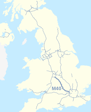
The M40 motorway links London, Oxford, and Birmingham in England, a distance of approximately 89 miles (143 km).
Bracknell is a town and civil parish in Berkshire, England, the westernmost area within the Greater London Urban Area and the administrative centre of the borough of Bracknell Forest. It lies 11 miles (18 km) to the east of Reading, 9 miles (14 km) south of Maidenhead, 10 miles (16 km) southwest of Windsor and 25 miles (40 km) west of central London. Bracknell is the third largest town in Berkshire.
The A4 is a major road in England from Central London to Avonmouth via Heathrow Airport, Reading, Bath and Bristol. It is historically known as the Bath Road with newer sections including the Great West Road and Portway. The road was once the main route from London to Bath, Bristol and the west of England and formed, after the A40, the second main western artery from London.
The M5 is a motorway in England linking the Midlands with the South West. It runs from junction 8 of the M6 at West Bromwich near Birmingham to Exeter in Devon. Heading south-west, the M5 runs east of West Bromwich and west of Birmingham through Sandwell Valley. It continues past Bromsgrove, Droitwich Spa, Worcester, Tewkesbury, Cheltenham, Gloucester, Bristol, Portishead, Clevedon, Weston-super-Mare, Bridgwater, Taunton, Tiverton, Cullompton terminating at junction 31 for Exeter.
The M20 is a motorway in Kent, England. It follows on from the A20 at Swanley, meeting the M25, and continuing on to Folkestone, providing a link to the Channel Tunnel and the ports at Dover. It is 50.6 miles (81.4 km) long. Although not signposted in England, this road is part of the European route E15. It is also used as a holding area for goods traffic when traffic across the English Channel is disrupted, such as Operation Stack and Operation Brock.
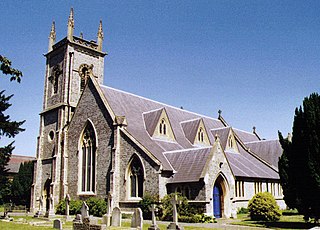
Earley is a town and civil parish in the Borough of Wokingham, Berkshire, England. Along with the neighbouring town of Woodley, the Office for National Statistics places Earley within the Reading/Wokingham Urban Area; for the purposes of local government it falls within the Borough of Wokingham, outside the area of Reading Borough Council. Its name is sometimes spelt Erleigh or Erlegh and consists of a number of smaller areas, including Maiden Erlegh and Lower Earley, and lies some 3 miles (5 km) south and east of the centre of Reading, and some 4 miles (6 km) northwest of Wokingham. It had a population of 32,036 at the 2011 Census.
The M32 is a 4.4-mile-long (7.1 km) motorway in South Gloucestershire and Bristol, England. It provides a link from the M4, a major motorway linking London and South Wales, to Bristol city centre and is maintained by National Highways, the national roads body.
The M49 is a motorway in England that links the M4 (J22) with the M5 (J18A). The southern end is on the outskirts of Avonmouth and the northern end is immediately to the east of the Prince of Wales Bridge which was constructed at the same time 1996. It is 5 miles (8 km) long and unique in that it is only accessible from other motorways.
The River Loddon is a tributary of the River Thames in southern England. It rises at Basingstoke in Hampshire and flows northwards for 28 miles (45 km) to meet the Thames at Wargrave in Berkshire. Together, the Loddon and its tributaries drain an area of 400 square miles (1,036 km2).
Winnersh is a large suburban village and civil parish in the borough of Wokingham in Berkshire, England. The village is located around 2 miles (3.2 km) northwest of Wokingham town centre and around 4 miles (6.4 km) southeast of central Reading. It is roughly bounded by the M4 motorway to the south, the A329(M) motorway to the north, and the River Loddon to the west. The parish extends beyond the M4 to cover the estate village of Sindlesham.
Winnersh Triangle railway station is one of two railway stations in Winnersh, Berkshire, England. It is served by South Western Railway services between London Waterloo and Reading. The station is on the west side of Winnersh, 39 miles 35 chains (63.5 km) from London Waterloo and 6.4 kilometres (4.0 mi) from Reading. It is situated on an embankment by which the railway crosses the valley of the River Loddon, and is some 500 metres (1,600 ft) east of the bridge across that river.
Sindlesham is an estate village in the borough of Wokingham in Berkshire, England. It is located around 4 miles (6.4 km) southeast of Reading and around 6 miles (9.7 km) west of the town of Bracknell, and just south of the village of Winnersh, from which it is separated by the M4 motorway. The River Loddon flows just to the west. A chapel was built in Sindlesham as early as 1220. A large 19th-century, three-storey watermill on the Loddon has more recently become part of a hotel.
Lower Earley is a suburb which forms the southern portion of the civil parish of Earley in the Borough of Wokingham in Berkshire, England. Along with neighbouring Earley, Winnersh, Woodley and Shinfield, It forms part of a part of the Reading/Wokingham Urban Area.
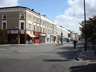
The A404 is a road in the United Kingdom that starts at Paddington in London and terminates near Maidenhead in Berkshire. It is 44.6 miles (71.8 km) long.
The A329 is an east–west road in Southern England that runs from Wentworth in Surrey to Thame in Oxfordshire.
The M31 was planned as a Reading to M3 motorway which was dubbed the 'M3 – M4 link motorway'. It would have provided a direct high-speed route between the two motorways. The motorway was planned at the same time as the largely unrealised London Ringways scheme and an additional section was planned that would have taken the M31 south and east from the M3 to connect to the scheme's Ringway 4 providing a shorter route for traffic travelling between the west and Surrey and Kent.
Thames Valley Park is a high-tech business park adjacent to the River Thames on the eastern outskirts of Reading in Berkshire, England. Companies based at the park include BBC Radio Berkshire, Steria, SGI, Regus, Websense, Oracle, Microsoft, OpenText and ING Direct. The site had formerly been Earley Power Station, which had been operational from the early 1940s until the early 1970s.
Reading's location in the Thames Valley at the confluence of the River Thames and River Kennet, and on both the Great Western Main Line and the M4 motorway, some 40 miles (64 km) west of London has made the town an important location in the nation's transport system.
Jennett's Park is a suburb of Bracknell in the English county of Berkshire. It is a recent development with the first residents moving there in 2007. It is in the Binfield South & Jennett's Park ward of Bracknell Forest Council.
{{cite book}}
: CS1 maint: location missing publisher (link)