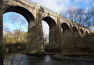
The Avon is a river largely in the Falkirk council area of Scotland.

The A9 is a major road in Scotland running from the Falkirk council area in central Scotland to Scrabster Harbour, Thurso in the far north, via Stirling, Bridge of Allan, Perth and Inverness. At 273 miles (439 km), it is the longest road in Scotland and the fifth-longest A-road in the United Kingdom. Historically it was the main road between Edinburgh and John o' Groats, and has been called the spine of Scotland. It is one of the three major north–south trunk routes linking the Central Belt to the Highlands – the others being the A82 and the A90.

The M8 is the busiest motorway in Scotland. It connects the country's two largest cities, Glasgow and Edinburgh, and serves other large communities including Airdrie, Coatbridge, Greenock, Livingston and Paisley. The motorway is 60 miles (97 km) long. A major construction project to build the final section between Newhouse and Baillieston was completed on 30 April 2017. The motorway has one service station, Heart of Scotland Services, previously named Harthill due to its proximity to the village.

The M9 is a major motorway in Scotland. It runs from the outskirts of Edinburgh, bypassing the towns of Linlithgow, Falkirk, Grangemouth and Stirling to end at Dunblane.

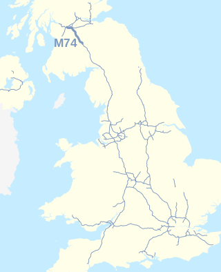
The A74(M) and M74 form a major motorway in Scotland, connecting it to England. The routes connect the M8 motorway in central Glasgow to the Scottish-English border at Gretna. They are part of the unsigned international E-road network E05. Although the entire route is colloquially referred to as the M74, for more than half its length, south of Abington, the road is officially the A74(M); see naming confusion below.

The River Forth is a major river in central Scotland, 47 km (29 mi) long, which drains into the North Sea on the east coast of the country. Its drainage basin covers much of Stirlingshire in Scotland's Central Belt. The Gaelic name for the upper reach of the river, above Stirling, is Abhainn Dubh, meaning "black river". The name for the river below the tidal reach is Uisge For.

The M90 is a motorway in Scotland. It runs from Junction 1A of the M9 motorway, south of the Queensferry Crossing, to Perth. It is the northernmost motorway in the United Kingdom. The northern point goes to the western suburbs of Perth at Broxden. A small part of the M90 was originally numbered as the M85 motorway.

The M180 is a 25.5-mile-long (41 km) motorway in eastern England, starting at junction 5 on the M18 motorway in Hatfield, within the Metropolitan Borough of Doncaster, South Yorkshire, and terminating at Barnetby, Lincolnshire, some 10 miles (16 km) from the port of Immingham and 14 miles (23 km) from the port of Grimsby. The A180 road continues to the east for Grimsby, Cleethorpes and Immingham. Scunthorpe, Lincoln, Hull, Brigg, Bawtry and the Isle of Axholme can be accessed using the motorway. Humberside Airport, the now-closed Doncaster Sheffield Airport, and the Killingholme, Humber and Lindsey oil refineries are close to the motorway. The road forms part of the unsigned Euroroute E22 and is the main route along the south bank of the Humber Estuary.

The M65 is a motorway between Preston and Colne in Lancashire, England. It runs from Bamber Bridge just south of Preston, through major junctions with the M6 and M61 motorways, east past Darwen, Blackburn, Accrington, Burnley, Brierfield, Nelson and ends at Colne.

Stirlingshire or the County of Stirling is a historic county and registration county of Scotland. Its county town is Stirling.

The M73 is a motorway in Glasgow and North Lanarkshire, Scotland. It is 7 miles (11 km) long and connects the M74 motorway with the M80 motorway, providing an eastern bypass for Glasgow. The short stretch between junctions 1 and 2 is part of unsigned international E-road network E05, where it continues along the M8 through Glasgow. To the south, the M74 motorway is also part of the E05.

The M80 is a motorway in Scotland's central belt, running between Glasgow and Stirling via Cumbernauld and Denny and linking the M8, M73 and M9 motorways. Following completion in 2011, the motorway is 25 miles (40 km) long. Despite being only a two lane motorway, parts of the M80 Stepps Bypass are used by around 60,000 vehicles per day.
The M181 is a motorway that links the town of Scunthorpe, England, to the M180 motorway. A spur of the M180, the road is virtually straight through its entire 2-mile (3.2 km) length. It was opened in December 1978, at the same time as the section of M180 from junction 3 (A15) to the east side of the River Trent.

Larbert is a town in the Falkirk council area of Scotland. The town lies in the Forth Valley above the River Carron which flows from the west. Larbert is three miles from the shoreline of the Firth of Forth and 2+1⁄2 miles northwest of Falkirk. Stenhousemuir lies directly east of Larbert, with both settlements being contiguous and sharing certain public amenities with one another.
The B800 is a short road in eastern Scotland, connecting the Forth Road Bridge to Kirkliston. It is a two-way single carriageway road.
Avondale Environmental, better known as Avondale Landfill, is a major Scottish landfill located in Polmont, off junction 4 of the M9 motorway. Avondale takes large volumes of waste from the Forth Valley and some from West Lothian. Avondale has the ability to accept Non-Hazardous, Stable Non-Reactive Hazardous waste including asbestos/gypsum and compliant hazardous wastes. This is the first and currently only landfill with the ability to accept hazardous waste to landfill in Scotland under the Landfill Directive.

The A803 is a road in central Scotland. It runs from Glasgow to Champany Corner, three miles (4.8 km) due north-east of Linlithgow).

The R747 road is a regional road in Ireland running north-west/south-east from the M9 near Ballitore in County Kildare to Arklow in County Wicklow, a distance of 66 km (41 mi).

Lecropt is a rural parish lying to the west of Bridge of Allan, Scotland.

The A801 is a road in Scotland which runs from east of Polmont to the A705 near Whitburn that heads towards Livingston in the other direction.


