Thameside Promenade

Last updated

Thameside Promenade
Thames Side Promenade - geograph.org.uk - 2606364.jpg
Thames Side Promenade looking downstream
Location map United Kingdom Reading.png
Red pog.svg
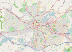
Location within Reading
Type Public
Location Reading, Berkshire, UK
Coordinates 51°28′04″N0°59′14″W / 51.4677°N 0.9872°W / 51.4677; -0.9872 Coordinates: 51°28′04″N0°59′14″W / 51.4677°N 0.9872°W / 51.4677; -0.9872

Thameside Promenade, or Thames Side Promenade, is a public park and promenade in Reading, Berkshire, England, located next to the River Thames. It stretches along the south (Reading) side of the river, to the west of Caversham Bridge, and forms part of the Thames Path long distance footpath. The park includes grassland behind the promenade. [1]

Thameside Promenade form part of a series of riverside open spaces, managed by Reading Borough Council, that stretch along one or other side of the River Thames throughout its passage through Reading. From west to east these are Thameside Promenade, Caversham Court, Christchurch Meadows, Hills Meadow, View Island and King's Meadow. [2]

The principle access to Thameside Promenade is from the eastern (Caversham Bridge) end, where there is a car park and Reading Rowing Club have their boathouse. A little further along, access is possible from Rivermeade Leisure Centre, which occupies a site on the grassland behind the promenade. About half-way along the promenade it is intersected by Cow Lane, and beyond that point the farmland behind the promenade is used as part of the Reading Festival site. In contrast to the relatively flat land on the promenade side of the river, the land on the opposite bank rises steeply into Caversham Heights, and the path provides good views of the up-market riverside housing along the Warren and the hills behind. [1] [3]

Related Research Articles

Reading, Berkshire Town and borough in Berkshire, England

Reading is a town and borough in Berkshire, South-East England. Located in the Thames Valley at the confluence of the rivers Thames and Kennet, the Great Western Main Line railway and the M4 motorway serve the town. Reading is 40 miles (64 km) east of Swindon, 28 miles (45 km) south of Oxford, 40 miles (64 km) west of London, 15 miles (24 km) north of Basingstoke, 13 miles (21 km) southwest of Maidenhead and 15 miles (24 km) east of Newbury.

Barnes, London District in the London Borough of Richmond upon Thames, England

Barnes is a district in south London, part of the London Borough of Richmond upon Thames, England. It takes up the extreme north-east of the borough, and as such is the closest part of the borough to central London. It is centred 5.8 miles (9.3 km) west south-west of Charing Cross in a bend of the River Thames.

Caversham, Reading Human settlement in England

Caversham is a suburb of Reading, England. Originally a village founded in the Middle Ages, it lies on the north bank of the River Thames, opposite the rest of Reading. Caversham Bridge, Reading Bridge, Christchurch Bridge, and Caversham Lock provide crossing points, with Sonning Bridge also available a few miles east of Caversham. Caversham has at Caversham Court foundations of a medieval house, a herb garden and tree-lined park open to the public at no charge. Caversham Lakes and marking its south and south-east border the Thames Path National Trail. Caversham rises from the River Thames, lying on flood plain and the lowest reaches of the Chiltern Hills.

River Brent River in London, England

The River Brent is a river in west and northwest London, England, and a tributary of the River Thames. 17.9 miles (28.8 km) in length, it rises in the Borough of Barnet and flows in a generally south-west direction before joining the Tideway stretch of the Thames at Brentford.

Caversham Lock Lock and weir on the River Thames in Berkshire, England

Caversham Lock is a lock and main weir on the River Thames in England at Reading, Berkshire. Both the lock and main weir are connected to De Bohun Island. The Thames Navigation Commissioners built the original lock in 1778. Additional sluices north of View Island and Heron Island form the whole weir complex. A footbridge passes over all three islands to connect Lower Caversham to Reading via a route other than George Street and Reading Bridge.

Walking in London

Walking is a popular recreational activity in London, despite traffic congestion. There are many streets that provide interesting walks, especially within historic central London, In addition there are attractive commons, parks, canals, and disused railway tracks that provide space for walks. This includes Wimbledon Common, Epping Forest, Hampstead Heath, and the eight Royal Parks: Hyde Park, Regent's Park, Richmond Park, etc. In recent years access to canals and rivers, including the Regent's Canal, and the River Thames has been greatly improved, and as well a number of long-distance walking routes have been created that link green spaces.

The London Borough of Bexley owns and maintains over 100 parks and open spaces within its boundaries, with a total of 638 hectares. They include small gardens, river and woodland areas, and large parks with many sporting and other facilities.

Lower Caversham Human settlement in England

Lower Caversham is an area of the former town of Caversham, in the English county of Berkshire. Today this is itself a suburb of the larger town of Reading. Lower Caversham has no formal boundaries, but the name usually refers to that part of Caversham situated on lower ground to the east of central Caversham, close to the River Thames.

A4074 road

The A4074 is a British A road from the Reading suburb of Caversham to the Heyford Hill roundabout on the Oxford Ring Road.

View Island Riverside park in Reading, England

View Island is a small island near Caversham Lock, on the River Thames at Reading, Berkshire in England.

Hampton Ferry (River Thames)

Hampton Ferry is a seasonal foot ferry across the Thames in England. It is about 1 mile (1.6 km) upstream, west, of Hampton Court Bridge. The bridge links a busy zone of activity on both banks including Hampton Court Palace. The ferry links a large riverside park to the oldest parts of the town of Hampton, London, including its church, inn and various listed buildings such as Garrick House which is private apartments and Garrick's Temple to Shakespeare beside a narrow strip of sloped bank. This is known as Saint Albans Riverside, as it was owned by one of the Dukes of Saint Albans, seated at Hanworth House and Park, about two miles away. On the north side, this part of former Middlesex became outer-most London in 1965 by an Act of 1963. The towpath on the south side is for about 400 metres each way in public grassland with picnic places and beyond, for about 1 mile (1.6 km) shaded by trees, east and west.

Charlton Riverside Human settlement in England

Charlton Riverside, previously known as New Charlton, is the area along the south bank of the river Thames at Charlton, London, which forms part of the Royal Borough of Greenwich. It was formerly a primarily industrial zone, known for the glass and rope making industries, but is now an area of regeneration.

Caversham Court Public park and former country house in Southern England

Caversham Court is a public garden and was a mansion located on the north bank of the River Thames in Caversham, a suburb of Reading in the English county of Berkshire. The park lies within the St Peter's conservation area. The park is listed as Grade II in the National Register of Historic Parks and Gardens.

Kings Meadow, Reading Riverside park in Reading, England

King's Meadow is a park in Reading, Berkshire, England, located next to the River Thames. It stretches from the Coal Woodland to King's Meadow Road near Reading Bridge. The Thames Path long distance footpath runs through the length of King's Meadow, which is visible from the railway when entering or leaving Reading railway station from the eastern side.

The Thameside Series are two canoe and kayak races organised by Reading Canoe Club, that coincide with the Waterside Series races, organised by Newbury Canoe Club. The two races are Thameside 1, and Thameside 2.

Transport in Reading, Berkshire Transport system overview

Reading's location in the Thames Valley at the confluence of the River Thames and River Kennet, and on both the Great Western Main Line and the M4 motorway, some 40 miles (64 km) west of London has made the town an important location in the nation's transport system.

Dukes Meadows Footbridge is a pedestrian bridge under construction in Chiswick, London that will allow the Thames Path on the north bank at Dukes Meadows to follow the river without diversion.

Thames is an electoral ward of the Borough of Reading, in the English county of Berkshire. It includes areas on both sides of both the River Thames and the River Kennet, to the north and east of the centre of Reading on the south bank, and to the east of the centre of Caversham on the north bank. It should not be confused with the ward of the same name that existed prior to the 2022 Reading Borough Council election, with which it has no area in common.

Christchurch Meadows, Reading Riverside park in Reading, England

Christchurch Meadows is a park in Reading, Berkshire, England, located next to the River Thames. It stretches along the north (Caversham) side of the river, between Caversham Bridge and Reading Bridge, and is linked to the south (Reading) bank by the Christchurch Bridge, a pedestrian and cycle bridge built in 2015. The name of the meadow derives from Christ Church in Oxford, whose dean owned 25 acres (10 ha) of farmland in Reading.

Hills Meadow Riverside park in Reading, England

Hills Meadow is a park in Reading, Berkshire, England, located next to the River Thames. It stretches along the north (Caversham) side of the river, to the east of Reading Bridge. It is linked to the south (Reading) bank by a footpath, locally known as The Clappers that crosses View Island and the weir at Caversham Lock.

References

  1. 1 2 Explorer 159: Reading, Wokingham & Pangbourne (Map). Ordnance Survey. ISBN   9780319243527.
  2. "Parks, Outdoor Facilities & Open Spaces". Reading Borough Council. Archived from the original on 28 June 2022. Retrieved 28 June 2022.
  3. "Thameside Promenade". Reading Borough Council. Archived from the original on 28 June 2022. Retrieved 28 June 2022.