The Okanagan Indian Band is a First Nations government in the Canadian province of British Columbia, located in the city of Vernon in the northern Okanagan Valley. The band is a member government of the Okanagan Nation Alliance.
The Lytton First Nation, a First Nations government, has its headquarters at Lytton in the Fraser Canyon region of the Canadian province of British Columbia. While it is the largest of all Nlaka'pamux bands, unlike all other governments of the Nlaka'pamux (Thompson) people, it is not a member of any of the three Nlaka'pamux tribal councils, which are the Nicola Tribal Association, the Fraser Canyon Indian Administration and the Nlaka'pamux Nation Tribal Council.
The Kluskus First Nation is the band government of the Lhoosk’uz, a Dakelh people whose main reserve located on the Chilcotin Plateau 130 km west of the city of Quesnel, British Columbia, Canada. The First Nation is a member of the Carrier-Chilcotin Tribal Council, which includes both Tsilhqot'in and Carrier (Dakelh) communities.
The Tŝideldel First Nation is the band government of the Tsi Del Del subgroup of the Tsilhqot'in people, located in the Chilcotin District in the western Central Interior region of the Canadian province of British Columbia. It is a member of the Tsilhqot'in National Government.

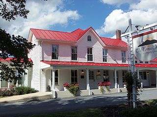
Comus is an unincorporated community in Montgomery County, Maryland, United States. Its elevation is 591 feet (180 m). The mostly rural community is located about 39.7 miles (63.9 km) by car from Washington D.C.
Gribbell Island is an island on the North Coast of British Columbia, Canada, located on the east side of the entrance to Douglas Channel at Wright Sound. Gribble Island Indian Reserve No. 10 is on its west coast, between Verney Passage and Ursula Channel at 53°21′00″N129°08′00″W. The small Wimbledon Range is on the south side of the island, facing the northern extremities of Princess Royal Island to the south, at 53°21′00″N129°02′00″W

The Terminal Range is the northernmost mountain range of the Canadian Rockies, so-named for its position at the northern terminus of the Rockies. Lying west of Muncho Lake and the Trout River, its northern perimeter is the Liard River. The Sentinel Range lies to its east.

Johnsons Glacier is the 1.8 km long and 2.3 km wide glacier on Hurd Peninsula, Livingston Island in the South Shetland Islands, Antarctica bounded by Charrúa Ridge and Charrúa Gap to the north, Napier Peak to the east, Mirador Hill to the southeast, Hurd Ice Cap to the southwest and Mount Reina Sofía to the west. It is draining northwestwards into Johnsons Dock. The glacier provides overland access from the Spanish base Juan Carlos Primero to the interior of the eastern Livingston Island.

Contell Glacier is 1.2 nmi long and 0.4 nautical miles wide glacier on Hurd Peninsula, Livingston Island in the South Shetland Islands, Antarctica bounded by Atlantic Club Ridge to the northwest, Krum Rock to the north, Balkan Snowfield to the northeast, and Charrúa Ridge and Charrúa Gap to the south. It is crescent-shaped, running northwestwards in its upper course, then between Charrúa Ridge and Krum Rock turning west-southwestwards to flow into South Bay north of Johnsons Dock.

Krapets Glacier is the 3.5 km long and 1.4 km wide glacier on Pefaur (Ventimiglia) Peninsula, Danco Coast on the west side of Antarctic Peninsula, situated east of Agalina Glacier and west of Zimzelen Glacier. It drains northwards, and flows into the east arm of Salvesen Cove.

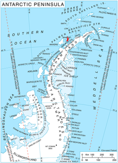
Kiev Peninsula is the predominantly ice-covered, oval shaped peninsula projecting 35 km in northwest direction from the west side of Graham Land, Antarctic Peninsula. It is bounded by Flandres Bay to the northeast and Beascochea Bay to the southwest, and separated from Wilhelm Archipelago to the northwest by Lemaire Channel and Penola Strait. The peninsula’s north extremity Cape Renard divides Graham Coast to the southwest from Danco Coast to the northeast.

Thunder Glacier is a through glacier, 4 nautical miles (7 km) long, which extends in an east-west direction across Wiencke Island between Sierra DuFief and the Wall Range, in the Palmer Archipelago. Probably known since the discovery of Wiencke Island by the Belgian Antarctic Expedition in 1898. Charted in 1944 by the Falkland Islands Dependencies Survey (FIDS), and so named by them because a survey party was nearly overwhelmed there by an avalanche.

Pulpudeva Glacier is the 4.6 nautical miles long and 3.2 nautical miles wide glacier in Sullivan Heights, Sentinel Range in Ellsworth Mountains, Antarctica. It is draining the area northeast of Nebeska Peak, north of Johnson Col and northwest of Mount Farrell, flowing northwards west of Mount Levack, and joining Ellen Glacier northwest of Mamarchev Peak and southeast of Mount Jumper.

Razboyna Glacier is the 3 nautical miles long and 1 nautical mile wide glacier in Petvar Heights on the southeast side of Sentinel Range in Ellsworth Mountains, Antarctica situated north of Drama Glacier, east of Kornicker Glacier, and south of the lower course of Thomas Glacier. It is draining the north slopes of Bagra Peak, and flowing northeastwards to leave the range north of Long Peak.

Taran Plateau is the ice-covered plateau of elevation 1100 to 1700 m on the east side of Harvey Heights in Stribog Mountains on Brabant Island in the Palmer Archipelago, Antarctica. It extends 5.5 km in east-west direction and 3.3 km in north-south direction, and is bounded by Laënnec Glacier on the north, Svetovrachene Glacier on the east and south, and the head of Malpighi Glacier on the southwest. The feature is connected to Avroleva Heights to the east by Doriones Saddle, and has its southwest part abutted by Basarbovo Ridge. It has steep and partly ice-free north slopes and small parts of the southeast and southwest slopes.

Burevestnik Glacier is the 4.2 km long and 3.5 km wide glacier on Pasteur Peninsula, Brabant Island in the Palmer Archipelago, Antarctica, situated east of Podayva Glacier and north of Lister Glacier. It drains the north slopes of Stribog Mountains, flows northeastwards and enters the sea east of Marinka Point and northwest of Levenov Point.
Copper Col is a col at 305 m, between Copper Peak and Billie Peak in the Osterrieth Range of Anvers Island, in the Palmer Archipelago. Probably first seen by the Belgian Antarctic Expedition (1897-99), under Adrien de Gerlache. The name Copper Glacier appears in this position on a chart based on a 1927 survey by Discovery Investigations personnel on the RRS Discovery. The feature was resurveyed in 1955 by the Falklands Islands Dependencies Survey, who reported that col would be a better descriptive term.
Copper Peak is a peak, 1,125 metres (3,691 ft) high and vivid green in color, standing 2 nautical miles (3.7 km) north-northeast of Billie Peak on the southeast side of Anvers Island, in the Palmer Archipelago. First seen by the Belgian Antarctic Expedition under Adrien de Gerlache (1897-99). The descriptive name appears on a chart based on a 1927 survey by DI personnel on the RRS Discovery.
Holt Inlet is a western arm of Lapeyrère Bay on Anvers Island, in the Palmer Archipelago. The inlet is 2 nautical miles (3.7 km) long and 1 nautical mile (1.9 km) wide, with the entrance south of The Hump. Named by the Advisory Committee on Antarctic Names in 2007 after Rennie S. Holt, Director, Antarctic Ecosystem Research Group, Southwest Fisheries Science Center, La Jolla, CA; leader of the U.S. Antarctic Marine Living Resources (AMLR) program to waters adjoining the South Shetland Islands and the northern Antarctic Peninsula, from 1989 to 2006.
Marina Point is a low rocky point which forms the northwestern tip of Galindez Island in the Argentine Islands of the Wilhelm Archipelago. It was first surveyed in 1935-36 by the British Graham Land Expedition under Rymill and named by members of the expedition for Princess Marina, later Duchess of Kent, who was married in November 1934, while the ship Penola was en route to the Argentine Islands.


