The Marlin Coast is a region of the Far North Queensland coast of Australia centered on Cairns. [1] It extends from the town of Cardwell in the south to Cooktown in the north. This coast, on the edge of the Coral Sea and the Great Barrier Reef, is famous for the blue marlin and the prized black marlin which may be caught there. The region contains the northernmost extent of tourist development along the east coast of Australia. [2]
The Marlin Coast is also home to the Cassowary, a unique flightless bird that lives in dense shrub and rain forest in Far North Queensland.

The Great Dividing Range, also known as the East Australian Cordillera or the Eastern Highlands, is a cordillera system in eastern Australia consisting of an expansive collection of mountain ranges, plateaus and rolling hills. It runs roughly parallel to the east coast of Australia and forms the fifth-longest land-based mountain chain in the world, and the longest entirely within a single country. It is mainland Australia's most substantial topographic feature and serves as the definitive watershed for the river systems in eastern Australia, hence the name.

Queensland is a state in north-eastern Australia, the second-largest and third-most populous of the Australian states. It is bordered by the Northern Territory, South Australia and New South Wales to the west, south-west and south respectively. To the east, Queensland is bordered by the Coral Sea and the Pacific Ocean; to its north is the Torres Strait, separating the Australian mainland from Papua New Guinea, and the Gulf of Carpentaria to the north-west. With an area of 1,729,742 square kilometres (667,857 sq mi), Queensland is the world's sixth-largest sub-national entity; it is larger than all but 16 countries. Due to its size, Queensland's geographical features and climates are diverse, including tropical rainforests, rivers, coral reefs, mountain ranges and sandy beaches in its tropical and sub-tropical coastal regions, as well as deserts and savanna in the semi-arid and desert climatic regions of its interior.

Cairns is a city in Queensland, Australia, on the tropical north east coast of Far North Queensland. In the 2021 census, Cairns had a population of 153,181 people.

The Sunshine Coast is a peri-urban region in South East Queensland, Australia. It is the district defined in 1967 as "the area contained in the Shires of Landsborough, Maroochy and Noosa, but excluding Bribie Island". Located 100 km (62 mi) north of the centre of Brisbane in South East Queensland, on the Coral Sea coastline, its urban area spans approximately 60 km (37 mi) of coastline and hinterland from Pelican Waters to Tewantin.

Northern Rivers is the most north-easterly region of the Australian state of New South Wales, located between 590 and 820 kilometres north of the state capital, Sydney, and encompasses the catchments and fertile valleys of the Clarence, Richmond, and Tweed rivers. It extends from Tweed Heads in the north to the southern extent of the Clarence river catchment which lies between Grafton and Coffs Harbour, and includes the main towns of Tweed Heads, Byron Bay, Ballina, Kyogle, Lismore, Casino and Grafton. At its most northern point, the region is 102 kilometres (63 mi) south-southeast of the Queensland capital, Brisbane.

Mission Beach is a coastal town and locality in the Cassowary Coast Region, Queensland, Australia. In the 2016 census, the locality of Mission Beach had a population of 815 people.
The Goreng Goreng, also known Kooreng Gooreng, are an inland Freshwater Australian Aboriginal people of Queensland, and also a language group. The Goreng Goreng area is between Central West Queensland in the north around Boyne Valley, extending westerly as far as the Great Dividing Range along the Dawes, Auburn, Nogo and Callide Ranges to meet the Wulli Wulli and Ghunghulu to their immediate west over the Great Dividing Range.

South East Queensland (SEQ) is a bio-geographical, metropolitan, political and administrative region of the state of Queensland in Australia, with a population of approximately 3.8 million people out of the state's population of 5.1 million. The area covered by South East Queensland varies, depending on the definition of the region, though it tends to include Queensland's three largest cities: the capital city Brisbane; the Gold Coast; and the Sunshine Coast. Its most common use is for political purposes, and covers 35,248 square kilometres (13,609 sq mi) and incorporates 11 local government areas, extending 240 kilometres (150 mi) from Noosa in the north to the Gold Coast and New South Wales border in the south, and 140 kilometres (87 mi) west to Toowoomba. It is the third largest urban area in Australia by population.
Ports North, the trading name of the Far North Queensland Ports Corporation Limited, is a Queensland Government statutory corporation that is responsible for the Cairns Marlin Marina and the Cairns Cityport project and the ports in Cairns, Cape Flattery, Karumba, Mourilyan, Skardon River, Quintell Beach, Thursday Island, Burketown and Cooktown, in Queensland, Australia. Since 2023, the shareholding Ministers are the Deputy Premier, Treasurer and Minister for Transport and Main Roads.

Cape Tribulation is a headland and coastal locality in the Shire of Douglas in northern Queensland, Australia. In the 2021 census, Cape Tribulation had a population of 123 people.
Far North Queensland (FNQ) is the northernmost part of the Australian state of Queensland. Its largest city is Cairns and it is dominated geographically by Cape York Peninsula, which stretches north to the Torres Strait, and west to the Gulf Country. The waters of Torres Strait include the only international border in the area contiguous with the Australian mainland, between Australia and Papua New Guinea.
The Regions of Queensland refer to the geographic areas of the Australian state of Queensland. Due to its large size and decentralised population, the state is often divided into regions for statistical and administrative purposes. Each region varies somewhat in terms of its economy, population, climate, geography, flora and fauna. Cultural and official perceptions and definitions of the various regions differ somewhat depending on the government agency or popular group by which they are being applied.

Natural Bridge is a rural locality in the City of Gold Coast, Queensland, Australia. It borders New South Wales. In the 2016 census, Natural Bridge had a population of 108 people.

Smithfield is a suburb of Cairns in the Cairns Region, Queensland, Australia. In the 2021 census Smithfield had a population of 6,664 people.
Jumbun is an Aboriginal community located in Murray Upper, Cassowary Coast Region which is 40 kilometres (25 mi) south-west of Tully in Far North Queensland, Australia. The word "jumbun" means "wood-grub" in Girrimay. The residents of Jumbun are predominantly from the Girrimay and Dyirbal Aboriginal nations. At the 2011 census, Jumbun had a population of 104.

The Gold Coast hinterland is an area of South East Queensland, Australia that comprises the Tweed Range, Nimmel Range, Tamborine Mountain, Numinbah Valley, eastern parts of the McPherson Range and western parts of suburban Gold Coast, such as Mudgeeraba. This undefined unit of area is known for its tourist attractions including resorts, rainforest, lookouts, national parks, its diversity of fauna and flora and as a green backdrop to the coastal strip. It overlaps part of the Scenic Rim and is part of both the City of Gold Coast and Scenic Rim Region and includes Springbrook, Binna Burra and O'Reilly.
Wide Bay–Burnett is a region of the Australian state of Queensland, located between 170–400 km (110–250 mi) north of the state capital, Brisbane. The area's population growth has exceeded the state average over the past 20 years, and it is forecast to grow to more than 430,000 by 2031. It is the subject of the Draft Wide Bay–Burnett Regional Plan, which aims to facilitate this growth while protecting over 90% of the region from urban development.
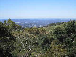
Flaxton is a rural locality in the Sunshine Coast Region, Queensland, Australia. In the 2021 census, Flaxton had a population of 992 people.
In South Australia, one of the states of Australia, there are many areas which are commonly known by regional names. Regions are areas that share similar characteristics. These characteristics may be natural such as the Murray River, the coastline, desert or mountains. Alternatively, the characteristics may be cultural, such as common land use. South Australia is divided by numerous sets of regional boundaries, based on different characteristics. In many cases boundaries defined by different agencies are coterminous.

South Mission Beach is a coastal town and locality in the Cassowary Coast Region, Queensland, Australia. In the 2021 census, the locality of South Mission Beach had a population of 968 people.
| | This Queensland location article is a stub. You can help Wikipedia by expanding it. |