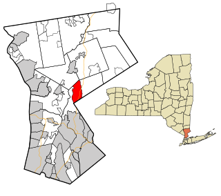
Armonk is a hamlet and census-designated place (CDP) in the town of North Castle, New York located in Westchester County. As of the 2010 census, Armonk's CDP population is 4,330 and it has a total area of 6.1 square miles (15.7 km2), of which 6.0 square miles (15.5 km2) is land and 0.077 square miles (0.2 km2), or 1.54 percent, is water. Armonk is well known as being the headquarters of IBM.

A hamlet is a small human settlement. In different jurisdictions and geographies, hamlets may be the size of a town, village or parish, be considered a smaller settlement or subdivision or satellite entity to a larger settlement. The word and concept of a hamlet have roots in the Anglo-Norman settlement of England, where the old French hamlet came to apply to small human settlements. In British geography, a hamlet is considered smaller than a village and distinctly without a church.

Yelvertoft is a village in the Daventry district of the county of Northamptonshire in England. At the time of the 2001 census, the parish's population was 821 people, reducing to 764 at the 2011 Census.

Perisher Valley, commonly called Perisher, is a valley formed below Mount Perisher, a mountain that is located in the Snowy Mountains of New South Wales, Australia.

The Crescenta Valley is a small inland valley in Los Angeles County, California, lying between the San Gabriel Mountains on the northeast and the Verdugo Mountains and San Rafael Hills on the southwest. It opens into the San Fernando Valley at the northwest and the San Gabriel Valley at the southeast. It is nearly bisected by the Verdugo Wash, a smaller valley separating the Verdugo Mountains from the San Rafael Hills. Most of the valley lies at an elevation of over 1,500 feet.

Ulong is a small town located on the Mid North Coast region, neighbouring the Northern Tablelands, of New South Wales, Australia.

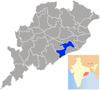
Khordha is an administrative division of the state of Odisha, India. It was formed on April 1, 1993, by the division of former Puri District into Puri, Khordha and Nayagarh districts. In the year 2000 the district name was changed to Khordha. The district headquarters is Khordha Town. The capital city of Bhubaneswar is located in this district. Khordha is the most urbanized of all the districts of Odisha. Khordha Road, the railway station that serves the town is also the divisional headquarters of the East Coast Railway of the Indian Railways. Khordha is known for its brass utensils, cottage industries, railway coach manufacturing, and cable manufacturing unit.

Summertown is a town in the Adelaide Hills region of South Australia. It adjoins Uraidla. At the 2006 census, Summertown had a population of 392.

Lobethal is a town in the Adelaide Hills area of South Australia. It is located in the Adelaide Hills Council local government area, and is nestled on the banks of a creek between the hills and up the sides of the valley. It was once the centre of the Adelaide Hills wool processing industry, which continued until around 1950. The mill buildings are now used by a number of cottage industry and handcraft businesses. At the 2006 census, Lobethal had a population of 1,836 which had grown to 1957 by the 2011 census.

Longview is a village in southern Alberta, Canada. It is located in the Canadian Rockies foothills, on Cowboy Trail, 32 km west of High River and 64 km south of Calgary. Highwood River flows west of the village.

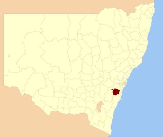
Wingecarribee Shire is the local government area of the Southern Highlands in the state of New South Wales, Australia. The Wingecarribee Shire is around 110 kilometres (70 mi) southwest of the Sydney central business district and is part of regional Capital Country and to some extent can be considered part of the Southern Tablelands.

Ben Lomond is a village on the Northern Tablelands in the New England region of New South Wales, Australia. The village is situated 6 km off the New England Highway between Armidale and Glen Innes. It was located in the Guyra Shire local government area until that council was amalgamated into the Armidale Regional Council on 12 May 2016, with parts of the surrounding district in Glen Innes Severn Shire and Inverell Shire. It is primarily a farming area, with most of the residents involved in sheep, cattle and grain farming.

Gunnedah Shire is a local government area in the North West Slopes region of New South Wales, Australia. The Shire is located adjacent to the Liverpool Plains in the Namoi River valley and is traversed by the Oxley Highway and the Kamilaroi Highway.

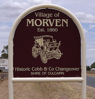
Morven is a small village about 7 kilometres east of Culcairn in the eastern Riverina district of New South Wales, Australia. At the 2006 census, Morven had a population of 464 people.

Phidim Municipality is the headquarters of the Panchthar District in the Mechi Zone of eastern Nepal. Phidim was upgraded to a 'municipality' from a 'village', when a development committee merged with other VDCs - including the Phidim, Chokmagu and Siwa villages - on May 18, 2014. It offers a route for trekkers and locals, who travel to and from the Taplejung district bordering with the Tibetan Autonomous Region of China. It is also a commercial hub for the rural surroundings.

Al-Annazah is a village, it is about 20 km to the north east of Tartus and /5/ km from the Mediterranean sea. It is less than one hour drive to Latakia and about 3 hours drive to Damascus. According to the Syria Central Bureau of Statistics, al-Annazah had a population of 3,357 in the 2004 census. Its inhabitants are predominantly members of the Alawite community.

Meisamia is a village in Üzümdil, in the Central District of Varzaqan County, East Azerbaijan Province, Iran. At the 2006 census, its population was 135, in 35 families.
Clear Mountain is a suburb in Moreton Bay Region, Queensland, Australia. It was once a suburb of the former Pine Rivers Shire, 20 km north-west of central Brisbane

The Rocky Fork Park Site is an archaeological site in the southeastern part of the U.S. state of Ohio. Located in Rocky Fork State Park in eastern Highland County, the site's earthworks have been designated a historic site because of their archaeological importance.

Tirupathur is a town in Tirupattur district, India, one of the oldest places in Tamil Nadu. It is approximately 40 km from Krishnagiri, 85 km from Hosur, 85 km from Thiruvannamalai, 210 km from Chennai, and 125 km from Bangalore.


