
The Pennsylvania Turnpike, sometimes shortened to Penna Turnpike or PA Turnpike, is a controlled-access toll road that is operated by the Pennsylvania Turnpike Commission (PTC) in the Commonwealth of Pennsylvania in the United States. It runs for 360 miles (580 km) across the state, connecting Pittsburgh in Western Pennsylvania with Philadelphia in eastern Pennsylvania, and passes through four tunnels as it crosses the Appalachian Mountains in central Pennsylvania.

John Loudon McAdam was a Scottish civil engineer and road-builder. He invented a new process, "macadamisation", for building roads with a smooth hard surface, using controlled materials of mixed particle size and predetermined structure, that would be more durable and less muddy than soil-based tracks.
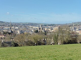
Bath and North East Somerset (B&NES) is a unitary authority district in Somerset, South West England. Bath and North East Somerset Council was created on 1 April 1996 following the abolition of the county of Avon. It is part of the ceremonial county of Somerset.

Chew Magna is a village and civil parish within the Chew Valley in the unitary authority of Bath and North East Somerset, in the ceremonial county of Somerset, England. The parish has a population of 1,149.
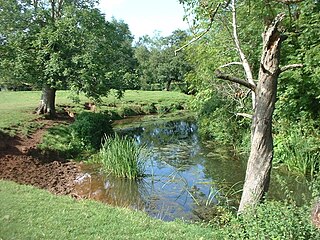
The River Chew is a small river in England that flows for some 17 miles (27 km) through the North Somerset countryside to form the Chew Valley before merging with the River Avon.

The Stanton Drew stone circles are just outside the village of Stanton Drew in the English county of Somerset. The largest stone circle is the Great Circle, 113 metres (371 ft) in diameter and the second largest stone circle in Britain ; it is considered to be one of the largest Neolithic monuments to have been built. The date of construction is not known, but is thought to be between 3000 and 2000 BCE, which places it in the Late Neolithic to Early Bronze Age. It was made a scheduled monument in 1982.
Chew Stoke is a small village and civil parish in the affluent Chew Valley, in Somerset, England, about 8 miles (13 km) south of Bristol and 10 miles north of Wells. It is at the northern edge of the Mendip Hills, a region designated by the United Kingdom as an Area of Outstanding Natural Beauty, and is within the Bristol and Bath green belt. The parish includes the hamlet of Breach Hill, which is approximately 2 miles (3.2 km) southwest of Chew Stoke itself.

Bishop Sutton is a village on the northern slopes of the Mendip Hills, within the affluent Chew Valley in Somerset. It lies east of Chew Valley Lake and north east of the Mendip Hills, approximately ten miles south of Bristol on the A368, Weston-super-Mare to Bath road. Bishop Sutton and the neighbouring village of Stowey form the civil parish of Stowey Sutton.
Clutton is a village and civil parish on the eastern edge of the Chew Valley, close to the Cam Brook river, in the Bath and North East Somerset Council area, within the ceremonial county of Somerset, England. The village lies east of the A37 road between Bristol and Shepton Mallet, and west of the A39 between Bath and Wells. It is 9 miles (14 km) from Bristol and Bath, and 11 miles (18 km) from Wells. Close by are the villages of Temple Cloud and High Littleton. The town of Midsomer Norton is 5 miles (8 km) away. The parish, which includes the hamlets of Clutton Hill and Northend, had a population of 1,602 in 2011.
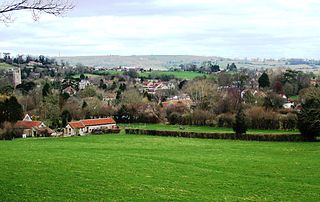
The Chew Valley is an affluent area in North Somerset, England, named after the River Chew, which rises at Chewton Mendip, and joins the River Avon at Keynsham. Technically, the area of the valley is bounded by the water catchment area of the Chew and its tributaries; however, the name Chew Valley is often used less formally to cover other nearby areas, for example, Blagdon Lake and its environs, which by a stricter definition are part of the Yeo Valley. The valley is an area of rich arable and dairy farmland, interspersed with a number of villages.

Chelwood is a small village and civil parish in Somerset, England, and is in the affluent Chew Valley in the Bath and North East Somerset council area, about 8 miles (13 km) from Bristol and Bath. The parish, which includes the hamlets of West Chelwood and Breach, has a population of 148. It is situated on the A368, very close to the A37.

Stowey is a small village and former civil parish, now in the parish of Stowey Sutton, in the Bath and North East Somerset district, in the ceremonial county of Somerset, England. It lies within the Chew Valley, south of Chew Valley Lake and north of the Mendip Hills, approximately 10 miles (16 km) south of Bristol on the A368 road Weston-super-Mare to Bath. Stowey and its neighbouring and larger village, Bishop Sutton, form the civil parish of Stowey Sutton.
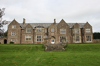
Sutton Court is an English house remodelled by Thomas Henry Wyatt in the 1850s from a manor house built in the 15th and 16th centuries around a 14th-century fortified pele tower and surrounding buildings. The house has been designated as Grade II* listed building.

Stanton Drew is a small village and civil parish within the Chew Valley in Somerset, England, lying north of the Mendip Hills, 8 miles (13 km) south of Bristol, just off the A368 between Chelwood and Bishop Sutton in the area of the Bath and North East Somerset unitary authority.

Turnpike trusts were bodies set up by individual Acts of Parliament, with powers to collect road tolls for maintaining the principal roads in Britain from the 17th but especially during the 18th and 19th centuries. At the peak, in the 1830s, over 1,000 trusts administered around 30,000 miles (48,000 km) of turnpike road in England and Wales, taking tolls at almost 8,000 toll-gates and side-bars.

A tollhouse or toll house is a building with accommodation for a toll collector, beside a tollgate on a toll road, canal, or toll bridge.

The Church of St Andrew in Chew Magna, Somerset, England dates from the 12th century with a large 15th-century pinnacled sandstone tower, a Norman font and a rood screen that is the full width of the church. It is a Grade I listed building.

The A3071 is a minor 'A' road in the English county of Cornwall, which links St Just to Penzance and the A30. It is 6.2 miles long.
The Manor House in Chew Magna, Somerset, England, was a country house built in the mid-17th century. It was the principal residence of the Adlam family from the mid-1800s until 1940. The house is a Grade II* listed building and was part of the Sacred Heart Convent School. It has now been redeveloped and returned to residential use.

