The Geffrye Museum of the Home is located on Kingsland Road in Shoreditch, London. The Museum explores home and home life from 1600 to the present day with a series of period room displays. It is housed in 18th-century Grade I-listed almshouses formerly belonging to the Ironmongers' Company which were built in 1714 thanks to a bequest by Sir Robert Geffrye, a former Lord Mayor of London and Master of the Ironmongers' Company. On 7 January 2018 the Geffrye closed for its two-year £18m development project, Unlocking the Geffrye. The museum is due to reopen in early 2020.
Syon Park is the 56.6 hectare garden of Syon House, the London home of the Duke of Northumberland in Isleworth in the London Borough of Hounslow. It was landscaped by Capability Brown in the 18th century, and it is Grade I listed by English Heritage under the Historic Buildings and Ancient Monuments Act 1953 for its special historic interest. The 56.6 hectare main gardens are a Site of Borough Importance for Nature Conservation, Grade I, and the flood meadows next to the River Thames are a biological Site of Special Scientific Interest (SSSI) and a Site of Metropolitan Importance for Nature Conservation.

Parsons Green is a mainly residential district of Fulham in the London Borough of Hammersmith and Fulham. The green itself, which is roughly triangular, is bounded on two of its three sides by the New King's Road section of the King's Road, A308 road and Parsons Green Lane. The wider neighbourhood is bounded by the Harwood and Wandsworth Bridge Roads, A217 road to the East and Munster Road to the West, while the Fulham Road, A3219 road may be said to define its northern boundary. Its southern boundary is less clearly defined as it merges quickly and imperceptibly with the Peterborough estate and Hurlingham.

Cherkley Court, at the extreme south-east of Leatherhead, Surrey, in England, is a late Victorian neo-classical mansion and estate of 370 acres (1.5 km2), once the home of Canadian-born press baron Lord Beaverbrook. The main house is a Grade II listed building.

Hurlingham Park is a park and multi-use sports ground in Fulham, London, England. It is currently used mostly for rugby matches, football matches and athletics events and is the home of Hammersmith and Fulham Rugby Football Club.

Richmond Hill in Richmond, London is a hill that rises gently on its northern side from the ancient Thames meadowlands around the site of Richmond Palace up to and slightly beyond the Richmond Gate entrance to Richmond Park, the former royal deer park 'emparked' or enclosed by Charles I. The descent southwestwards from this point back down to the upstream meadows is noticeably steeper, although the down gradient is less marked on its southerly and easterly progress through the park itself. Richmond Hill is also the name of the road that runs from Richmond town centre to the top of the hill, and is one-way up the hill along its northern part.

Doughty House is a large house on Richmond Hill in Richmond, London, England, built in the 18th century, with later additions. It has fine views down over the Thames, and both the house and gallery are Grade II listed buildings.

The Boltons is a street and "Garden Square" of symmetrical lune shape in the Brompton district of the Royal Borough of Kensington and Chelsea, London, England. The opposing sides of the street face the communal gardens with large expensive houses, in what is the third-most expensive street in the country. The gardens of the Boltons are Grade II listed on the Register of Historic Parks and Gardens.
The Ranelagh Club was a polo club located at Barn Elms in south west London, England. It was founded in 1878 as a split-off from the Hurlingham Club and by 1894 was the largest polo club in the world. The club had approximately 3000 members in 1913, including many prominent military figures and members of different royal families.
Fulham High Street is a street in Fulham, London.

Sandford Manor House is a Grade II* listed house in Rewell Street, Fulham, London.

Broom Villa is a Grade II listed building at 27 Broomhouse Road, Fulham, London.
The King's Head is a Grade II listed public house at 4 Fulham High Street, Fulham, London.

The Cock is a Grade II listed public house at 360 North End Road, Fulham, London.

Aragon House is a Grade II listed public house at 247 New King's Road, Fulham, London.

The Duke Of Cumberland is a Grade II listed public house at 235 New King's Road, Fulham, London.

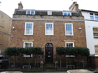
Northumberland House is a Grade II listed house at 134 New King's Road, Fulham, London, built in the early 18th century.
Dwight House is a Grade II listed house at 38 Burlington Road, Fulham, London, built in the late 18th century.