
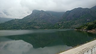
Palakkad is one of the 14 districts in the Indian state of Kerala. It was carved out of the southeastern region of the former Malabar District on 1 January 1957. It is located at the central region of Kerala and is the second largest district in the state after Idukki. The city of Palakkad is the district headquarters. Palakkad is bordered on the northwest by the Malappuram district, on the southwest by the Thrissur district, on the northeast by Nilgiris district, and on the east by Coimbatore district of Tamil Nadu. The district is nicknamed "The granary of Kerala". Palakkad is the gateway to Kerala due to the presence of the Palakkad Gap, in the Western Ghats. The 2,383 m high Anginda peak, which is situated in the border of Palakkad district, Nilgiris district, and Malappuram district, in Silent Valley National Park, is the highest point of elevation in Palakkad district. Palakkad city is about 347 kilometres (216 mi) northeast of the state capital, Thiruvananthapuram.

Sathyamangalam is a town and municipality in Erode district in the Indian state of Tamil Nadu. It lies on the banks of the Bhavani river, a tributary of the Cauvery in the foothills of the Western Ghats and is the headquarters of Sathyamangalam taluk. It is about 65 km from Erode, 58 km from Tiruppur and 65 km from Coimbatore. As of 2011, the town had a population of 37,816.

Rayavaram is a village Panchayat in Pudukkottai district in Tamil Nadu, India.
Pollachi is a town and municipality in Coimbatore district of the Indian state of Tamil Nadu. It is the administrative headquarters of Pollachi taluk. It is situated near the center of the South Indian Peninsula, surrounded by Western Ghats. Agriculture and textile industries contribute majorly to the economy of the town and the town is a popular marketplace for jaggery, vegetables and cattle.
Alandurai is a panchayat town in Coimbatore district in the state of Tamil Nadu, India. It falls under Perur taluk. It is a western suburb of Coimbatore, which comes under the Coimbatore Municipal Corporation. It lies very close to Kerala border and is located between Madavarayapuram and Pooluvapatti.
Chettipalayam is a suburb of Coimbatore city in Tamil Nadu, India. The place and its vicinity is also home to Kari Motor Speedway, the LOTUS and the Coimbatore Golf Club. It is located 17 km away from Coimbatore Junction. There is also a railway station in Podanur nearby. It is a Town Panchayat and not within the Coimbatore Corporation limits.

Dharapuram is a town situated along the banks of Amaravati River in Tiruppur district in the Indian state of Tamil Nadu. Dharapuram is one of the oldest towns in South India and was the capital of Kongu Nadu under the Cheras, Western Ganga Dynasty and later Kongu Cholas, at which time it was known as Viradapuram. Amaravathi River flows through the town. As of 2011, the town had a population of 67,007. The city houses famous temples including Agatheeswarar Temple, Kaadu Hanumanthasamy temple and many others.
Kalambur is a selection grade town panchayat in Polur taluk, Tiruvanamalai district in the Indian state of Tamil Nadu, famous for its rice production. As of the 2011 census, the town had a population of 31,751. K.T.R.Palani is a Chairman of Kalambur selection grade Town panchyat.
Kanjikoil is a panchayat town in Erode district in the Indian state of Tamil Nadu. The ancient name of the town is "Kanji Kooval" and it is called by the Name Kanji koil or Kanji Kovil.
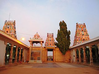
Karamadai is a town located near Mettupalayam, in the Indian state of Tamil Nadu. It is located on Coimbatore - Ooty NH 67. Nearby places are Teachers colony, Press Colony, Jodhipuram and Periyanaickenpalayam. The Ranganathaswamy temple and Nanjundeswarar temple are the most prominent landmarks in the town. The place of Karamadai came into limelight due to the presence of ex-steel giant Sri Ramakrishna Steel Industries.
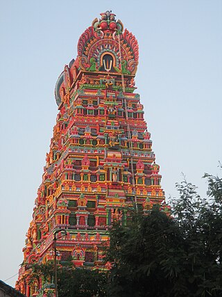
Kodumudi is a panchayat town and taluk headquarters of Kodumudi taluk in Erode district at state of Tamil Nadu, India. Kodumudi has an average elevation of 144 metres (472 feet). Also Kodumudi is an tourism spot. The holy Kaveri river and Magudeswarar temple in Kodumudi attracts thousands of pilgrims daily across South India.
Kunnathur is a panchayat town in Tirupur district in the Indian state of Tamil Nadu. It was previously under the jurisdiction of the Erode district. However kunnathur is in tiruppur district, legislative assembly consistency for kunnathur is Perundurai which is in Erode district.
Periya Negamam is a panchayat town in Coimbatore district in the southern Indian State of Tamil Nadu. It comes under Pollachi Taluk and pollachi Assembly constituency. Negamam used to be a popular small town serving the commercial and transport needs of many small villages around it until 1980s. With the arrival of frequent city buses to Pollachi and Udumalpet as transportation mode, growth of Negamam remained stunted. Weekly market on Tuesday used to be a big crowd puller.

Perur is a major residential neighbourhood and cultural hub of the city of Coimbatore in Tamil Nadu, India. It is located on the banks of Noyyal River, which divides the settlement into equal halves.
Samathur is a panchayat town in Coimbatore district in the Indian state of Tamil Nadu, Zamin Samathur is home to the Vanavarayar clan. Believed to have established their base here several hundred years ago, the Samathur Vanavarayars were revered initially as the polygars before taking on the role of Zamindars. The Vanavarayar's have ruled from Samathur for generations for almost 700 years.
Thondamuthur is a suburb of Coimbatore city in the Indian state of Tamil Nadu. It comes under the Coimbatore Corporation. Thondamuthur is located 15 km west from the District headquarters Coimbatore, there are three routes available to reach Thondamuthur, through Vadavalli (15 km), through Perur (15 km), through Gandhi park, Vedapatti (14 km). Thondamuthur is the residential area. There is very high rise in population due to the development of many residential plots, apartments and many people reside here because the place is well connected with city centre through many routes and they can easily commute daily from Thondamuthur. The climate of Thondamuthur is very pleasant, low pollution, and many tourist spots like kovai Kutralam, Velliangiri hills, Isha Foundation, Siruvani hills, Vaidehi falls are situated near Thondamuthur. People can taste World's second tastiest water Siruvani here.

Udumalai, also known as Udumalaipettai and Udumalpet, is a town in Tiruppur district in the Indian state of Tamil Nadu. It is located 535 km south west from the state capital, Chennai and 72 km from Coimbatore. It is the headquarters of Udumalaipettai taluk and had a population of 61,133 as per 2011 Census of India. The town comes under the Udumalaipettai Assembly constituency.

Vadavalli is a neighborhood in Coimbatore in the Indian state of Tamil Nadu. It is located on the Marudamalai Road and has been under the jurisdiction of the Coimbatore City Municipal Corporation limits since 2007. Located at the foothills of the Western Ghats, Vadavalli has a pleasant climate all through the year and has good ground water resources.
Vedapatti is a suburb of Coimbatore in the Indian state of Tamil Nadu. It is the western suburb of Coimbatore, which was included with the Coimbatore Corporation limits in 2011.
Kottur-Malayandipattinam or Kottur is the biggest panchayat town in Anaimalai_taluk of Coimbatore rural district in the Indian state of Tamil Nadu. Its short name is KM Pattinam. The name Kottur-Malayandipattinam is used to distinguish it from other places of the same name in south India, with Malayandipattinam (malai-yandi-pattanam) being the name of the southern part of the town and named after being surrounded by western ghats. It is famous for buying elephant ivory 100 years before, kottur Tamil meaning of kottu is elephant ivory and it also means the end of town.
