
Ganpatipule is a coastal town in Ratnagiri district of Maharashtra. Due to its Ganpati mandir the town is popular Hindu pilgrimage and tourists destination.
Sindhudurg district is an administrative district of the Konkan division in India, which was carved out of the erstwhile Ratnagiri district. The district headquarters are located at Oros. The district occupies an area of approximately 5,207 km2 and has a population of 849,651, of which 12.59% were urban. As of 2011, it is the least populous district of Maharashtra.
Vatakara,, is a Municipality, Taluk and a major town in the Kozhikode district of Kerala state, India. The municipality of Vatakara covers an area of 23.33 km2 (9.01 sq mi) and is bordered by Mahé to the north and Payyoli to the south. It is the headquarters of Vatakara taluk, which consists of 22 panchayats. During the reign of the Kolathiris and Zamorins, Vatakara was known as Kadathanadu. During the British Raj, it was part of the North Malabar region of Malabar District in the state of Madras. The historic Lokanarkavu temple, made famous by the Vadakkan Pattukal, is situated in Vatakara. A new tardigrade species collected from Vadakara coast has been named after Kerala State; Stygarctus keralensis.
Revdanda is a village near Alibaug, Raigad District, Maharashtra. It is the site of the medieval 'Chaul harbor'.
Kengeri is a western suburb of Bangalore city, located along Mysore Road.It is bordered by Nagarbhavi and Ullal to the north, Rajarajeshwari Nagar to the east, Kumbalgodu to the west and Uttarahalli to the south.
Mala is a small town in Thrissur district of Kerala state, India. There is a Jewish synagogue in Mala town. At the moment, it is in ruins. The famous Pambu Mekkattu Mana (temple) is located here and attracts thousands of devotees every year.
Kottapadi is a village near Guruvayur town in the district of Thrissur, Kerala, South India. Kottapadi literally translates to Gates to Fort. Kottapadi has now gained prominence Punnathurkotta for which it has been named, which used to house elephants belonging to the Guruvayoor temple. Elephants that are an integral part of certain temple rituals are boarded and trained here.
Kalutara or Kalutota is a major city in Kalutara District, Western Province, Sri Lanka. It is also the administrative capital of Kalutara District. It is located approximately 43 km (27 mi) south of the capital Colombo. The city holds a unique position for one of the four major rivers in Sri Lanka, the Kalu Ganga, which joins the sea at the centre of the city. Kaluthara is known for making rope, baskets, and other articles from the fibre of the coconut palm. The area also produces the Mangosteens, a fruit introduced from Malaysia in the 19th century.

Thanjavur district is one of the 38 districts of the state of Tamil Nadu, in southeastern India. Its headquarters is Thanjavur (Tanjore). The district is located in the delta of the Cauvery River and is mostly agrarian.

Anjarle is a village in Dapoli taluka, Ratnagiri district, Maharashtra India. It is a small port located near the mouth of Jog river, about 4 mi (6.4 km) south of Aade and 2 mi (3.2 km) north of Suvarnadurga. The nearest railway station is Khed, 31 mi (50 km) to the southeast.

Asoli is a small village in Taluka Vengurla and district Sindhudurg of Maharashtra, India.
Thycattusserry is a village in the Cherthala taluk of the Alappuzha district in the Indian state of Kerala.

Chadayamangalam is a village located in Kollam district of Kerala state, India. It is located along the Ithikkara river and the MC road that passes across the major urban locations of Kerala. It acts as centre for Chadayamangalam block panchayat, gram panchayat and assembly constituency. It hosts numerous government institutions including hospitals, schools and police station. Chadayamangalam is well noticed for newly constructed Jatayu Earth’s Center, which is a tourism centre in the town with the world’s largest bird sculpture. The place is also referred to as Jatayumangalam.
Samasingha is a gram panchayat in the district of Jharsuguda in the state of Odisha in India. The block office and police station of Samasingha is Kolabira, site of the Kolabira fort. It is divided into fourteen wards. The MLA constituency is Jharsuguda and the MP constituency is Bargarh. The village is situated on the bank of the Bhede river, a tributary of the Mahanadi. Two small seasonal streams flow through the village, the larger is named Badbahal and the smaller Nalia. Bhugarapali, Junadihi, Belmunda, Jalapara/Jaladihi and Kumharmal are villages are in the neighbourhood of Samasingha. Other nearby places include Jharsuguda, Sambalpur, Kuchinda, Bamra and Bagdihi. The nearest place of tourist attraction is Gudguda. It is on the route between Sambalpur and Ranchi.

Anchuthengu, formerly known as Anjengo, Angengo or Anjenga, is a coastal panchayath and town in the Thiruvananthapuram District of Kerala. It is situated 9km south-west of Varkala Town along Trivandrum - Varkala - Kollam coastal highway.

Agrahara Belaguli is a village in Karnataka, India. It is situated about 25 km northeast from Channarayapattana in Hassan district. It was a major town before the 14th-century during the Hoysala times. Early inscriptions here date from the 11th and 12th-century. Kesava Dannayaka – a general of king Vira Ballala, added several Hoysala temples dedicated to Shiva and Vishnu here in early 13th-century. He also constructed a water reservoir called Kesavasamudra. This historic water infrastructure is now to the west of the village. The village became an Agrahara who were believed to be following Shatkarmas in the second half of the 13th-century, renamed as Kesavapura. This town was destroyed after the 13th-century. Belaguli is now a small village, and most of the historic temples ruined. Of these, the Betteshvara temple – Kesavesvara temple in inscriptions survives in the most preserved form. This is a twin-temple, with two equal sanctums, one dedicated to Kesava-Vishnu and other to Isvara-Shiva. It has beautifully carved pillars and partly mutilated remains of Shaivism, Vaishnavism, Shaktism and Vedic deity relief panels.
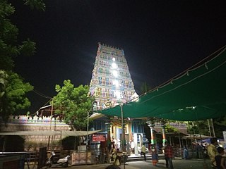
Sri Peddamma Thalli Temple or Peddamma Gudi is a Hindu temple located at Jubilee Hills in Hyderabad, Telangana, India. It is very famous during the festive season of Bonaalu.
Kammanahalli is a small village located in Tumkur District, Turuvekere Taluk, Mayasandra Hobli and Vittalapura Post in India's Karnataka State. The village is about 12 km from Yadiyur which is famous for the Lord Siddalingeshwara Temple and is about 100 km from Bangalore.

The Kottankulangara Devi Temple is a Hindu temple to the goddess Durga Bhagavathy or Aadi Shakthi, the supreme mother of power, located in the village of Chavara, Kerala, India.
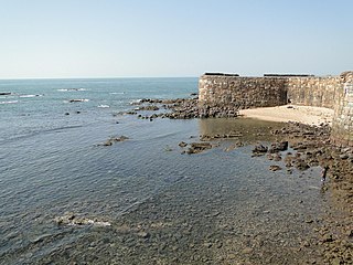
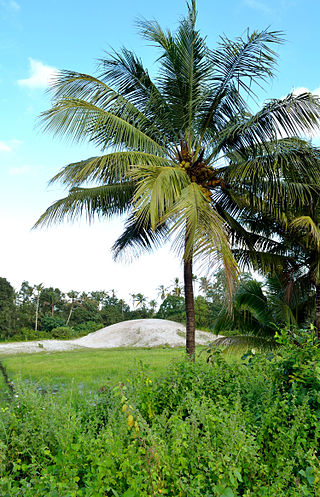
Redi is a village in the district of Sindhudurg in Maharashtra. Originally known as Rewati, Redi is located close to the shores of the Arabian Sea. Cashew and coconut trees grow in the region.

