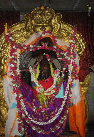
Tumakuru district is an administrative district in the state of Karnataka in India. It is the third largest district in Karnataka by land area with an area of 10,598 km2, and fourth largest by Population. It is a one-and-a-half-hour drive from Bengaluru, the state capital. The district is known for the production of coconuts and is also called as 'Kalpataru Nadu'. It is the only discontiguous district in Karnataka.
Chikjajur is a town in Karnataka. The town is served by a railway line. Chikjajur later emerged as the market centre for surrounding regions there.

Bayaluseemé or Bayalu Seemé is the area lying to the east of Malenadu, a region of Karnataka state in India. The area is largely open plain, with few hillocks. It includes the districts of Bangalore, Bangalore Rural, Ramanagara, Bagalkot, Bijapur, Chitradurga, Davanagere, Vijayanagara, Ballari, Kalaburagi, Dharwad, Koppal, Kolar, Gadag, Hassan, Bidar, Haveri, Belgaum, Mandya, Chikkaballapur, Mysore, Yadgir, Raichur and Tumkur.

Chitradurga is a city and the headquarters of Chitradurga district, which is located on the valley of the Vedavati river in the central part of the Indian state of Karnataka. Chitradurga is a place with historical significance and a major tourist hub of Karnataka. The city is renowned for its 15th century Kallina Kote or Stone Fortress. This is formed of two Kannada words: ‘Kallina’ means "Stone's" and Kote means "Fort". Other names used in Kannada are ‘Ukkina Kote": "Steel Fort" and ‘Yelusuttina Kote’: "Seven Circles Fort".

Tumkur is a city located in the southern part of the Indian state of Karnataka. It is situated at a distance of 70 km (43 mi) northwest of Bangalore, the state capital, along NH 48 and NH 73, located at an altitude of 835 m (2739.5 ft). The city serves as the headquarters of Tumakuru district.
Chikkanayakanahalli is a town in Tiptur sub-division of Tumakuru district, in the state of Karnataka, India. It is 30 km away from Tiptur and 132 km from Bangalore.

Thipatooru (Tiptur) is a city in the southern part of the state of Karnataka, India. It is one of the three sub-divisional headquarters of Tumkur district in Karnataka. Capital city Bangalore is 140 km from Thipatooru. Thipatooru city is known for its coconut plantations.
Nayakas of Chitradurga (1588–1779) were an Indian dynasty that ruled parts of eastern Karnataka during the post-Vijayanagara period, centered at Chitradurga. During the rule of the Hoysala Empire and the Vijayanagara Empire, they served as a feudatory chiefdom. Later, after the fall of the Vijayanagara Empire, they ruled at times as an independent chiefdom and at other times as a vassal of the Mysore Kingdom, Mughal Empire and Maratha Empire. Their territories merged into the Kingdom of Mysore under British rule.

Chitradurga Fort, or as the British called it Chitaldoorg, is a fortification that straddles several hills and a peak overlooking a flat valley in the Chitradurga District, Karnataka, India. The fort's name Chitrakaldurga, which means 'picturesque fort' in Kannada, is the namesake of the town Chitradurga and its administrative district.
Sira is a city and taluk headquarters of Sira Taluk of Tumkur district in the state of Karnataka, India. It lies on the AH 47, NH 48. It is the second largest city in the district after the headquarters by population, area and economy. It is the fastest developing city in the district. The State Capital city, Bengaluru, is 120 km from Sira. It is known for its historical significance as a political and military center and for being the capital of Imperial Sira Subah in the early 1700s.
Epigraphia Carnatica is a set of books on epigraphy of the Old Mysore region of India, compiled by Benjamin Lewis Rice, the Director of the Mysore Archaeological Department. Over a period of about ten years between 1894 and 1905, Rice published the books in a set of twelve volumes. The books contain the study of about 9,000 inscriptions from lithic surfaces and copper plates, which were found in the region. Apart from the original inscription, an English translation and a Roman transliteration are also provided.
Bukkapatna is a village in the southern state of Karnataka, India. It is located in the Sira taluk of Tumkur district in Karnataka.
Huliyar is a town in the southern state of Karnataka, India. It is located in the Chiknayakanhalli taluk of Tumakuru district in Karnataka. It is 42 km (26 mi) from its sub-divisional headquarters, Tiptur and 90 km (56 mi) from district headquarter Tumakuru.

Yallappa Nayakana Hosakote, often written as Y. N. Hosakote is a small town in the southern state of Karnataka, India. It is located in the Pavagada taluk of Tumkur district in Karnataka. In 1556 a local king named Yallappa Nayaka founded the fort on the hill Siddarabetta beside Kundurpi, named Yallappanayakana hosakote.

Bajagur is a village in Tiptur Taluk in Tumkur district of Karnataka, India. It is situated on the southern side of the state of Karnataka.
Kallambella is a village in Tumkur district of Karnataka state of India.
Thimmanahalli is a village in Chikkanayakanahalli, a town in Tumkur District. Its estimated population is about 5500-6000. Thimmanahalli is also known as Kaayi Thimmanahalli.
Nittur is a village in Tumkur district of Karnataka, India.
Kibbanahalli is a village in the Tiptur taluk of Tumkur district in Karnataka state, India. Kibbanahalli is a pre-historic site. Archaeologists believe that this site along with Biligere belong to the Early Stone Age. Hand-axe, guillotine chisels and many other Palaeolithic specimens found in the region are kept in the museum of the Geology Department of the Central College, Bangalore.
The Kasturi Rangappa Nayaka Fort in Sira in Tumkur district of Karnataka is named after the Nayaka ruler Kasturi Rangappa Nayaka, who had ruled over Sira in the early 17th century as a palegar under the Vijayanagar Empire. After their rule, the fort and the Province of Sira came under the control of several rulers. Restoration works have been carried out by the Archaeology Department of Karnataka.


